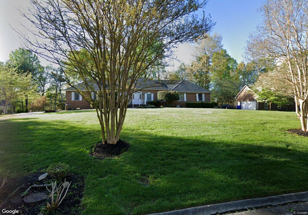
117 Whippoorwill Dr Oak Ridge, TN 37830
Estimated Value: $420,885 - $574,000
3
Beds
2
Baths
2,049
Sq Ft
$251/Sq Ft
Est. Value
About This Home
This home is located at 117 Whippoorwill Dr, Oak Ridge, TN 37830 and is currently estimated at $514,471, approximately $251 per square foot. 117 Whippoorwill Dr is a home located in Roane County with nearby schools including Linden Elementary, Robertsville Middle School, and Oak Ridge High School.
Ownership History
Date
Name
Owned For
Owner Type
Purchase Details
Closed on
Jan 6, 2006
Sold by
Pilloud Lorraine F Rev Tru
Bought by
Averill Frank W
Current Estimated Value
Home Financials for this Owner
Home Financials are based on the most recent Mortgage that was taken out on this home.
Original Mortgage
$100,000
Outstanding Balance
$56,041
Interest Rate
6.22%
Estimated Equity
$458,430
Purchase Details
Closed on
Jan 20, 1988
Create a Home Valuation Report for This Property
The Home Valuation Report is an in-depth analysis detailing your home's value as well as a comparison with similar homes in the area
Home Values in the Area
Average Home Value in this Area
Purchase History
| Date | Buyer | Sale Price | Title Company |
|---|---|---|---|
| Averill Frank W | $245,500 | -- | |
| -- | $23,000 | -- |
Source: Public Records
Mortgage History
| Date | Status | Borrower | Loan Amount |
|---|---|---|---|
| Open | Not Available | $100,000 |
Source: Public Records
Tax History Compared to Growth
Tax History
| Year | Tax Paid | Tax Assessment Tax Assessment Total Assessment is a certain percentage of the fair market value that is determined by local assessors to be the total taxable value of land and additions on the property. | Land | Improvement |
|---|---|---|---|---|
| 2024 | -- | $62,450 | $10,450 | $52,000 |
| 2023 | $2,906 | $62,450 | $10,450 | $52,000 |
| 2022 | $2,906 | $62,450 | $10,450 | $52,000 |
| 2021 | $2,869 | $62,450 | $10,450 | $52,000 |
| 2020 | $1,411 | $62,450 | $10,450 | $52,000 |
| 2019 | $3,060 | $61,075 | $12,000 | $49,075 |
| 2018 | $2,986 | $61,075 | $12,000 | $49,075 |
| 2017 | $2,974 | $61,075 | $12,000 | $49,075 |
| 2016 | $2,974 | $61,075 | $12,000 | $49,075 |
| 2015 | $1,435 | $61,075 | $12,000 | $49,075 |
| 2013 | -- | $68,775 | $12,000 | $56,775 |
Source: Public Records
Map
Nearby Homes
- 111 Winchester Cir
- 126 William Ln
- 116 William Ln
- 1088 W Outer Dr
- 1070 W Outer Dr
- 736 Mahoney Rd
- 17 Westover Dr
- 1046 W Outer Dr
- 102 Norway Ln
- 16 Forest Creek Pkwy
- 194 Sweet Gum Ln
- 142 Forest Creek Pkwy
- 137 Forest Creek Pkwy
- 107 Nebraska Ave
- 281 Ollis Rd
- 0 Poplar Creek Rd
- 103 Cherry Oak Dr
- 118 Black Oak Dr
- 120 Black Oak Dr
- 0 Lot 38 and 39 Black Oak Dr
- 119 Whippoorwill Dr
- 115 Whippoorwill Dr
- 121 Whippoorwill Dr
- 126 Whippoorwill Dr
- 128 Whippoorwill Dr
- 123 Whippoorwill Dr
- 122 Whippoorwill Dr
- 130 Whippoorwill Dr
- 124 Whippoorwill Dr
- 125 Whippoorwill Dr
- 112 Whippoorwill Dr
- 110 Whippoorwill Dr
- 109 Whippoorwill Dr
- 102 Winchester Cir
- 106 Winchester Cir
- 108 Winchester Cir
- 106 Whippoorwill Dr
- 136 Whippoorwill Dr
- 108 Whippoorwill Dr
- 107 Whippoorwill Dr