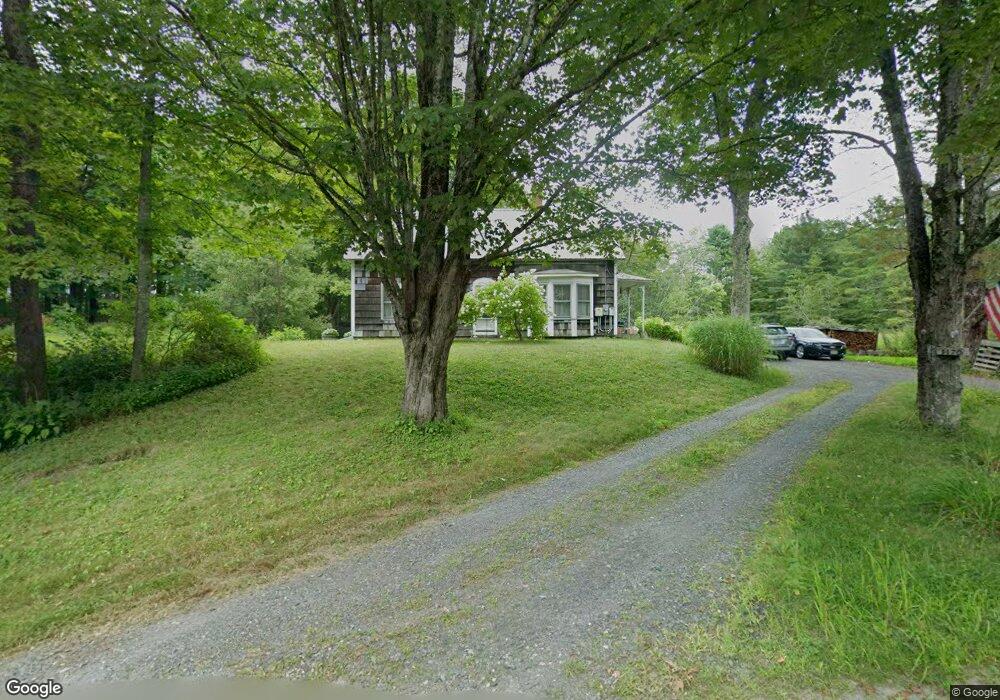
1170 Bug Hill Rd Ashfield, MA 01330
Ashfield NeighborhoodEstimated Value: $475,000 - $523,000
5
Beds
2
Baths
2,298
Sq Ft
$214/Sq Ft
Est. Value
About This Home
This home is located at 1170 Bug Hill Rd, Ashfield, MA 01330 and is currently estimated at $491,791, approximately $214 per square foot. 1170 Bug Hill Rd is a home with nearby schools including Mohawk Trail Regional High School.
Ownership History
Date
Name
Owned For
Owner Type
Purchase Details
Closed on
Sep 28, 2001
Sold by
Delapp Joan T
Bought by
Bakey Thomas F and Bakey Katherine A
Current Estimated Value
Create a Home Valuation Report for This Property
The Home Valuation Report is an in-depth analysis detailing your home's value as well as a comparison with similar homes in the area
Home Values in the Area
Average Home Value in this Area
Purchase History
| Date | Buyer | Sale Price | Title Company |
|---|---|---|---|
| Bakey Thomas F | $177,500 | -- |
Source: Public Records
Mortgage History
| Date | Status | Borrower | Loan Amount |
|---|---|---|---|
| Open | Bakey Thomas F | $181,000 | |
| Closed | Bakey Thomas F | $186,763 | |
| Closed | Bakey Thomas F | $69,800 |
Source: Public Records
Tax History Compared to Growth
Tax History
| Year | Tax Paid | Tax Assessment Tax Assessment Total Assessment is a certain percentage of the fair market value that is determined by local assessors to be the total taxable value of land and additions on the property. | Land | Improvement |
|---|---|---|---|---|
| 2025 | $5,096 | $378,600 | $121,400 | $257,200 |
| 2024 | $5,248 | $359,200 | $121,400 | $237,800 |
| 2023 | $4,572 | $259,600 | $98,100 | $161,500 |
| 2022 | $4,355 | $250,600 | $93,800 | $156,800 |
| 2021 | $66 | $247,500 | $93,800 | $153,700 |
| 2020 | $4,123 | $247,500 | $93,800 | $153,700 |
| 2019 | $75 | $223,100 | $77,400 | $145,700 |
| 2018 | $3,833 | $223,100 | $77,400 | $145,700 |
| 2017 | $3,611 | $222,600 | $76,500 | $146,100 |
| 2016 | $3,513 | $213,700 | $76,500 | $137,200 |
| 2015 | $3,413 | $213,700 | $76,500 | $137,200 |
| 2014 | $3,610 | $223,400 | $71,200 | $152,200 |
Source: Public Records
Map
Nearby Homes
- 374 Watson Spruce Corner Rd
- 220 Hawley Rd
- 0 Old Stage Rd Unit 73326639
- 81 Smith Rd
- 0 John Ford Rd Unit 73403157
- 0 John Ford Rd Unit 73403156
- 333 Ranney Corner Rd
- 4 Plainfield Rd
- 41 Buckland Rd
- 0 Spruce Corner Rd Unit 73244975
- 0 Ashfield Rd
- 292 E Hawley Rd
- 0 Sears Rd Unit 73373850
- 240 Beldingville Rd
- 29 Union St
- 80 River Rd
- 106 Shaw Rd
- 0 Upper St
- 121 Stage Rd
- 42 Shaw Rd
- 1157 Bug Hill Rd
- 1127 Bug Hill Rd
- 1266 Bug Hill Rd
- 1069 Bug Hill Rd
- 1294 Bug Hill Rd
- 1057 Bug Hill Rd
- 1017 Bug Hill Rd
- 1012 Bug Hill Rd
- 1356 Bug Hill Rd
- 955 Bug Hill Rd
- 1411 Bug Hill Rd
- 15 Ford Rd
- lot Willis Howes Rd
- 966 Watson Spruce Corner Rd
- 891 Bug Hill Rd
- 51+52 Ford Rd
- 926 Watson Spruce Corner Rd
- 653 Bear Swamp Rd
- 843 Bug Hill Rd
- 786 Bug Hill Rd