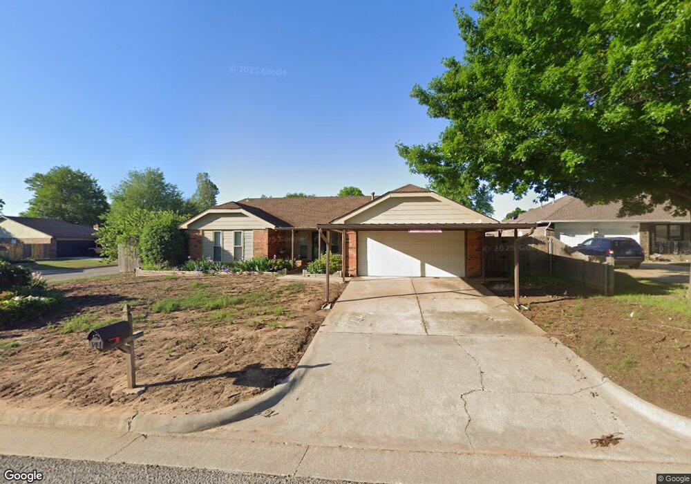
11700 Sandy Cir Yukon, OK 73099
Hollyrock-Silver Maple NeighborhoodEstimated Value: $189,000 - $207,000
3
Beds
2
Baths
1,512
Sq Ft
$132/Sq Ft
Est. Value
About This Home
This home is located at 11700 Sandy Cir, Yukon, OK 73099 and is currently estimated at $199,675, approximately $132 per square foot. 11700 Sandy Cir is a home located in Canadian County with nearby schools including Mustang Creek Elementary School, Meadow Brook Intermediate School, and Mustang Central Middle School.
Ownership History
Date
Name
Owned For
Owner Type
Purchase Details
Closed on
Jul 3, 2003
Sold by
Ponder Charles E and Ponder Judy J
Bought by
Tucker Ginger C and Tucker Charles B
Current Estimated Value
Home Financials for this Owner
Home Financials are based on the most recent Mortgage that was taken out on this home.
Original Mortgage
$71,920
Interest Rate
5.27%
Purchase Details
Closed on
Jul 9, 1992
Sold by
Conversion
Purchase Details
Closed on
Jun 1, 1987
Create a Home Valuation Report for This Property
The Home Valuation Report is an in-depth analysis detailing your home's value as well as a comparison with similar homes in the area
Home Values in the Area
Average Home Value in this Area
Purchase History
| Date | Buyer | Sale Price | Title Company |
|---|---|---|---|
| Tucker Ginger C | $90,000 | -- | |
| -- | $71,500 | -- | |
| -- | $65,500 | -- |
Source: Public Records
Mortgage History
| Date | Status | Borrower | Loan Amount |
|---|---|---|---|
| Previous Owner | Tucker Ginger C | $71,920 |
Source: Public Records
Tax History Compared to Growth
Tax History
| Year | Tax Paid | Tax Assessment Tax Assessment Total Assessment is a certain percentage of the fair market value that is determined by local assessors to be the total taxable value of land and additions on the property. | Land | Improvement |
|---|---|---|---|---|
| 2024 | $1,358 | $12,990 | $1,122 | $11,868 |
| 2023 | $1,358 | $12,990 | $1,126 | $11,864 |
| 2022 | $1,344 | $12,691 | $1,411 | $11,280 |
| 2021 | $1,339 | $12,691 | $1,598 | $11,093 |
| 2020 | $1,352 | $12,691 | $1,762 | $10,929 |
| 2019 | $1,351 | $12,691 | $1,868 | $10,823 |
| 2018 | $1,376 | $12,691 | $1,973 | $10,718 |
| 2017 | $1,358 | $12,691 | $1,924 | $10,767 |
| 2016 | $1,355 | $12,691 | $1,927 | $10,764 |
| 2015 | $1,381 | $12,690 | $2,040 | $10,650 |
| 2014 | $1,381 | $12,828 | $2,040 | $10,788 |
Source: Public Records
Map
Nearby Homes
- 11741 Oakdale St
- 309 Glen Dr
- 310 Glen Dr
- 11817 Hollyrock Dr
- 12177 Hollyrock Dr
- 612 S Willowood Dr
- 624 Caladium Dr
- 705 Westview Dr
- 612 Ellsworth Ave
- 311 Tumbleweed Rd
- 724 Westridge Ct
- 11608 NW 6th St
- 418 Palo Verde Dr
- 11713 NW 6th St
- 708 Cactus Ct
- 713 Vickery Ave
- 913 Laurel Creek Dr
- 11516 SW 8th Cir
- 717 Vickery Ave
- 11632 SW 9th St
- 11704 Sandy Cir
- 11713 Oakdale St
- 11708 Sandy Cir
- 11701 Sandy Cir
- 11700 Oakdale St
- 11704 Oakdale St
- 11616 Oakdale St
- 11708 Oakdale St
- 11705 Sandy Cir
- 11721 Oakdale St
- 11712 Sandy Cir
- 11612 Oakdale St
- 11709 Sandy Cir
- 11712 Oakdale St
- 11613 Oakdale St
- 11725 Oakdale St
- 136 Maindale Dr
- 11716 Oakdale St
- 11621 Sagamore Dr
- 11617 Sagamore Dr