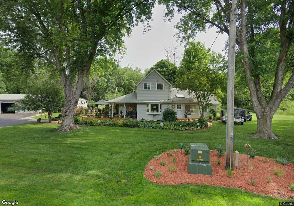
11702 Highway S33 Unit CO Iowa Falls, IA 50126
Estimated Value: $191,000 - $227,000
4
Beds
2
Baths
1,813
Sq Ft
$111/Sq Ft
Est. Value
About This Home
This home is located at 11702 Highway S33 Unit CO, Iowa Falls, IA 50126 and is currently estimated at $200,941, approximately $110 per square foot. 11702 Highway S33 Unit CO is a home located in Hardin County with nearby schools including Pineview Elementary School, Rock Run Elementary School, and Riverbend Middle School.
Ownership History
Date
Name
Owned For
Owner Type
Purchase Details
Closed on
Apr 6, 2023
Sold by
Beaupain Xia J and Beaupain Ernest
Bought by
Loyd Dalton T D
Current Estimated Value
Home Financials for this Owner
Home Financials are based on the most recent Mortgage that was taken out on this home.
Original Mortgage
$150,000
Outstanding Balance
$139,137
Interest Rate
5.66%
Mortgage Type
New Conventional
Estimated Equity
$61,804
Create a Home Valuation Report for This Property
The Home Valuation Report is an in-depth analysis detailing your home's value as well as a comparison with similar homes in the area
Home Values in the Area
Average Home Value in this Area
Purchase History
| Date | Buyer | Sale Price | Title Company |
|---|---|---|---|
| Loyd Dalton T D | $158,000 | -- |
Source: Public Records
Mortgage History
| Date | Status | Borrower | Loan Amount |
|---|---|---|---|
| Open | Loyd Dalton T D | $150,000 |
Source: Public Records
Tax History Compared to Growth
Tax History
| Year | Tax Paid | Tax Assessment Tax Assessment Total Assessment is a certain percentage of the fair market value that is determined by local assessors to be the total taxable value of land and additions on the property. | Land | Improvement |
|---|---|---|---|---|
| 2025 | $1,354 | $151,560 | $25,090 | $126,470 |
| 2024 | $1,354 | $129,760 | $25,090 | $104,670 |
| 2023 | $1,418 | $129,760 | $25,090 | $104,670 |
| 2022 | $1,340 | $109,540 | $25,090 | $84,450 |
| 2021 | $1,340 | $109,540 | $25,090 | $84,450 |
| 2020 | $1,100 | $87,470 | $14,390 | $73,080 |
| 2019 | $976 | $87,470 | $0 | $0 |
| 2018 | $976 | $79,520 | $0 | $0 |
| 2017 | $946 | $72,290 | $0 | $0 |
| 2016 | $956 | $72,290 | $0 | $0 |
| 2015 | $984 | $72,290 | $0 | $0 |
| 2014 | $972 | $72,290 | $0 | $0 |
Source: Public Records
Map
Nearby Homes
- 1319 Scenic View Dr
- 1108 Willow Ln
- 1316 Siloam Ave
- 1016 Palisades Ct
- 1806 Custer St
- 1012 Palisades Ct
- 1008 Palisades Ct
- 1006 Palisades Ct
- 1004 Palisades Ct
- 1010 Palisades Ct
- 1014 Palisades Ct
- 2510 Kenison Way
- 1005 Palisades Ct
- 2352 River Rd
- 1009 Palisades Ct
- 1013 Palisades Ct
- 2354 River Rd
- 2356 River Rd
- 2360 River Rd
- 2362 River Rd
- 11700 Highway S33
- 11698 Highway S33 Unit CO
- 11698 Highway S33
- 11698 Highway S33
- 11686 Highway S33 Unit CO
- 11685 Highway S33 Unit CO
- 11685 Highway S33 Unit CO
- 11694 Highway S33 Unit CO
- 1700 Siloam Ave
- 11676 Highway S33 Unit CO
- 11676 Highway S33
- 11676 County Highway S33
- 11672 Highway S33 Unit CO
- 11664 Highway S33 Unit CO
- 1530 Siloam Ave
- 11652 Highway S33 Unit CO
- 11652 Highway S33
- 1518 Siloam Ave
- 1617 Elk Run Rd
- 1616 Elk Run Rd