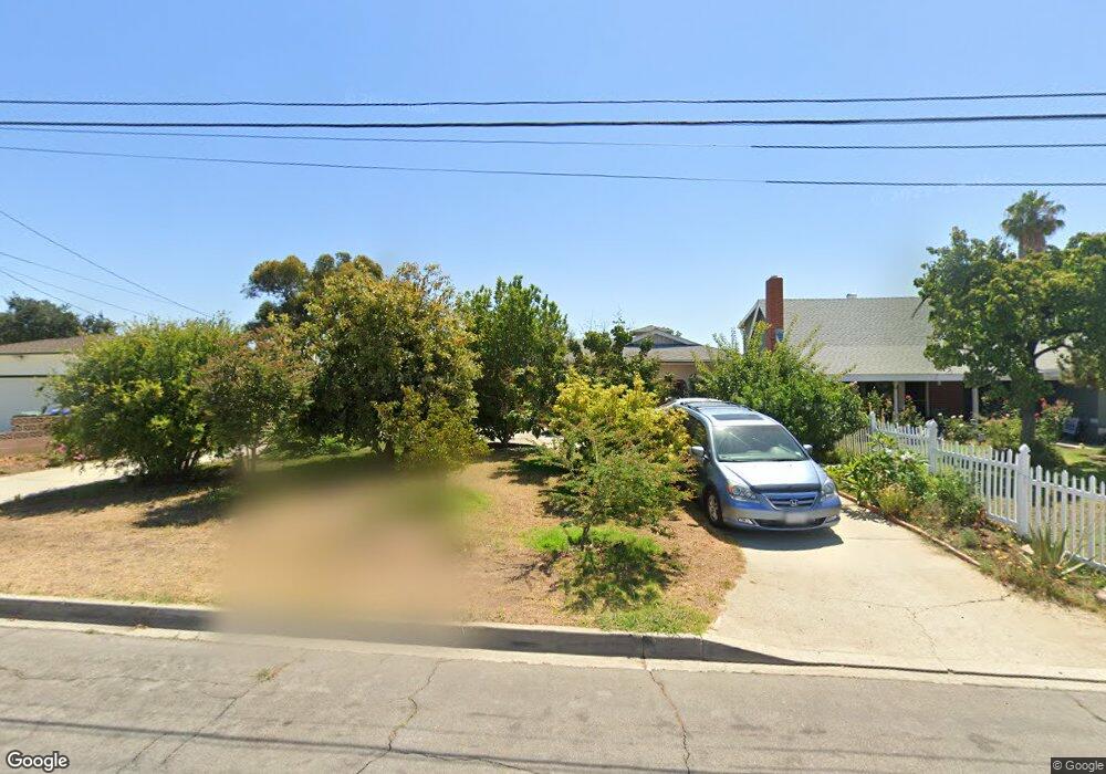
11704 Ramsey Dr Whittier, CA 90605
South Whittier NeighborhoodEstimated Value: $797,000 - $987,000
3
Beds
2
Baths
1,907
Sq Ft
$469/Sq Ft
Est. Value
About This Home
This home is located at 11704 Ramsey Dr, Whittier, CA 90605 and is currently estimated at $894,016, approximately $468 per square foot. 11704 Ramsey Dr is a home located in Los Angeles County with nearby schools including California High School and St. Gregory The Great.
Ownership History
Date
Name
Owned For
Owner Type
Purchase Details
Closed on
Sep 27, 2007
Sold by
Spillman Suzanne B
Bought by
Hinn Bora
Current Estimated Value
Home Financials for this Owner
Home Financials are based on the most recent Mortgage that was taken out on this home.
Original Mortgage
$156,000
Interest Rate
6.35%
Mortgage Type
Purchase Money Mortgage
Purchase Details
Closed on
Mar 13, 2000
Sold by
Perkins Margaret A
Bought by
Perkins Margaret A and Margaret A Perkins Trust
Create a Home Valuation Report for This Property
The Home Valuation Report is an in-depth analysis detailing your home's value as well as a comparison with similar homes in the area
Home Values in the Area
Average Home Value in this Area
Purchase History
| Date | Buyer | Sale Price | Title Company |
|---|---|---|---|
| Hinn Bora | $506,818 | Chicago Title Company | |
| Perkins Margaret A | -- | -- |
Source: Public Records
Mortgage History
| Date | Status | Borrower | Loan Amount |
|---|---|---|---|
| Previous Owner | Hinn Bora | $156,000 |
Source: Public Records
Tax History Compared to Growth
Tax History
| Year | Tax Paid | Tax Assessment Tax Assessment Total Assessment is a certain percentage of the fair market value that is determined by local assessors to be the total taxable value of land and additions on the property. | Land | Improvement |
|---|---|---|---|---|
| 2025 | $8,175 | $665,675 | $466,291 | $199,384 |
| 2024 | $8,175 | $652,624 | $457,149 | $195,475 |
| 2023 | $7,919 | $639,829 | $448,186 | $191,643 |
| 2022 | $7,981 | $627,285 | $439,399 | $187,886 |
| 2021 | $7,817 | $614,986 | $430,784 | $184,202 |
| 2019 | $7,683 | $596,747 | $418,007 | $178,740 |
| 2018 | $6,693 | $527,000 | $369,000 | $158,000 |
| 2016 | $6,601 | $527,000 | $369,000 | $158,000 |
| 2015 | $6,112 | $490,900 | $343,500 | $147,400 |
| 2014 | $6,164 | $490,900 | $343,500 | $147,400 |
Source: Public Records
Map
Nearby Homes
- 11426 Newgate Ave
- 13857 Leffingwell Rd
- 11329 Telechron Ave
- 11827 Loma Dr Unit 15
- 11531 Sunnybrook Ln
- 11624 Starlight Ave
- 14034 Coteau Dr Unit 1103
- 13538 Lukay St
- 13481 Meyer Rd
- 11118 Bunker Ln
- 11116 Leland Ave
- 11102 Eagle Ln
- 14135 Chere Dr
- 13513 Leffingwell Rd
- 11016 Inez St
- 0 Telegraph Rd Unit DW24244539
- 13305 Meyer Rd Unit B
- 11828 Louis Ave
- 10745 Victoria Ave Unit 4
- 10745 Victoria Ave Unit 6
- 11642 Ramsey Dr
- 11712 Ramsey Dr
- 11718 Ramsey Dr
- 11638 Ramsey Dr
- 11709 Ramsey Dr
- 11703 Ramsey Dr
- 11804 Ramsey Dr
- 11715 Ramsey Dr
- 11639 Ramsey Dr
- 11808 Ramsey Dr
- 11719 Ramsey Dr
- 11626 Ramsey Dr
- 11627 Ramsey Dr
- 11725 Ramsey Dr
- 11814 Ramsey Dr
- 11731 Ramsey Dr
- 11704 Marquardt Ave
- 11628 Marquardt Ave
- 11620 Ramsey Dr
- 11710 Marquardt Ave