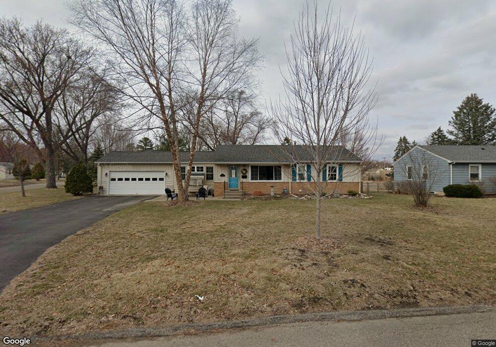
11706 Bradford Rd Hopkins, MN 55343
Estimated Value: $382,000 - $446,235
5
Beds
3
Baths
984
Sq Ft
$406/Sq Ft
Est. Value
About This Home
This home is located at 11706 Bradford Rd, Hopkins, MN 55343 and is currently estimated at $399,059, approximately $405 per square foot. 11706 Bradford Rd is a home located in Hennepin County with nearby schools including Glen Lake Elementary School, Hopkins West Junior High School, and Hopkins Senior High School.
Ownership History
Date
Name
Owned For
Owner Type
Purchase Details
Closed on
Jun 2, 2021
Sold by
Sweeney Thomas D and Sweeney Carla A
Bought by
Sweeney Carla A
Current Estimated Value
Home Financials for this Owner
Home Financials are based on the most recent Mortgage that was taken out on this home.
Original Mortgage
$111,053
Outstanding Balance
$100,545
Interest Rate
2.9%
Mortgage Type
New Conventional
Estimated Equity
$298,514
Purchase Details
Closed on
May 4, 2006
Sold by
David Trent A and David Kimberly M
Bought by
Sweeny Thomas D and Sweeny Carla A
Create a Home Valuation Report for This Property
The Home Valuation Report is an in-depth analysis detailing your home's value as well as a comparison with similar homes in the area
Home Values in the Area
Average Home Value in this Area
Purchase History
| Date | Buyer | Sale Price | Title Company |
|---|---|---|---|
| Sweeney Carla A | -- | Nationallink | |
| Sweeny Thomas D | $239,900 | -- |
Source: Public Records
Mortgage History
| Date | Status | Borrower | Loan Amount |
|---|---|---|---|
| Open | Sweeney Carla A | $111,053 |
Source: Public Records
Tax History Compared to Growth
Tax History
| Year | Tax Paid | Tax Assessment Tax Assessment Total Assessment is a certain percentage of the fair market value that is determined by local assessors to be the total taxable value of land and additions on the property. | Land | Improvement |
|---|---|---|---|---|
| 2024 | $3,844 | $354,000 | $167,200 | $186,800 |
| 2023 | $3,949 | $353,000 | $167,200 | $185,800 |
| 2022 | $3,307 | $339,100 | $167,200 | $171,900 |
| 2021 | $3,197 | $287,400 | $152,000 | $135,400 |
| 2020 | $3,259 | $282,100 | $152,000 | $130,100 |
| 2019 | $3,102 | $273,800 | $152,000 | $121,800 |
| 2018 | $2,821 | $264,700 | $152,000 | $112,700 |
| 2017 | $2,847 | $236,100 | $145,000 | $91,100 |
| 2016 | $3,105 | $247,600 | $139,500 | $108,100 |
| 2015 | $3,255 | $252,600 | $150,000 | $102,600 |
| 2014 | -- | $244,200 | $150,000 | $94,200 |
Source: Public Records
Map
Nearby Homes
- 2062 Mainstreet
- 4717 Karen Cir
- 11908 James Rd
- 130 17th Ave S
- 4532 Fairview Ave
- 11823 Shady Oak Dr
- 37 19th Ave N
- 102 16th Ave N
- 4838 Diane Dr
- 4760 Dominick Dr
- 12209 Woodbine Rd
- 4724 Merilee Dr
- 4006 Huntingdon Dr
- 32 11th Ave S Unit 303
- 32 11th Ave S Unit 204
- 32 11th Ave S Unit 305
- 3930 Cottage Ln
- 4044 Merriam Rd
- 329 & 327 16th Ave N
- 228 12th Ave N
- 11700 Bradford Rd
- 4511 Crawford Rd
- 11714 Bradford Rd
- 11616 Bradford Rd
- 4505 Crawford Rd
- 11705 Bradford Rd
- 11701 Bradford Rd
- 4512 Crawford Rd
- 11711 Bradford Rd
- 11720 Bradford Rd
- 11691 Bradford Rd
- 11717 Bradford Rd
- 4501 Crawford Rd
- 4506 Crawford Rd
- 4500 Crawford Rd
- 11800 Bradford Rd
- 11723 Bradford Rd
- 4431 Crawford Rd
- 118 Shady Oak Rd
- 11800 Crawford Rd W