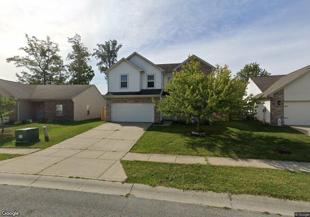
11717 Rossmore Dr Indianapolis, IN 46235
Estimated Value: $275,044 - $307,000
--
Bed
--
Bath
2,390
Sq Ft
$124/Sq Ft
Est. Value
About This Home
This home is located at 11717 Rossmore Dr, Indianapolis, IN 46235 and is currently estimated at $295,261, approximately $123 per square foot. 11717 Rossmore Dr is a home located in Marion County with nearby schools including Winding Ridge Elementary School, Belzer Middle School, and Lawrence Central High School.
Ownership History
Date
Name
Owned For
Owner Type
Purchase Details
Closed on
Apr 16, 2021
Sold by
Lowry Mrs Sharon Jl
Bought by
Lowry Mr James C
Current Estimated Value
Purchase Details
Closed on
Aug 3, 2007
Sold by
Arbor Homes Llc
Bought by
Lowry Sharon
Home Financials for this Owner
Home Financials are based on the most recent Mortgage that was taken out on this home.
Original Mortgage
$163,040
Interest Rate
6.31%
Mortgage Type
New Conventional
Create a Home Valuation Report for This Property
The Home Valuation Report is an in-depth analysis detailing your home's value as well as a comparison with similar homes in the area
Home Values in the Area
Average Home Value in this Area
Purchase History
| Date | Buyer | Sale Price | Title Company |
|---|---|---|---|
| Lowry Mr James C | -- | None Available | |
| Lowry Sharon | -- | None Available |
Source: Public Records
Mortgage History
| Date | Status | Borrower | Loan Amount |
|---|---|---|---|
| Previous Owner | Lowry Sharon | $163,040 |
Source: Public Records
Tax History Compared to Growth
Tax History
| Year | Tax Paid | Tax Assessment Tax Assessment Total Assessment is a certain percentage of the fair market value that is determined by local assessors to be the total taxable value of land and additions on the property. | Land | Improvement |
|---|---|---|---|---|
| 2024 | $6,026 | $276,000 | $37,000 | $239,000 |
| 2023 | $6,026 | $274,600 | $37,000 | $237,600 |
| 2022 | $5,356 | $239,300 | $37,000 | $202,300 |
| 2021 | $2,373 | $208,400 | $37,000 | $171,400 |
| 2020 | $2,096 | $182,600 | $38,600 | $144,000 |
| 2019 | $1,747 | $169,800 | $38,600 | $131,200 |
| 2018 | $1,687 | $164,000 | $34,000 | $130,000 |
| 2017 | $1,621 | $157,600 | $34,000 | $123,600 |
| 2016 | $1,566 | $152,300 | $34,000 | $118,300 |
| 2014 | $1,501 | $150,100 | $38,600 | $111,500 |
| 2013 | $1,464 | $150,100 | $38,600 | $111,500 |
Source: Public Records
Map
Nearby Homes
- 5151 Sandwood Dr
- 5020 Greenside Dr
- 5262 Bogey Dr
- 4859 Penoyer Ln
- 11851 Fawn Crest Dr
- 4846 Chip Shot Ln
- 5331 Hammock Glen Dr
- 4831 Birmingham Dr
- 11727 Fawn Crest Dr
- 4758 Chip Shot Ln
- 11427 Flatstick Ct
- 11753 Pawleys Ct
- 5339 Brassie Dr
- 5350 Brassie Dr
- 11754 Hamble Dr
- 11226 Winterwood Dr
- 11533 Basalt Dr
- 11557 Glenn Abbey Ln
- 11620 Glenn Abbey Ln
- 11532 Glenn Abbey Ln
- 11723 Rossmore Dr
- 11711 Rossmore Dr
- 11705 Rossmore Dr
- 11724 White Cloud Dr
- 11730 White Cloud Dr
- 11718 White Cloud Dr
- 11736 White Cloud Dr
- 11735 Rossmore Dr
- 11712 White Cloud Dr
- 11712 Rossmore Dr
- 11720 Rossmore Dr
- 5104 Graywood Ct
- 11742 White Cloud Dr
- 11704 Rossmore Dr
- 11741 Rossmore Dr
- 11706 White Cloud Dr
- 5103 Sandwood Dr
- 5101 Gray Wood Ct
- 11748 White Cloud Dr
- 5052 Chip Shot Ln