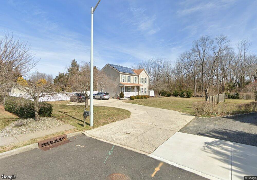
1172 Roanoke Dr Toms River, NJ 08753
Estimated Value: $611,000 - $671,000
3
Beds
3
Baths
3,288
Sq Ft
$197/Sq Ft
Est. Value
About This Home
This home is located at 1172 Roanoke Dr, Toms River, NJ 08753 and is currently estimated at $647,774, approximately $197 per square foot. 1172 Roanoke Dr is a home located in Ocean County with nearby schools including St Joseph Grade School, Ambassador Christian Academy, and Donovan Catholic High School.
Ownership History
Date
Name
Owned For
Owner Type
Purchase Details
Closed on
Feb 22, 2001
Sold by
Hasse Daniel
Bought by
Osborne Joseph and Osborne Catherine
Current Estimated Value
Home Financials for this Owner
Home Financials are based on the most recent Mortgage that was taken out on this home.
Original Mortgage
$152,000
Outstanding Balance
$55,192
Interest Rate
7.15%
Estimated Equity
$592,582
Create a Home Valuation Report for This Property
The Home Valuation Report is an in-depth analysis detailing your home's value as well as a comparison with similar homes in the area
Home Values in the Area
Average Home Value in this Area
Purchase History
| Date | Buyer | Sale Price | Title Company |
|---|---|---|---|
| Osborne Joseph | $192,000 | -- | |
| Osborne Joseph | $192,000 | -- |
Source: Public Records
Mortgage History
| Date | Status | Borrower | Loan Amount |
|---|---|---|---|
| Open | Osborne Joseph | $152,000 | |
| Closed | Osborne Joseph | $152,000 |
Source: Public Records
Tax History Compared to Growth
Tax History
| Year | Tax Paid | Tax Assessment Tax Assessment Total Assessment is a certain percentage of the fair market value that is determined by local assessors to be the total taxable value of land and additions on the property. | Land | Improvement |
|---|---|---|---|---|
| 2025 | $9,575 | $525,800 | $123,000 | $402,800 |
| 2024 | $9,102 | $525,800 | $123,000 | $402,800 |
| 2023 | $8,776 | $525,800 | $123,000 | $402,800 |
| 2022 | $8,776 | $525,800 | $123,000 | $402,800 |
| 2021 | $7,833 | $312,700 | $98,300 | $214,400 |
| 2020 | $7,799 | $312,700 | $98,300 | $214,400 |
| 2019 | $7,461 | $312,700 | $98,300 | $214,400 |
| 2018 | $7,361 | $312,700 | $98,300 | $214,400 |
| 2017 | $7,072 | $303,000 | $98,300 | $204,700 |
| 2016 | $6,887 | $303,000 | $98,300 | $204,700 |
| 2015 | $6,627 | $303,000 | $98,300 | $204,700 |
| 2014 | $6,308 | $303,000 | $98,300 | $204,700 |
Source: Public Records
Map
Nearby Homes
- 1037 Savannah St
- 109 Twin Rivers Dr
- 1112 Formicola St
- 202 Genoa Ave
- 73 Cedar Grove Rd
- 14 Turnberry Cir Unit 117
- 57 Turnberry Cir Unit 145
- 741 Spruce Hill Dr
- 22 Turnberry Cir Unit 121
- 54 Turnberry Cir Unit 137
- 256 Marigold Ct Unit 256E
- 679 Clifton Ave
- 291 Marigold Ct Unit C29G1
- 522 Oakview Dr
- 325 Scarlet Ct Unit 3205
- 263 Marigold Ct Unit 2603
- 523 Pheasant Ln
- 202 Terrace Ave
- 707 Cedar Point Ct
- 105 Geranium Ct
- 1168 Roanoke Dr
- 1171 Roanoke Dr
- 249 Constitution Ave
- 1024 Hooper Ave
- 253 Constitution Ave
- 1023 Vauxhall Rd
- 245 Constitution Ave
- 257 Constitution Ave
- 1160 Roanoke Dr
- 1019 Vauxhall Rd
- 1022 Vauxhall Rd
- 241 Constitution Ave
- 1156 Roanoke Dr
- 261 Constitution Ave
- 250 Constitution Ave
- 1018 Vauxhall Rd
- 1015 Vauxhall Rd
- 237 Constitution Ave
- 723 Vivian Dr
- 240 Constitution Ave