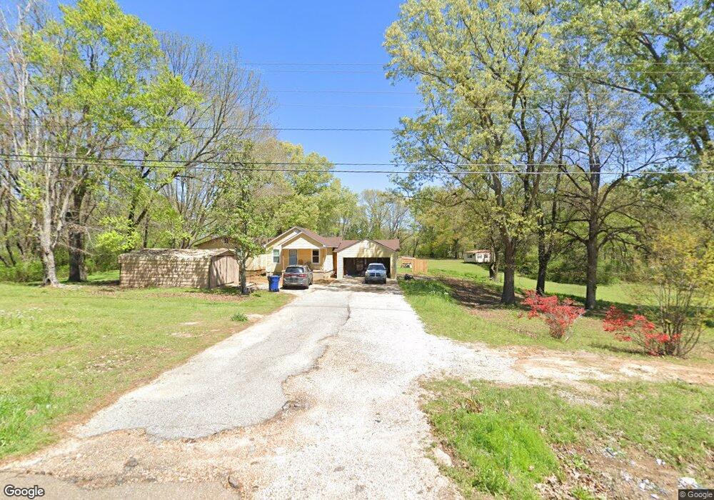
11720 Highway 178 Olive Branch, MS 38654
Center Hill NeighborhoodEstimated Value: $214,046 - $295,000
3
Beds
--
Bath
1,619
Sq Ft
$154/Sq Ft
Est. Value
About This Home
This home is located at 11720 Highway 178, Olive Branch, MS 38654 and is currently estimated at $249,762, approximately $154 per square foot. 11720 Highway 178 is a home located in DeSoto County with nearby schools including Center Hill Elementary School, Center Hill High School, and Desoto Christian Academy.
Ownership History
Date
Name
Owned For
Owner Type
Purchase Details
Closed on
Aug 25, 2020
Sold by
Eldridge Austin
Bought by
Parker Joshua B
Current Estimated Value
Home Financials for this Owner
Home Financials are based on the most recent Mortgage that was taken out on this home.
Original Mortgage
$152,000
Outstanding Balance
$108,707
Interest Rate
3%
Mortgage Type
New Conventional
Estimated Equity
$141,055
Purchase Details
Closed on
Oct 18, 2017
Sold by
Millard Jamie S and Dickey Cathryn Lea
Bought by
Eldridge Austin
Home Financials for this Owner
Home Financials are based on the most recent Mortgage that was taken out on this home.
Original Mortgage
$4,123
Interest Rate
3.83%
Mortgage Type
New Conventional
Purchase Details
Closed on
May 27, 2014
Sold by
Millard Jamie S
Bought by
Millard Jamie S and Stclair Cathryn Lea Dickey
Create a Home Valuation Report for This Property
The Home Valuation Report is an in-depth analysis detailing your home's value as well as a comparison with similar homes in the area
Home Values in the Area
Average Home Value in this Area
Purchase History
| Date | Buyer | Sale Price | Title Company |
|---|---|---|---|
| Parker Joshua B | -- | Realty Title | |
| Eldridge Austin | -- | Edco Title | |
| Millard Jamie S | -- | None Available |
Source: Public Records
Mortgage History
| Date | Status | Borrower | Loan Amount |
|---|---|---|---|
| Open | Parker Joshua B | $152,000 | |
| Previous Owner | Eldridge Austin | $4,123 |
Source: Public Records
Tax History Compared to Growth
Tax History
| Year | Tax Paid | Tax Assessment Tax Assessment Total Assessment is a certain percentage of the fair market value that is determined by local assessors to be the total taxable value of land and additions on the property. | Land | Improvement |
|---|---|---|---|---|
| 2024 | $813 | $8,134 | $3,200 | $4,934 |
| 2023 | $813 | $8,134 | $0 | $0 |
| 2022 | $813 | $8,134 | $3,200 | $4,934 |
| 2021 | $813 | $8,134 | $3,200 | $4,934 |
| 2020 | $487 | $7,872 | $3,200 | $4,672 |
| 2019 | $487 | $7,872 | $3,200 | $4,672 |
| 2017 | $777 | $12,226 | $7,713 | $4,513 |
| 2016 | $777 | $7,713 | $3,200 | $4,513 |
| 2015 | $777 | $12,226 | $7,713 | $4,513 |
| 2014 | $477 | $7,713 | $0 | $0 |
| 2013 | $21 | $7,713 | $0 | $0 |
Source: Public Records
Map
Nearby Homes
- 10890 Mississippi 178
- 9490 Mississippi 178
- 4442 Polk Ln
- 2 Bethel Rd
- 1 Bethel Rd
- 4073 Colton Dr
- 5480 Polk Ln
- 4213 Sidlehill Dr
- 12780 Myrtle Bend Loop
- 4333 Rocky Top Cove
- 10719 Highway 178
- 12860 Pine Crest Dr
- 4253 Lakecrest Cove
- 3406 Bethel Rd
- 10482 Lafayette Dr
- 12821 Whispering Pines Dr
- 11444 Vicki's Ln
- 12200 Whispering Pines Dr
- 11258 Vicki's Ln
- 10640 Mississippi 178
- 11720 Old Hwy 78
- 11720 Old Highway 78
- 11175 Highway Unit 178
- 11626 Highway 78 Unit 178
- 11626 Highway 178
- 11659 Highway 178
- 11675 Highway 178
- 11641 Old Highway 78
- 11641 Highway 178
- 11740 Highway 178
- 11620 Highway 78 Unit 178
- 11620 Highway 78
- 11620 Highway 178
- 11620 Highway 178
- 11767 Highway 178
- 11760 Highway 178
- 11760 Highway 78 Unit 178
- 11760 Highway 178
- 11780 Highway 178
- 11756 Highway 178