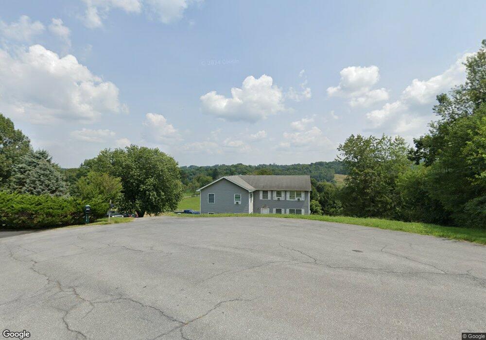
11721 Bunker Hill Ct Union Bridge, MD 21791
Estimated Value: $454,000 - $628,000
--
Bed
2
Baths
2,928
Sq Ft
$172/Sq Ft
Est. Value
About This Home
This home is located at 11721 Bunker Hill Ct, Union Bridge, MD 21791 and is currently estimated at $504,956, approximately $172 per square foot. 11721 Bunker Hill Ct is a home located in Frederick County with nearby schools including New Midway/Woodsboro Elementary School, Walkersville Middle School, and Walkersville High School.
Ownership History
Date
Name
Owned For
Owner Type
Purchase Details
Closed on
Dec 23, 1996
Sold by
Wright Clint A and Wright Kelly A
Bought by
Brown Scott D and Brown Deborah M
Current Estimated Value
Purchase Details
Closed on
Jun 17, 1993
Sold by
Richard Gary A and Richard Mary E
Bought by
Wright Clint A and Wright Kelly A
Home Financials for this Owner
Home Financials are based on the most recent Mortgage that was taken out on this home.
Original Mortgage
$127,720
Interest Rate
7.48%
Purchase Details
Closed on
Nov 1, 1989
Sold by
R. Richard Builder, Inc.
Bought by
Richard Gary A and Richard Mary E
Home Financials for this Owner
Home Financials are based on the most recent Mortgage that was taken out on this home.
Original Mortgage
$98,400
Interest Rate
9.82%
Create a Home Valuation Report for This Property
The Home Valuation Report is an in-depth analysis detailing your home's value as well as a comparison with similar homes in the area
Home Values in the Area
Average Home Value in this Area
Purchase History
| Date | Buyer | Sale Price | Title Company |
|---|---|---|---|
| Brown Scott D | $139,900 | -- | |
| Wright Clint A | $127,500 | -- | |
| Richard Gary A | $98,400 | -- |
Source: Public Records
Mortgage History
| Date | Status | Borrower | Loan Amount |
|---|---|---|---|
| Previous Owner | Wright Clint A | $127,720 | |
| Previous Owner | Richard Gary A | $98,400 | |
| Closed | Brown Scott D | -- |
Source: Public Records
Tax History Compared to Growth
Tax History
| Year | Tax Paid | Tax Assessment Tax Assessment Total Assessment is a certain percentage of the fair market value that is determined by local assessors to be the total taxable value of land and additions on the property. | Land | Improvement |
|---|---|---|---|---|
| 2025 | $4,599 | $405,700 | $128,300 | $277,400 |
| 2024 | $4,599 | $367,567 | $0 | $0 |
| 2023 | $3,974 | $329,433 | $0 | $0 |
| 2022 | $3,531 | $291,300 | $108,300 | $183,000 |
| 2021 | $3,503 | $290,100 | $0 | $0 |
| 2020 | $3,503 | $288,900 | $0 | $0 |
| 2019 | $3,489 | $287,700 | $108,300 | $179,400 |
| 2018 | $3,423 | $279,400 | $0 | $0 |
| 2017 | $3,297 | $287,700 | $0 | $0 |
| 2016 | $2,704 | $262,800 | $0 | $0 |
| 2015 | $2,704 | $261,567 | $0 | $0 |
| 2014 | $2,704 | $260,333 | $0 | $0 |
Source: Public Records
Map
Nearby Homes
- 12613 Good Intent Rd
- 12633 Claybaugh Rd
- 0 Muth Rd
- 430 Bucher John Rd
- 45 N Main St
- 6 N Farquhar St
- 147 Union Bridge Rd
- 6200 Middleburg Rd
- 11420 Green Valley Rd
- 718 Francis Scott Key Hwy
- 10216 Fountain School Rd
- 11320 Baker Rd
- 1450 Marble Quarry Rd
- 11856 Renner Rd
- 9630 B Clemsonville Rd
- 4939 Middleburg Rd
- 244 Stem Rd
- 57B Hoff Rd
- 0 Crouse Mill Rd Unit MDCR2028936
- 1312 Bruceville Rd
- 11719 Bunker Hill Ct
- 11718 Bunker Hill Ct
- 11714 Bunker Hill Ct
- 11716 Bunker Hill Ct
- 11710 Bunker Hill Ct
- 11717 Bunker Hill Ct
- 11736 Beaver Dam Rd
- 11715 Bunker Hill Ct
- 11708 Bunker Hill Ct
- 11728 Beaver Dam Rd
- 12729 Bunker Hill Rd
- 12743 Bunker Hill Rd
- 12749 Bunker Hill Rd
- 12723 Bunker Hill Rd
- 11713 Bunker Hill Ct
- 12745 Bunker Hill Rd
- 11712 Bunker Hill Ct
- 11720 Beaver Dam Rd
- 11711 Bunker Hill Ct
- 12751 Bunker Hill Rd