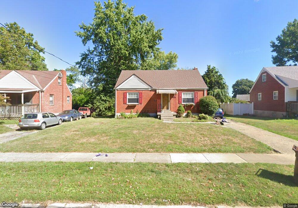
1174 Madeleine Cir Cincinnati, OH 45231
Finneytown NeighborhoodEstimated Value: $181,000 - $206,000
4
Beds
1
Bath
1,156
Sq Ft
$170/Sq Ft
Est. Value
About This Home
This home is located at 1174 Madeleine Cir, Cincinnati, OH 45231 and is currently estimated at $197,011, approximately $170 per square foot. 1174 Madeleine Cir is a home located in Hamilton County with nearby schools including Mt Healthy High School, John Paul II Catholic School, and Central Baptist Academy.
Ownership History
Date
Name
Owned For
Owner Type
Purchase Details
Closed on
Jul 20, 2006
Sold by
Federal Home Loan Mortgage Corporation
Bought by
Williams Ebony
Current Estimated Value
Home Financials for this Owner
Home Financials are based on the most recent Mortgage that was taken out on this home.
Original Mortgage
$92,000
Outstanding Balance
$55,159
Interest Rate
6.83%
Mortgage Type
Unknown
Estimated Equity
$141,852
Purchase Details
Closed on
Mar 27, 2006
Sold by
Allen Karen
Bought by
Federal Home Loan Mortgage Corporation
Purchase Details
Closed on
Aug 25, 1997
Sold by
Hoerst Mark W and Hoerst Jennifer J
Bought by
Allen Karen S
Home Financials for this Owner
Home Financials are based on the most recent Mortgage that was taken out on this home.
Original Mortgage
$82,822
Interest Rate
7.57%
Mortgage Type
FHA
Create a Home Valuation Report for This Property
The Home Valuation Report is an in-depth analysis detailing your home's value as well as a comparison with similar homes in the area
Home Values in the Area
Average Home Value in this Area
Purchase History
| Date | Buyer | Sale Price | Title Company |
|---|---|---|---|
| Williams Ebony | -- | None Available | |
| Federal Home Loan Mortgage Corporation | $82,000 | None Available | |
| Allen Karen S | $83,000 | -- |
Source: Public Records
Mortgage History
| Date | Status | Borrower | Loan Amount |
|---|---|---|---|
| Open | Williams Ebony | $92,000 | |
| Previous Owner | Allen Karen S | $82,822 |
Source: Public Records
Tax History Compared to Growth
Tax History
| Year | Tax Paid | Tax Assessment Tax Assessment Total Assessment is a certain percentage of the fair market value that is determined by local assessors to be the total taxable value of land and additions on the property. | Land | Improvement |
|---|---|---|---|---|
| 2024 | $3,525 | $51,745 | $12,331 | $39,414 |
| 2023 | $3,465 | $51,745 | $12,331 | $39,414 |
| 2022 | $3,051 | $33,037 | $12,166 | $20,871 |
| 2021 | $2,993 | $33,037 | $12,166 | $20,871 |
| 2020 | $3,042 | $33,037 | $12,166 | $20,871 |
| 2019 | $2,793 | $27,997 | $10,311 | $17,686 |
| 2018 | $2,579 | $27,997 | $10,311 | $17,686 |
| 2017 | $2,457 | $27,997 | $10,311 | $17,686 |
| 2016 | $2,756 | $30,867 | $10,651 | $20,216 |
| 2015 | $2,773 | $30,867 | $10,651 | $20,216 |
| 2014 | $2,775 | $30,867 | $10,651 | $20,216 |
| 2013 | $2,826 | $32,491 | $11,211 | $21,280 |
Source: Public Records
Map
Nearby Homes
- 8925 Monsanto Dr
- 8950 Daly Rd
- 1190 Sugartree Ct
- 8831 Daly Rd
- 1100 Gracewind Ct
- 8840 Grenada Dr
- 8772 Balboa Dr
- 8734 Grenada Dr
- 8627 Mockingbird Ln
- 8622 Mockingbird Ln
- 1151 Hempstead Dr
- 8491 Daly Rd
- 1013 Vacationland Dr
- 8681 Desoto Dr
- 958 Hollytree Dr
- 954 Hollytree Dr
- 1277 Prospect Place
- 1029 Bluejay Dr
- 1031 Lost Crossing
- 1458 Van Fleet Ave
- 1176 Madeleine Cir
- 1172 Madeleine Cir
- 1170 Madeleine Cir
- 8920 Monsanto Dr
- 1187 Tassie Ln
- 8896 Monsanto Dr
- 8912 Monsanto Dr
- 8886 Monsanto Dr
- 8904 Monsanto Dr
- 1168 Madeleine Cir
- 1173 Madeleine Cir
- 1175 Madeleine Cir
- 8930 Monsanto Dr
- 1169 Madeleine Cir
- 1177 Tassie Ln
- 1193 Tassie Ln
- 1179 Madeleine Cir
- 1167 Madeleine Cir
- 1171 Tassie Ln
- 1183 Madeleine Cir