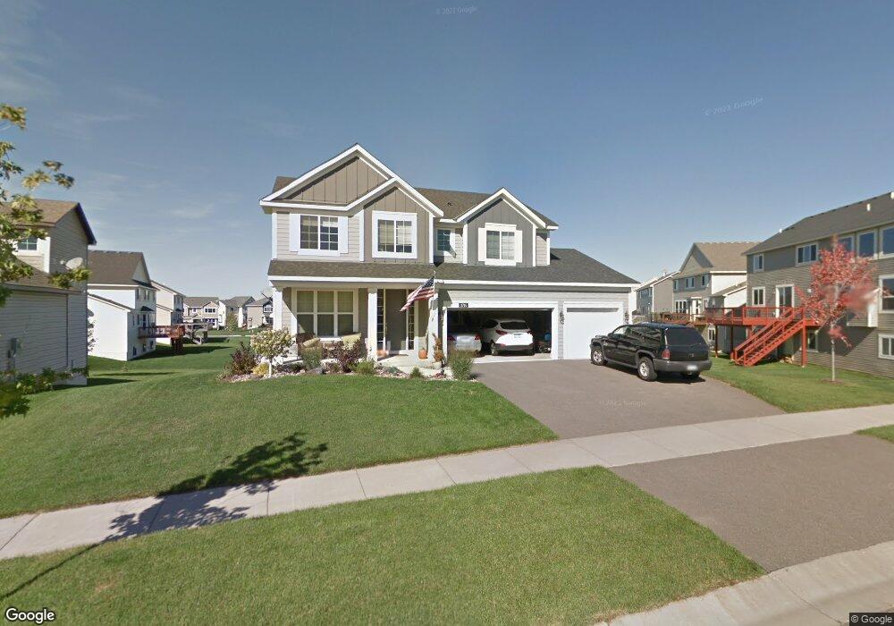
11746 Independence Way Woodbury, MN 55129
Estimated Value: $594,355 - $633,000
5
Beds
4
Baths
3,480
Sq Ft
$174/Sq Ft
Est. Value
About This Home
This home is located at 11746 Independence Way, Woodbury, MN 55129 and is currently estimated at $606,589, approximately $174 per square foot. 11746 Independence Way is a home located in Washington County with nearby schools including Afton-Lakeland Elementary School, Oak-Land Middle School, and Stillwater Area High School.
Ownership History
Date
Name
Owned For
Owner Type
Purchase Details
Closed on
Jul 31, 2020
Sold by
Olson Scott
Bought by
Abu Khashan Amer and Abu Khashan Samar
Current Estimated Value
Home Financials for this Owner
Home Financials are based on the most recent Mortgage that was taken out on this home.
Original Mortgage
$369,600
Outstanding Balance
$328,467
Interest Rate
3.1%
Mortgage Type
New Conventional
Estimated Equity
$278,123
Purchase Details
Closed on
Jul 2, 2018
Sold by
Olson Nicole Lennon and Lennon Nicole
Bought by
Olson Scott B
Create a Home Valuation Report for This Property
The Home Valuation Report is an in-depth analysis detailing your home's value as well as a comparison with similar homes in the area
Home Values in the Area
Average Home Value in this Area
Purchase History
| Date | Buyer | Sale Price | Title Company |
|---|---|---|---|
| Abu Khashan Amer | $461,818 | Title One Inc | |
| Olson Scott B | -- | None Available |
Source: Public Records
Mortgage History
| Date | Status | Borrower | Loan Amount |
|---|---|---|---|
| Open | Abu Khashan Amer | $369,600 |
Source: Public Records
Tax History Compared to Growth
Tax History
| Year | Tax Paid | Tax Assessment Tax Assessment Total Assessment is a certain percentage of the fair market value that is determined by local assessors to be the total taxable value of land and additions on the property. | Land | Improvement |
|---|---|---|---|---|
| 2024 | $5,690 | $562,600 | $140,000 | $422,600 |
| 2023 | $5,690 | $598,000 | $170,000 | $428,000 |
| 2022 | $4,616 | $532,100 | $135,000 | $397,100 |
| 2021 | $4,334 | $443,400 | $112,500 | $330,900 |
| 2020 | $4,630 | $431,700 | $112,500 | $319,200 |
| 2019 | $4,390 | $427,800 | $100,000 | $327,800 |
| 2018 | $4,348 | $406,000 | $100,000 | $306,000 |
| 2017 | $4,352 | $394,800 | $90,000 | $304,800 |
| 2016 | $4,460 | $381,300 | $85,000 | $296,300 |
| 2015 | $4,298 | $372,100 | $104,000 | $268,100 |
| 2013 | -- | $303,500 | $58,600 | $244,900 |
Source: Public Records
Map
Nearby Homes
- 3143 Frontier Dr
- 3181 Frontier Dr
- 3140 Legacy Ln
- 3237 Countryside Ct Unit A
- 11781 Harvest Path
- 11568 Ivywood Bay
- 2844 Rosemill Cir
- 11652 Aster Place
- 3015 Arden Dr
- 11344 Eagle View Terrace
- 11333 Ivywood Trail
- 11294 Ivywood Trail
- 11212 Halstead Trail
- 11080 Dogwood Ct
- 3452 Mulberry Cir
- 11458 Balsam Way
- 11446 Balsam Way
- 3307 Hazel Trail Unit C
- 12403 Meadow Bluff Trail
- 3332 Hazel Trail Unit D
- 11742 Independence Way
- 2998 Frontier Dr
- 3017 Liberty Trail
- 2994 Frontier Dr
- 2400 Liberty Trail
- 11747 Independence Way
- 2990 Frontier Dr
- 3011 Liberty Trail
- 11751 Independence Way
- 11743 Independence Way
- 2416 Liberty Trail
- 3028 Liberty Trail
- 2986 Frontier Dr
- 11754 Independence Way
- 3022 Liberty Trail
- 11739 Independence Way
- 3016 Liberty Trail
- 11755 Independence Way
- 3010 Liberty Trail
- 3042 Frontier Ridge