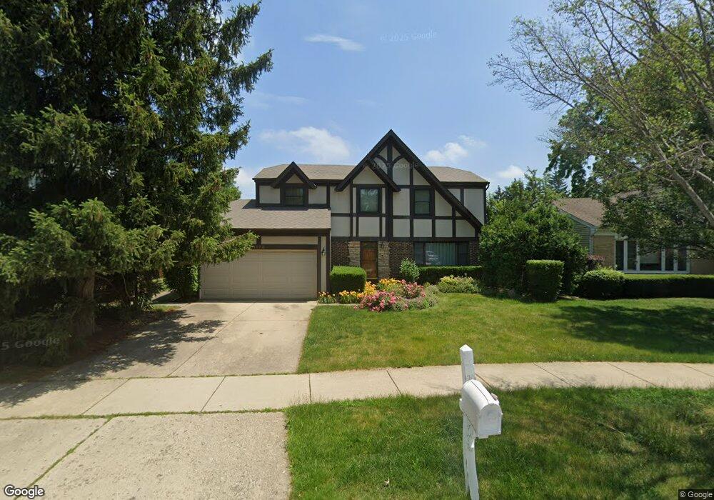
1175 Devonshire Rd Unit 1 Buffalo Grove, IL 60089
Prairie Park-Lake County NeighborhoodEstimated Value: $562,315 - $723,000
4
Beds
3
Baths
2,199
Sq Ft
$286/Sq Ft
Est. Value
About This Home
This home is located at 1175 Devonshire Rd Unit 1, Buffalo Grove, IL 60089 and is currently estimated at $628,079, approximately $285 per square foot. 1175 Devonshire Rd Unit 1 is a home located in Lake County with nearby schools including Prairie Elementary School, Twin Groves Middle School, and Adlai E Stevenson High School.
Ownership History
Date
Name
Owned For
Owner Type
Purchase Details
Closed on
Oct 27, 2011
Sold by
Mitchell Bryan Barbara and Mitchell Bryan
Bought by
Shroff Kalpesh and Shroff Kartika K
Current Estimated Value
Home Financials for this Owner
Home Financials are based on the most recent Mortgage that was taken out on this home.
Original Mortgage
$269,600
Outstanding Balance
$184,461
Interest Rate
4.09%
Mortgage Type
New Conventional
Estimated Equity
$443,618
Create a Home Valuation Report for This Property
The Home Valuation Report is an in-depth analysis detailing your home's value as well as a comparison with similar homes in the area
Home Values in the Area
Average Home Value in this Area
Purchase History
| Date | Buyer | Sale Price | Title Company |
|---|---|---|---|
| Shroff Kalpesh | $337,000 | Attorneys Title Guaranty Fun |
Source: Public Records
Mortgage History
| Date | Status | Borrower | Loan Amount |
|---|---|---|---|
| Open | Shroff Kalpesh | $269,600 |
Source: Public Records
Tax History
| Year | Tax Paid | Tax Assessment Tax Assessment Total Assessment is a certain percentage of the fair market value that is determined by local assessors to be the total taxable value of land and additions on the property. | Land | Improvement |
|---|---|---|---|---|
| 2024 | $14,569 | $159,000 | $34,357 | $124,643 |
| 2023 | $13,803 | $150,028 | $32,418 | $117,610 |
| 2022 | $13,803 | $138,375 | $29,900 | $108,475 |
| 2021 | $13,280 | $136,883 | $29,578 | $107,305 |
| 2020 | $12,967 | $137,350 | $29,679 | $107,671 |
| 2019 | $12,789 | $136,844 | $29,570 | $107,274 |
| 2018 | $12,237 | $137,725 | $29,224 | $108,501 |
| 2017 | $12,242 | $134,510 | $28,542 | $105,968 |
| 2016 | $11,924 | $128,804 | $27,331 | $101,473 |
| 2015 | $11,610 | $120,457 | $25,560 | $94,897 |
| 2014 | $10,311 | $106,186 | $27,452 | $78,734 |
| 2012 | $10,233 | $106,399 | $27,507 | $78,892 |
Source: Public Records
Map
Nearby Homes
- 1234 Devonshire Rd
- 1265 Devonshire Rd
- 1318 Gail Dr Unit 4
- 1361 Brandywyn Ln
- 1152 Courtland Dr Unit 406
- 327 Lasalle Ln
- 810 Silver Rock Ln
- 1380 Larchmont Dr
- 962 Thompson Blvd
- 1161 Parker Ln
- 5176 Aptakisic Rd
- 531 Lasalle Ln
- 5107 N Arlington Heights Rd
- 938 Hidden Lake Dr
- 1096 Pine Tree Cir N
- 533 Lyon Dr
- 1265 Franklin Ln Unit L1
- 1325 Fairfax Ln
- 5135 Bridlewood Ct
- 126 Autumn Ct Unit CT76021
- 1169 Devonshire Rd
- 1181 Devonshire Rd
- 1172 Brandywyn Ln
- 1163 Devonshire Rd
- 1187 Devonshire Rd
- 1180 Brandywyn Ln
- 1174 Devonshire Rd
- 1166 Brandywyn Ln
- 1164 Devonshire Rd
- 1203 Devonshire Rd
- 1157 Devonshire Rd
- 1186 Brandywyn Ln
- 1184 Devonshire Rd
- 1194 Devonshire Rd
- 1154 Devonshire Rd
- 1209 Devonshire Rd
- 1151 Devonshire Rd
- 1200 Brandywyn Ln
- 1160 Brandywyn Ln
- 1175 Dayton Rd
Your Personal Tour Guide
Ask me questions while you tour the home.