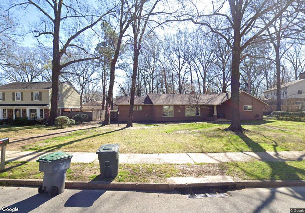
1176 Brookfield Rd Memphis, TN 38119
Colonial Acres NeighborhoodEstimated Value: $371,000 - $413,000
3
Beds
3
Baths
2,585
Sq Ft
$152/Sq Ft
Est. Value
About This Home
This home is located at 1176 Brookfield Rd, Memphis, TN 38119 and is currently estimated at $392,747, approximately $151 per square foot. 1176 Brookfield Rd is a home located in Shelby County with nearby schools including Sea Isle Elementary School, Colonial Middle, and Overton High.
Ownership History
Date
Name
Owned For
Owner Type
Purchase Details
Closed on
Jun 15, 2004
Sold by
Prescott Lana K
Bought by
Eddins Joseph E and Eddins Tonya
Current Estimated Value
Home Financials for this Owner
Home Financials are based on the most recent Mortgage that was taken out on this home.
Original Mortgage
$169,200
Outstanding Balance
$84,371
Interest Rate
6.3%
Mortgage Type
Purchase Money Mortgage
Estimated Equity
$308,376
Create a Home Valuation Report for This Property
The Home Valuation Report is an in-depth analysis detailing your home's value as well as a comparison with similar homes in the area
Home Values in the Area
Average Home Value in this Area
Purchase History
| Date | Buyer | Sale Price | Title Company |
|---|---|---|---|
| Eddins Joseph E | $212,500 | -- |
Source: Public Records
Mortgage History
| Date | Status | Borrower | Loan Amount |
|---|---|---|---|
| Open | Eddins Joseph E | $169,200 | |
| Closed | Eddins Joseph E | $42,300 |
Source: Public Records
Tax History Compared to Growth
Tax History
| Year | Tax Paid | Tax Assessment Tax Assessment Total Assessment is a certain percentage of the fair market value that is determined by local assessors to be the total taxable value of land and additions on the property. | Land | Improvement |
|---|---|---|---|---|
| 2025 | $1,525 | $89,000 | $17,625 | $71,375 |
| 2024 | $2,525 | $74,475 | $16,025 | $58,450 |
| 2023 | $4,537 | $74,475 | $16,025 | $58,450 |
| 2022 | $4,537 | $74,475 | $16,025 | $58,450 |
| 2021 | $4,590 | $74,475 | $16,025 | $58,450 |
| 2020 | $3,953 | $54,550 | $16,025 | $38,525 |
| 2019 | $3,953 | $54,550 | $16,025 | $38,525 |
| 2018 | $3,953 | $54,550 | $16,025 | $38,525 |
| 2017 | $2,242 | $54,550 | $16,025 | $38,525 |
| 2016 | $2,280 | $52,175 | $0 | $0 |
| 2014 | $2,280 | $52,175 | $0 | $0 |
Source: Public Records
Map
Nearby Homes
- 1164 Brookfield Rd
- 5691 Park Ave
- 1121 Park Green Cove
- 5512 Park Ave
- 1220 E Irvin Dr
- 1279 W Crestwood Dr
- 1149 E Irvin Dr
- 5476 E East End Village Dr
- 5478 N Rolling Oaks Dr
- 5492 Park Ave
- 5482 Park Ave
- 5480 Park Ave
- 5845 Park Ave Unit 5845
- 1205 Bristol Dr Unit 18
- 5474 Park Ave
- 1212 Bristol Dr
- 5867 Park Ave Unit 5867
- 1238 Bristol Dr Unit 1238
- 1040 Park Court Dr
- 1220 Chamberlain Dr Unit 1
- 1196 Yorkshire Dr
- 1200 Yorkshire Dr
- 1183 Brookfield Rd
- 5699 Park Ave
- 1173 Brookfield Rd
- 1163 Brookfield Rd
- 1204 Yorkshire Dr
- 1191 Brookfield Rd
- 1201 Brookfield Rd
- 5707 Park Ave
- 1197 Yorkshire Dr
- 1208 Yorkshire Dr
- 5615 Park Ave
- 1203 Yorkshire Dr
- 5717 Park Ave
- 1176 E Crestwood Dr
- 1166 E Crestwood Dr
- 1217 Brookfield Rd
- 1212 Yorkshire Dr
- 1207 Yorkshire Dr