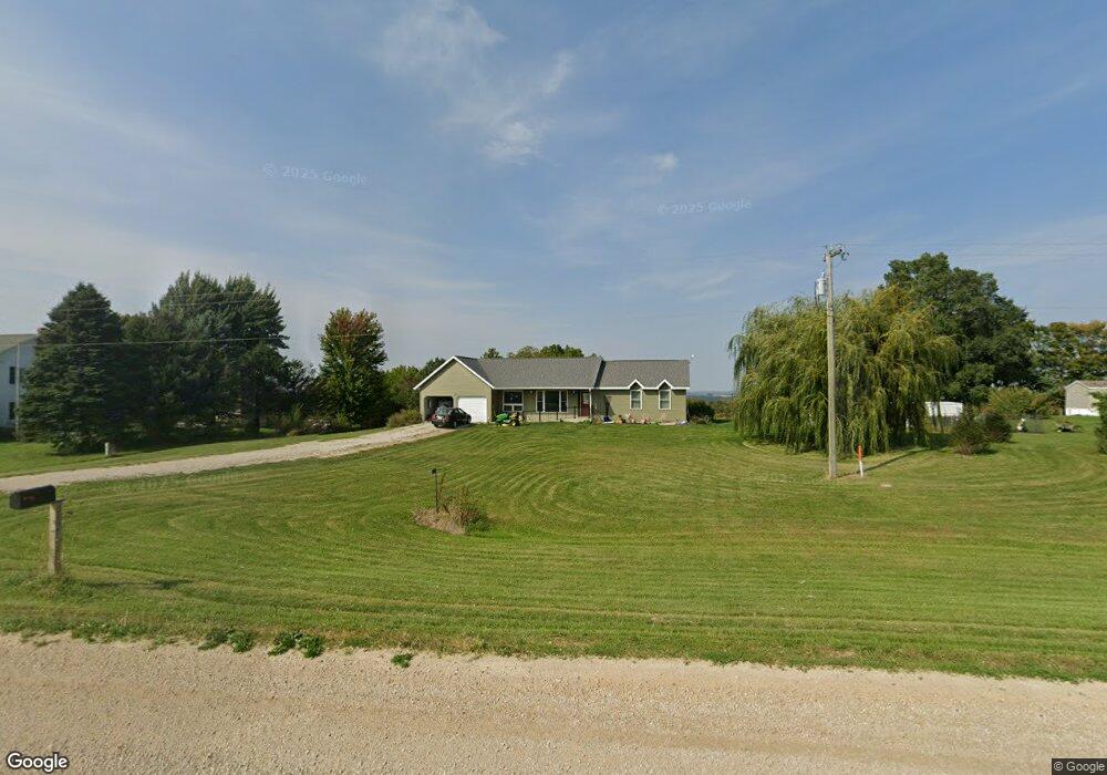
1176 Highway 9 Lansing, IA 52151
Estimated Value: $252,000 - $372,000
2
Beds
1
Bath
1,615
Sq Ft
$201/Sq Ft
Est. Value
About This Home
This home is located at 1176 Highway 9, Lansing, IA 52151 and is currently estimated at $324,103, approximately $200 per square foot. 1176 Highway 9 is a home located in Allamakee County with nearby schools including West Campus Elementary School, East Campus Elementary School, and Waukon Middle School.
Ownership History
Date
Name
Owned For
Owner Type
Purchase Details
Closed on
Feb 19, 2014
Sold by
Middendorf Brian J
Bought by
Harris Jennifer Kay
Current Estimated Value
Home Financials for this Owner
Home Financials are based on the most recent Mortgage that was taken out on this home.
Original Mortgage
$175,000
Outstanding Balance
$132,506
Interest Rate
4.39%
Mortgage Type
New Conventional
Estimated Equity
$191,597
Create a Home Valuation Report for This Property
The Home Valuation Report is an in-depth analysis detailing your home's value as well as a comparison with similar homes in the area
Home Values in the Area
Average Home Value in this Area
Purchase History
| Date | Buyer | Sale Price | Title Company |
|---|---|---|---|
| Harris Jennifer Kay | $150,000 | None Available |
Source: Public Records
Mortgage History
| Date | Status | Borrower | Loan Amount |
|---|---|---|---|
| Open | Harris Jennifer Kay | $175,000 |
Source: Public Records
Tax History Compared to Growth
Tax History
| Year | Tax Paid | Tax Assessment Tax Assessment Total Assessment is a certain percentage of the fair market value that is determined by local assessors to be the total taxable value of land and additions on the property. | Land | Improvement |
|---|---|---|---|---|
| 2025 | $3,202 | $309,300 | $45,100 | $264,200 |
| 2024 | $3,202 | $276,900 | $45,100 | $231,800 |
| 2023 | $3,048 | $276,900 | $45,100 | $231,800 |
| 2022 | $2,528 | $209,400 | $45,100 | $164,300 |
| 2021 | $2,396 | $209,400 | $45,100 | $164,300 |
| 2020 | $2,396 | $189,400 | $40,800 | $148,600 |
| 2019 | $2,246 | $175,000 | $0 | $0 |
| 2018 | $2,196 | $175,000 | $0 | $0 |
| 2017 | $2,196 | $160,800 | $0 | $0 |
| 2016 | $1,956 | $155,800 | $0 | $0 |
| 2015 | $1,956 | $155,800 | $0 | $0 |
| 2014 | $1,830 | $155,800 | $0 | $0 |
Source: Public Records
Map
Nearby Homes
- 1464 Iowa 9
- 000 Tbd Lycurgus Rd
- 2162 Lycurgus Rd
- 1511 Scenic Valley Rd
- 2307 Mays Prairie Rd
- 210 Northgate Ave NW
- 821 4th St NW
- 820 4th St NW
- 602 2nd St NW
- 0 Parcel Id#1031351007 Unit 20211899
- 0 Parcel Id#1506100051 Unit 20211897
- 0 Parcel Id#1031376012 Unit 20211905
- 0 Parcel Id#1031376013 Unit 20211902
- 0 Parcel Id#1031351004 Unit 20211906
- 0 Parcel Id#1031376005 Unit 20211907
- 0 Parcel Id#1031351006 Unit 20211900
- 933 Iowa River Dr
- 22 3rd Ave SE
- 525 4th St SE
- 2036 Iowa 76