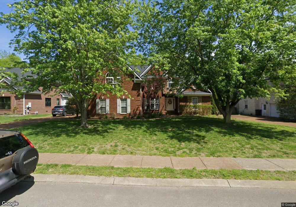
1176 Mccoury Ln Spring Hill, TN 37174
Estimated Value: $680,049 - $747,000
--
Bed
5
Baths
2,984
Sq Ft
$242/Sq Ft
Est. Value
About This Home
This home is located at 1176 Mccoury Ln, Spring Hill, TN 37174 and is currently estimated at $721,262, approximately $241 per square foot. 1176 Mccoury Ln is a home located in Williamson County with nearby schools including Primrose School of Spring Hill.
Ownership History
Date
Name
Owned For
Owner Type
Purchase Details
Closed on
Dec 3, 2008
Sold by
Prudential Relocation Inc
Bought by
Zongor Steve and Zongor Patricia
Current Estimated Value
Home Financials for this Owner
Home Financials are based on the most recent Mortgage that was taken out on this home.
Original Mortgage
$190,000
Interest Rate
5.24%
Mortgage Type
Purchase Money Mortgage
Purchase Details
Closed on
Dec 1, 2008
Sold by
Turk Ronald B and Turk Joyce
Bought by
Prudential Relocation Inc
Home Financials for this Owner
Home Financials are based on the most recent Mortgage that was taken out on this home.
Original Mortgage
$190,000
Interest Rate
5.24%
Mortgage Type
Purchase Money Mortgage
Purchase Details
Closed on
Dec 1, 2003
Sold by
Santoro Custom Builders Inc
Bought by
Turk Ronald B
Home Financials for this Owner
Home Financials are based on the most recent Mortgage that was taken out on this home.
Original Mortgage
$191,900
Interest Rate
4.69%
Mortgage Type
Purchase Money Mortgage
Create a Home Valuation Report for This Property
The Home Valuation Report is an in-depth analysis detailing your home's value as well as a comparison with similar homes in the area
Home Values in the Area
Average Home Value in this Area
Purchase History
| Date | Buyer | Sale Price | Title Company |
|---|---|---|---|
| Zongor Steve | $279,000 | Security Title & Escrow Co L | |
| Prudential Relocation Inc | $297,500 | Bankers Title & Escrow Corp | |
| Turk Ronald B | $281,900 | Watauga Title Company |
Source: Public Records
Mortgage History
| Date | Status | Borrower | Loan Amount |
|---|---|---|---|
| Previous Owner | Zongor Steve | $190,000 | |
| Previous Owner | Turk Ronald B | $191,900 |
Source: Public Records
Tax History Compared to Growth
Tax History
| Year | Tax Paid | Tax Assessment Tax Assessment Total Assessment is a certain percentage of the fair market value that is determined by local assessors to be the total taxable value of land and additions on the property. | Land | Improvement |
|---|---|---|---|---|
| 2025 | $845 | $174,675 | $42,500 | $132,175 |
| 2024 | $845 | $114,300 | $22,500 | $91,800 |
| 2023 | $845 | $114,300 | $22,500 | $91,800 |
| 2022 | $2,092 | $114,300 | $22,500 | $91,800 |
| 2021 | $2,092 | $114,300 | $22,500 | $91,800 |
| 2020 | $1,933 | $89,500 | $16,250 | $73,250 |
| 2019 | $1,933 | $89,500 | $16,250 | $73,250 |
| 2018 | $1,871 | $89,500 | $16,250 | $73,250 |
| 2017 | $1,853 | $89,500 | $16,250 | $73,250 |
| 2016 | $1,826 | $89,500 | $16,250 | $73,250 |
| 2015 | -- | $75,200 | $15,000 | $60,200 |
| 2014 | -- | $75,200 | $15,000 | $60,200 |
Source: Public Records
Map
Nearby Homes
- 2165 Loudenslager Dr
- 2184 Loudenslager Dr
- 1083 Auldridge Dr
- 2785 Rutland Ct
- 2836 Pedigo Place
- 2127 Loudenslager Dr
- 403 Preakness Dr
- 2112 Loudenslager Dr
- 0 Campbell Station Pkwy
- 0 O'Hallorn Dr
- 2052 Hemlock Dr
- 3040 Havasu Dr
- 1092 Misty Morn Cir
- 2104 Loudenslager Dr
- 2641 Buckner Rd
- 2091 Hemlock Dr
- 3024 Harrah Dr
- 6011 Dupont Cove
- 2935 Stewart Campbell Point
- 2021 Hemlock Dr
- 2167 Loudenslager Dr
- 1172 Mccoury Ln
- 1180 Mccoury Ln
- 1181 Mccoury Ln
- 2163 Loudenslager Dr
- 1175 Mccoury Ln
- 2169 Loudenslager Dr
- 1179 Mccoury Ln
- 1170 Mccoury Ln
- 1183 Mccoury Ln
- 2171 Loudenslager Dr
- 1182 Mccoury Ln
- 2161 Loudenslager Dr
- 1173 Mccoury Ln
- 2159 Loudenslager Dr
- 1171 Mccoury Ln
- 1168 Mccoury Ln
- 1185 Mccoury Ln
- 2166 Loudenslager Dr
- 2168 Loudenslager Dr