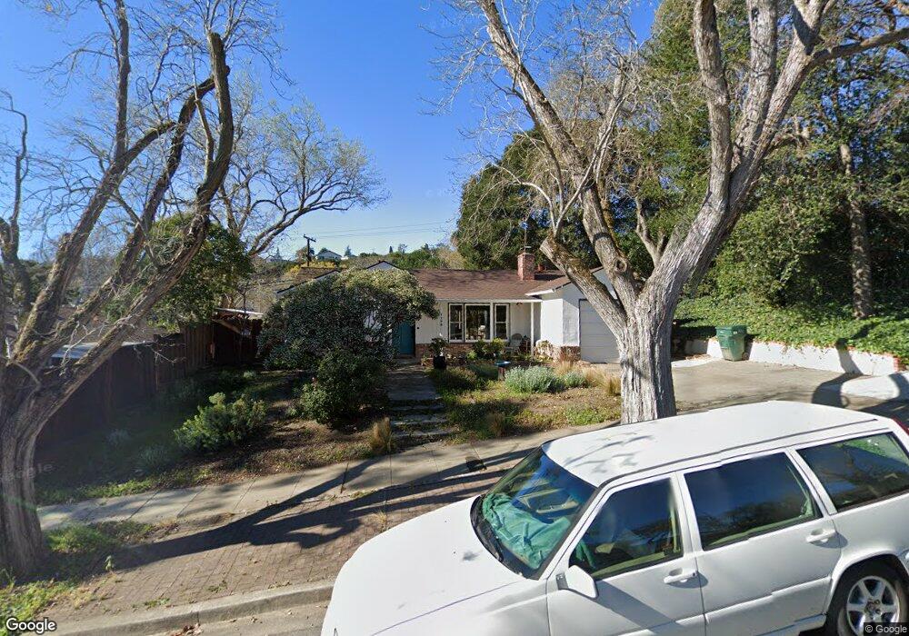
1176 Westwood St Redwood City, CA 94061
Farm Hill NeighborhoodEstimated Value: $1,706,000 - $1,987,000
3
Beds
2
Baths
1,210
Sq Ft
$1,514/Sq Ft
Est. Value
About This Home
This home is located at 1176 Westwood St, Redwood City, CA 94061 and is currently estimated at $1,831,660, approximately $1,513 per square foot. 1176 Westwood St is a home located in San Mateo County with nearby schools including Roosevelt Elementary School, John F. Kennedy Middle School, and Woodside High School.
Ownership History
Date
Name
Owned For
Owner Type
Purchase Details
Closed on
Jul 9, 2020
Sold by
Ragains Joseph E and Ragains Gail
Bought by
Ragains Joseph Earl and Ragains Gail Marie
Current Estimated Value
Purchase Details
Closed on
Sep 22, 1995
Sold by
Eldredge Michael J and Eldredge Nancy H
Bought by
Ragains Joseph E and Ragains Gail
Home Financials for this Owner
Home Financials are based on the most recent Mortgage that was taken out on this home.
Original Mortgage
$227,500
Interest Rate
7.25%
Create a Home Valuation Report for This Property
The Home Valuation Report is an in-depth analysis detailing your home's value as well as a comparison with similar homes in the area
Home Values in the Area
Average Home Value in this Area
Purchase History
| Date | Buyer | Sale Price | Title Company |
|---|---|---|---|
| Ragains Joseph Earl | -- | None Available | |
| Ragains Joseph E | $302,500 | North American Title Co |
Source: Public Records
Mortgage History
| Date | Status | Borrower | Loan Amount |
|---|---|---|---|
| Closed | Ragains Joseph E | $227,500 |
Source: Public Records
Tax History Compared to Growth
Tax History
| Year | Tax Paid | Tax Assessment Tax Assessment Total Assessment is a certain percentage of the fair market value that is determined by local assessors to be the total taxable value of land and additions on the property. | Land | Improvement |
|---|---|---|---|---|
| 2025 | $6,652 | $502,502 | $251,251 | $251,251 |
| 2023 | $6,652 | $482,992 | $241,496 | $241,496 |
| 2022 | $6,216 | $473,522 | $236,761 | $236,761 |
| 2021 | $5,094 | $464,238 | $232,119 | $232,119 |
| 2020 | $5,026 | $459,478 | $229,739 | $229,739 |
| 2019 | $5,006 | $450,470 | $225,235 | $225,235 |
| 2018 | $4,875 | $441,638 | $220,819 | $220,819 |
| 2017 | $4,822 | $432,980 | $216,490 | $216,490 |
| 2016 | $4,726 | $424,492 | $212,246 | $212,246 |
| 2015 | $4,550 | $418,116 | $209,058 | $209,058 |
| 2014 | $4,462 | $409,926 | $204,963 | $204,963 |
Source: Public Records
Map
Nearby Homes
- 1159 Chesterton Ave
- 2504 Hastings Ave
- 1103 Connecticut Dr
- 3694 Country Club Dr
- 3622 Farm Hill Blvd
- 949 Pleasant Hill Rd
- 697 Glennan Dr
- 3676 Mcnulty Way
- 3647 Jefferson Ave
- 2474 Washington Ave
- 2423 Palm Ave
- 938 Round Hill Rd
- 3654 Altamont Way
- 2013 Oregon Ave
- 1830 Vera Ave
- 624 Sapphire St
- 1640 Connecticut Dr
- 1465 Bonnie Ct
- 155 Normandy Ln
- 542 Topaz St
- 1131 Westwood St
- 1177 Westwood St
- 1181 Fernside St
- 1181 Westwood St
- 1177 Fernside St
- 2913 Roosevelt Ave
- 1169 Fernside St
- 1187 Westwood St
- 1203 Fernside St
- 1155 Fernside St
- 2835 Briarfield Ave
- 1208 Westwood St
- 1209 Fernside St
- 2902 Briarfield Ave
- 2926 Briarfield Ave
- 1132 Crompton Rd
- 2894 Briarfield Ave
- 2950 Briarfield Ave
- 1180 Crompton Rd
- 2864 Briarfield Ave