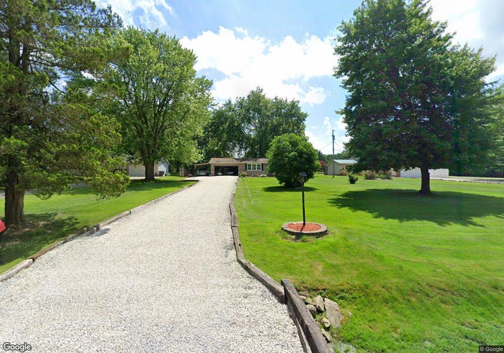
11766 Sharp Dr Doylestown, OH 44230
Estimated Value: $259,000 - $301,000
3
Beds
1
Bath
1,232
Sq Ft
$222/Sq Ft
Est. Value
About This Home
This home is located at 11766 Sharp Dr, Doylestown, OH 44230 and is currently estimated at $273,308, approximately $221 per square foot. 11766 Sharp Dr is a home located in Wayne County with nearby schools including Hazel Harvey Elementary School, Chippewa Intermediate School, and Chippewa Jr./Sr. High School.
Ownership History
Date
Name
Owned For
Owner Type
Purchase Details
Closed on
May 24, 1999
Sold by
Dashofy Keith A
Bought by
Douglas Mark W Elizabeth F
Current Estimated Value
Home Financials for this Owner
Home Financials are based on the most recent Mortgage that was taken out on this home.
Original Mortgage
$105,750
Outstanding Balance
$23,897
Interest Rate
6.99%
Mortgage Type
New Conventional
Estimated Equity
$249,411
Purchase Details
Closed on
Jan 12, 1996
Sold by
Rittenhour Mark
Bought by
Dashofy Keith A and Dashofy Sally S
Home Financials for this Owner
Home Financials are based on the most recent Mortgage that was taken out on this home.
Original Mortgage
$86,000
Interest Rate
7.36%
Mortgage Type
New Conventional
Purchase Details
Closed on
Jun 30, 1986
Bought by
Rittenhour Mark and Mary Be
Create a Home Valuation Report for This Property
The Home Valuation Report is an in-depth analysis detailing your home's value as well as a comparison with similar homes in the area
Home Values in the Area
Average Home Value in this Area
Purchase History
| Date | Buyer | Sale Price | Title Company |
|---|---|---|---|
| Douglas Mark W Elizabeth F | $117,500 | -- | |
| Dashofy Keith A | $98,000 | -- | |
| Rittenhour Mark | $54,000 | -- |
Source: Public Records
Mortgage History
| Date | Status | Borrower | Loan Amount |
|---|---|---|---|
| Open | Douglas Mark W Elizabeth F | $105,750 | |
| Previous Owner | Dashofy Keith A | $86,000 |
Source: Public Records
Tax History
| Year | Tax Paid | Tax Assessment Tax Assessment Total Assessment is a certain percentage of the fair market value that is determined by local assessors to be the total taxable value of land and additions on the property. | Land | Improvement |
|---|---|---|---|---|
| 2025 | $2,771 | $80,170 | $22,630 | $57,540 |
| 2024 | $2,771 | $80,170 | $22,630 | $57,540 |
| 2023 | $2,784 | $80,170 | $22,630 | $57,540 |
| 2022 | $2,074 | $54,910 | $15,500 | $39,410 |
| 2021 | $2,089 | $54,910 | $15,500 | $39,410 |
| 2020 | $1,888 | $49,250 | $15,500 | $33,750 |
| 2019 | $1,832 | $46,140 | $14,770 | $31,370 |
| 2018 | $1,850 | $46,140 | $14,770 | $31,370 |
| 2017 | $1,807 | $46,140 | $14,770 | $31,370 |
| 2016 | $1,789 | $44,380 | $14,210 | $30,170 |
| 2015 | $1,781 | $44,380 | $14,210 | $30,170 |
| 2014 | $1,563 | $44,380 | $14,210 | $30,170 |
| 2013 | $1,549 | $42,640 | $15,180 | $27,460 |
Source: Public Records
Map
Nearby Homes
- 12214 Vince Dr
- 18592 Edwards Rd Unit 137
- 18592 Edwards Rd Unit 3
- 7648 N 2nd Ave
- 16441 Bieri Rd
- 100 Merlot Ct
- 2761 North St
- 12045 Coal Bank Rd
- 6300 S Cleveland Massillon Rd
- 204 Circle Dr
- 15899 Mccallum Dr
- 14740 Oak Grove Dr Unit 41
- 580 Thorn Way
- 680 Thorn Way
- 620 Thorn Way
- 8177 S Cleveland Massillon Rd Unit 16
- 0 S Portage St
- 6670 Kepler Rd
- VL 1067 Homan Dr
- 14831 Calaboone Rd
- 11756 Sharp Dr
- 11788 Sharp Dr
- 11742 Sharp Dr
- 11730 Sharp Dr
- 11804 Clinton Rd
- 11814 Clinton Rd
- 11761 Clinton Rd
- 11720 Sharp Dr
- 11767 Clinton Rd
- 11787 Clinton Rd
- 11637 Rogues Dr
- 18390 William Dr
- 11824 Clinton Rd
- 18428 William Dr
- 11642 Rogues Dr
- 11813 Clinton Rd
- 11834 Clinton Rd
- 18468 William Dr
- 11867 Breezewood Dr
- 11827 Clinton Rd
Your Personal Tour Guide
Ask me questions while you tour the home.