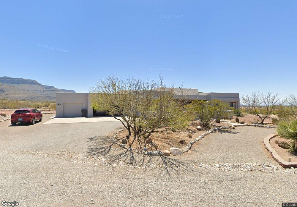
1177 Caneadea Loop Alamogordo, NM 88310
Estimated Value: $437,000 - $543,000
4
Beds
3
Baths
2,507
Sq Ft
$196/Sq Ft
Est. Value
About This Home
This home is located at 1177 Caneadea Loop, Alamogordo, NM 88310 and is currently estimated at $492,410, approximately $196 per square foot. 1177 Caneadea Loop is a home located in Otero County with nearby schools including Yucca Elementary School, Desert Star Elementary School, and Mountain View Middle School.
Ownership History
Date
Name
Owned For
Owner Type
Purchase Details
Closed on
Jun 15, 2023
Sold by
King Maria Reynalda
Bought by
Lopez Julio F
Current Estimated Value
Purchase Details
Closed on
Jun 25, 2009
Sold by
Benson Mark J and Benson Beverley J
Bought by
King Randolph E and King Mary K
Home Financials for this Owner
Home Financials are based on the most recent Mortgage that was taken out on this home.
Original Mortgage
$260,000
Interest Rate
4.83%
Mortgage Type
Purchase Money Mortgage
Purchase Details
Closed on
Apr 27, 2006
Sold by
Brown Fred C and Brown Rose M
Bought by
Benson Mark J and Benson Beverley J
Create a Home Valuation Report for This Property
The Home Valuation Report is an in-depth analysis detailing your home's value as well as a comparison with similar homes in the area
Purchase History
| Date | Buyer | Sale Price | Title Company |
|---|---|---|---|
| Lopez Julio F | -- | None Listed On Document | |
| King Randolph E | -- | None Available | |
| Benson Mark J | -- | None Available |
Source: Public Records
Mortgage History
| Date | Status | Borrower | Loan Amount |
|---|---|---|---|
| Previous Owner | King Randolph E | $260,000 |
Source: Public Records
Tax History
| Year | Tax Paid | Tax Assessment Tax Assessment Total Assessment is a certain percentage of the fair market value that is determined by local assessors to be the total taxable value of land and additions on the property. | Land | Improvement |
|---|---|---|---|---|
| 2025 | $3,366 | $143,900 | $16,683 | $127,217 |
| 2024 | $3,395 | $139,709 | $15,744 | $123,965 |
| 2023 | $3,350 | $135,640 | $14,750 | $120,890 |
| 2022 | $3,272 | $131,690 | $14,750 | $116,940 |
| 2021 | $3,310 | $131,640 | $14,363 | $117,277 |
| 2020 | $3,310 | $131,640 | $14,363 | $117,277 |
| 2019 | $3,262 | $129,060 | $14,082 | $114,978 |
| 2018 | $3,173 | $127,781 | $13,941 | $113,828 |
| 2017 | $2,917 | $125,276 | $13,668 | $111,596 |
| 2016 | $2,836 | $122,820 | $0 | $0 |
| 2015 | $2,775 | $120,412 | $0 | $0 |
| 2014 | -- | $118,050 | $12,880 | $105,170 |
Source: Public Records
Map
Nearby Homes
- 815 Shiprock
- 809 Shiprock
- 0 Divers Cove
- 848 Sky Ranch
- 34 Claraboya Loop
- 477 Camino Real
- 2147 Camino Del Sol
- 63 Desert Lakes Rd
- 452 Camino Real
- 1552 Puesta Del Sol
- 2097 Cielo Bonito
- 2416 Sedona Ridge
- 2429 Desert Bloom Ct
- 2472 Sedona Ridge
- 814 Arroyo Seco
- 1675 Las Lomas Unit 6
- 500 S Florida Ave
- 2073 Calle de Vistas
- 2435 Cherry Hills Dr
- 346 Camino Real
- 2035 Cameo Dr
- 1146 Caneadea Loop
- 2034 Cameo Dr
- 1217 Caneadea Loop
- 1137 Caneadea Loop
- 2005 Cameo Dr
- 1226 Caneadea Loop
- 2014 Cameo Dr
- 1116 Caneadea Loop
- 1066 Caneadea Loop
- 825 Shiprock
- 1257 Caneadea Loop
- 823 Shiprock
- 824 Shiprock
- 1246 Caneadea Loop
- 1984 Cameo Dr
- 1117 Caneadea Loop
- 936 Caneadea Loop
- 821 Shiprock
- 819 Shiprock
Your Personal Tour Guide
Ask me questions while you tour the home.