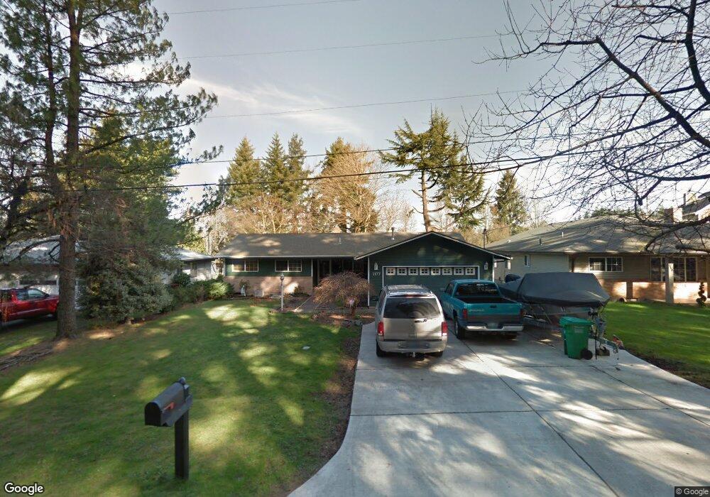
1177 NW Council Dr Gresham, OR 97030
Northwest Gresham NeighborhoodEstimated Value: $468,000 - $522,000
3
Beds
3
Baths
2,082
Sq Ft
$241/Sq Ft
Est. Value
About This Home
This home is located at 1177 NW Council Dr, Gresham, OR 97030 and is currently estimated at $500,908, approximately $240 per square foot. 1177 NW Council Dr is a home located in Multnomah County with nearby schools including North Gresham Elementary School, Clear Creek Middle School, and Gresham High School.
Ownership History
Date
Name
Owned For
Owner Type
Purchase Details
Closed on
Mar 19, 2025
Sold by
Casteel Mary Elizabeth and Casteel Michael H
Bought by
Passive Dog Heaven Trust and Casteel
Current Estimated Value
Create a Home Valuation Report for This Property
The Home Valuation Report is an in-depth analysis detailing your home's value as well as a comparison with similar homes in the area
Home Values in the Area
Average Home Value in this Area
Purchase History
| Date | Buyer | Sale Price | Title Company |
|---|---|---|---|
| Passive Dog Heaven Trust | -- | None Listed On Document |
Source: Public Records
Tax History
| Year | Tax Paid | Tax Assessment Tax Assessment Total Assessment is a certain percentage of the fair market value that is determined by local assessors to be the total taxable value of land and additions on the property. | Land | Improvement |
|---|---|---|---|---|
| 2025 | $5,272 | $259,090 | -- | -- |
| 2024 | $5,047 | $251,550 | -- | -- |
| 2023 | $5,047 | $273,990 | -- | -- |
| 2022 | $5,014 | $266,010 | $0 | $0 |
| 2021 | $4,888 | $258,270 | $0 | $0 |
| 2020 | $4,599 | $250,750 | $0 | $0 |
| 2019 | $4,479 | $243,450 | $0 | $0 |
| 2018 | $4,271 | $236,360 | $0 | $0 |
| 2017 | $4,097 | $229,480 | $0 | $0 |
| 2016 | $3,613 | $222,800 | $0 | $0 |
| 2015 | $3,535 | $216,320 | $0 | $0 |
| 2014 | $3,449 | $210,020 | $0 | $0 |
Source: Public Records
Map
Nearby Homes
- 1711 NW 19th St
- 920 SE 214th Ave
- 2013 NW Bella Vista Dr
- 1811 NW 19th St
- 1026 SE 209th Ave
- 21001 SE Yamhill St
- 21532 SE Alder St
- 1861 NW Wonderview Ave
- 21016 SE Stark St Unit 71
- 21016 SE Stark St Unit 69
- 21260 SE Stark St
- 21400 SE Stark St Unit 2
- 994 NW Wallula Ave
- 21525 SE Oak St
- 1035 SE 225th Ave
- 1387 NW Riverview Ave Unit 14B
- 209 SE 214th Ave
- 132 SE 214th Ave
- 21553 SE Ankeny Terrace
- 54 NW 13th St
- 1233 NW Council Dr
- 1131 NW Council Dr
- 1072 NW Burnside Rd Unit 1
- 1072 NW Burnside Rd
- 1259 NW Council Dr
- 1224 NW Burnside Rd
- 1068 NW Burnside Rd Unit 2
- 1068 NW Burnside Rd
- 1064 NW Burnside Rd Unit 3
- 1064 NW Burnside Rd
- 1063 NW Council Dr Unit 19
- 1063 NW Council Dr
- 1056 NW Burnside Rd Unit 4
- 1056 NW Burnside Rd
- 1056 NW Council Dr
- 1059 NW Council Dr Unit 18
- 1059 NW Council Dr
- 1057 NW Council Dr
- 2128 NW Wallula Ave
- 2102 NW Wallula Ave
Your Personal Tour Guide
Ask me questions while you tour the home.