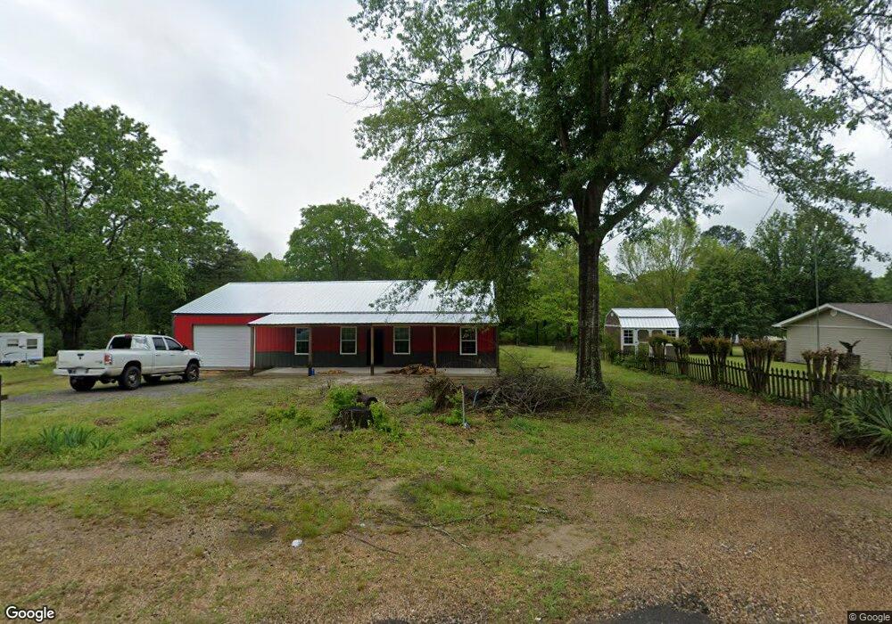
1178 Francois Rd Malvern, AR 72104
Estimated Value: $102,000 - $175,000
--
Bed
1
Bath
1,044
Sq Ft
$119/Sq Ft
Est. Value
About This Home
This home is located at 1178 Francois Rd, Malvern, AR 72104 and is currently estimated at $124,361, approximately $119 per square foot. 1178 Francois Rd is a home located in Hot Spring County with nearby schools including Glen Rose Elementary School, Glen Rose Middle School, and Glen Rose High School.
Ownership History
Date
Name
Owned For
Owner Type
Purchase Details
Closed on
Apr 29, 2022
Sold by
Holder Lisa G
Bought by
Harmon Varonica
Current Estimated Value
Purchase Details
Closed on
Jan 29, 2021
Sold by
Sage Holdings Llc
Bought by
Barkley Sharon R
Home Financials for this Owner
Home Financials are based on the most recent Mortgage that was taken out on this home.
Original Mortgage
$80,514
Interest Rate
2.6%
Mortgage Type
FHA
Purchase Details
Closed on
Jun 13, 2019
Sold by
Nelson Scott L and Nelson Ashley M
Bought by
Sage Holdings Llc
Purchase Details
Closed on
Nov 10, 2003
Bought by
Walters Howard Dean
Purchase Details
Closed on
Apr 1, 2002
Bought by
Taylor Brenda Janis
Create a Home Valuation Report for This Property
The Home Valuation Report is an in-depth analysis detailing your home's value as well as a comparison with similar homes in the area
Home Values in the Area
Average Home Value in this Area
Purchase History
| Date | Buyer | Sale Price | Title Company |
|---|---|---|---|
| Harmon Varonica | $74,000 | First National Title | |
| Barkley Sharon R | $80,500 | First National Title Co | |
| Sage Holdings Llc | -- | None Available | |
| Walters Howard Dean | $1,000 | -- | |
| Taylor Brenda Janis | -- | -- |
Source: Public Records
Mortgage History
| Date | Status | Borrower | Loan Amount |
|---|---|---|---|
| Previous Owner | Barkley Sharon R | $80,514 |
Source: Public Records
Tax History Compared to Growth
Tax History
| Year | Tax Paid | Tax Assessment Tax Assessment Total Assessment is a certain percentage of the fair market value that is determined by local assessors to be the total taxable value of land and additions on the property. | Land | Improvement |
|---|---|---|---|---|
| 2024 | $572 | $11,060 | $1,515 | $9,545 |
| 2023 | $522 | $11,060 | $1,515 | $9,545 |
| 2022 | $572 | $11,060 | $1,515 | $9,545 |
| 2021 | $572 | $11,060 | $1,515 | $9,545 |
| 2020 | $550 | $10,590 | $1,520 | $9,070 |
| 2019 | $550 | $10,590 | $1,520 | $9,070 |
| 2018 | $550 | $10,590 | $1,520 | $9,070 |
| 2017 | $550 | $10,590 | $1,520 | $9,070 |
| 2016 | $550 | $10,590 | $1,520 | $9,070 |
| 2015 | $483 | $10,250 | $1,520 | $8,730 |
| 2014 | $458 | $9,701 | $1,204 | $8,497 |
Source: Public Records
Map
Nearby Homes
- 226 Wine Dot Rd
- 0 Gifford
- 122 Crestview Ln
- 347 Chandler Rd
- 751 Gifford Rd
- 1629 Glen Rose Rd
- 1681,1719,1771 Glen Rose Rd
- TBD Giff St
- 879 Rhinehart Rd
- 2572 Sand Rd
- 932 Perla St
- 23-4-16 Rhinehart Rd
- 211 Perla Rd
- 1805 Pine Bluff St
- 340 E Nix Rd
- 1503 Dogwood Trail
- 1625 Circle Dr
- 1616 Pine Bluff St
- 1105 Dawson St
- 1903 Monroe St
- 0 Francois Rd Unit 16026460
- 0 Francois Rd Unit 20034855
- 1198 Francois Rd
- 1138 Francois Rd
- 1134 Francois Rd
- 1200 Francois Rd
- 1330 Francois Rd
- 18471 Highway 67
- 18588 Highway 67
- 150 Arena Ln
- 18448 Highway 67
- 18448 Highway 67
- 224 Arena Ln
- 1343 Francois Rd
- 896 Francois Rd
- 18849 Highway 67
- 18862 Highway 67
- 19153 Highway 67
- 19153 Highway 67
- 1452 Francois Rd