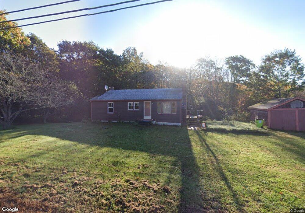
1179 N Brookfield Rd Oakham, MA 01068
Estimated Value: $261,000 - $377,000
3
Beds
1
Bath
864
Sq Ft
$372/Sq Ft
Est. Value
About This Home
This home is located at 1179 N Brookfield Rd, Oakham, MA 01068 and is currently estimated at $321,071, approximately $371 per square foot. 1179 N Brookfield Rd is a home located in Worcester County with nearby schools including Quabbin Regional Middle School and Quabbin Regional High School.
Ownership History
Date
Name
Owned For
Owner Type
Purchase Details
Closed on
May 5, 2025
Sold by
Colony Property Invs Llc
Bought by
Mcdonald Loreen and Huffstetler James
Current Estimated Value
Home Financials for this Owner
Home Financials are based on the most recent Mortgage that was taken out on this home.
Original Mortgage
$281,059
Outstanding Balance
$279,564
Interest Rate
6.67%
Mortgage Type
FHA
Estimated Equity
$41,507
Purchase Details
Closed on
Mar 31, 2023
Sold by
Heaney Peter and Hume Sandra
Bought by
Colony Property Invs Llc
Home Financials for this Owner
Home Financials are based on the most recent Mortgage that was taken out on this home.
Original Mortgage
$276,500
Interest Rate
6.32%
Mortgage Type
Purchase Money Mortgage
Purchase Details
Closed on
Apr 12, 2002
Sold by
Dean Jordan A and Dean Verna A
Bought by
Heaney Peter M and Hume Sandra L
Create a Home Valuation Report for This Property
The Home Valuation Report is an in-depth analysis detailing your home's value as well as a comparison with similar homes in the area
Home Values in the Area
Average Home Value in this Area
Purchase History
| Date | Buyer | Sale Price | Title Company |
|---|---|---|---|
| Mcdonald Loreen | $299,900 | None Available | |
| Mcdonald Loreen | $299,900 | None Available | |
| Colony Property Invs Llc | $276,500 | None Available | |
| Colony Property Invs Llc | $276,500 | None Available | |
| Heaney Peter M | $75,000 | -- | |
| Heaney Peter M | $75,000 | -- |
Source: Public Records
Mortgage History
| Date | Status | Borrower | Loan Amount |
|---|---|---|---|
| Open | Mcdonald Loreen | $281,059 | |
| Closed | Mcdonald Loreen | $281,059 | |
| Previous Owner | Colony Property Invs Llc | $276,500 |
Source: Public Records
Tax History
| Year | Tax Paid | Tax Assessment Tax Assessment Total Assessment is a certain percentage of the fair market value that is determined by local assessors to be the total taxable value of land and additions on the property. | Land | Improvement |
|---|---|---|---|---|
| 2025 | $2,864 | $248,000 | $140,300 | $107,700 |
| 2024 | $2,698 | $243,500 | $137,600 | $105,900 |
| 2023 | $2,530 | $218,700 | $120,700 | $98,000 |
| 2022 | $2,414 | $189,800 | $105,000 | $84,800 |
| 2021 | $2,371 | $182,100 | $101,900 | $80,200 |
| 2020 | $2,299 | $169,700 | $98,600 | $71,100 |
| 2019 | $2,351 | $162,000 | $92,600 | $69,400 |
| 2018 | $2,213 | $145,600 | $80,500 | $65,100 |
| 2017 | $2,075 | $145,600 | $80,500 | $65,100 |
| 2016 | $1,981 | $142,500 | $77,400 | $65,100 |
| 2015 | $1,949 | $142,500 | $77,400 | $65,100 |
| 2014 | $1,847 | $142,500 | $77,400 | $65,100 |
Source: Public Records
Map
Nearby Homes
- 1310 N Brookfield Rd
- 116 Spencer Rd
- Lot 0 N Brookfield Rd
- 1380 N Brookfield Rd
- 67 Maple St
- 275 Crawford Rd
- 241 N Brookfield Rd
- 1109 New Braintree Rd
- 926 Old Turnpike Rd
- 21 Wildbrook Dr
- 311 Pleasantdale Rd
- 122 Integrity Dr Unit 61
- Lot 11 Pleasantdale Rd
- 38 Edson Rd
- 621 Woods Rd
- 196 N Spencer Rd
- Lot 6 Irish Ln
- 111 Northwest Rd
- Lot 2 Barrack Hill Rd
- 0 Barrack Hill Rd Unit 73395148
- 1158 N Brookfield Rd
- Lot 0 N Brookfield Rd
- Lot 3 N Brookfield Rd
- Lot 4 N Brookfield Rd
- Lot B N Brookfield Rd
- Lot S N Brookfield Rd
- Lot #1 N Brookfield Rd
- 1202 N Brookfield Rd
- 1246 N Brookfield Rd
- 1251 N Brookfield Rd
- 1081 N Brookfield Rd
- 1293 N Brookfield Rd
- 1079 N Brookfield Rd
- 1300 N Brookfield Rd
- Lot A N Brookfield Rd
- 78 Spencer Rd
- 1291 N Brookfield Rd
- 1291 N Brookfield Rd Unit 1
- 1048 N Brookfield Rd
- LOT A Lincoln Rd
Your Personal Tour Guide
Ask me questions while you tour the home.