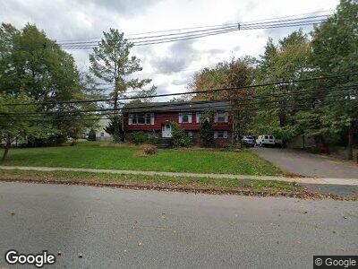
1179 Vail Rd Parsippany, NJ 07054
Parsippany NeighborhoodEstimated Value: $578,000 - $774,000
4
Beds
3
Baths
2,388
Sq Ft
$290/Sq Ft
Est. Value
About This Home
This home is located at 1179 Vail Rd, Parsippany, NJ 07054 and is currently estimated at $693,575, approximately $290 per square foot. 1179 Vail Rd is a home located in Morris County with nearby schools including Rockaway Meadow School, Central Middle School, and Parsippany High School.
Ownership History
Date
Name
Owned For
Owner Type
Purchase Details
Closed on
Sep 28, 2000
Sold by
Curcio Anthony J
Bought by
Thaler George J and Thaler Janice T
Current Estimated Value
Home Financials for this Owner
Home Financials are based on the most recent Mortgage that was taken out on this home.
Original Mortgage
$150,000
Interest Rate
7.96%
Mortgage Type
Purchase Money Mortgage
Create a Home Valuation Report for This Property
The Home Valuation Report is an in-depth analysis detailing your home's value as well as a comparison with similar homes in the area
Home Values in the Area
Average Home Value in this Area
Purchase History
| Date | Buyer | Sale Price | Title Company |
|---|---|---|---|
| Thaler George J | $250,000 | Chicago Title Insurance Co |
Source: Public Records
Mortgage History
| Date | Status | Borrower | Loan Amount |
|---|---|---|---|
| Open | Lin Frank C | $350,000 | |
| Closed | Thaler George J | $200,000 | |
| Closed | Thaler George J | $150,000 |
Source: Public Records
Tax History Compared to Growth
Tax History
| Year | Tax Paid | Tax Assessment Tax Assessment Total Assessment is a certain percentage of the fair market value that is determined by local assessors to be the total taxable value of land and additions on the property. | Land | Improvement |
|---|---|---|---|---|
| 2024 | $11,231 | $324,600 | $144,300 | $180,300 |
| 2023 | $11,231 | $324,600 | $144,300 | $180,300 |
| 2022 | $10,478 | $324,600 | $144,300 | $180,300 |
| 2021 | $10,478 | $324,600 | $144,300 | $180,300 |
| 2020 | $10,254 | $324,600 | $144,300 | $180,300 |
| 2019 | $9,968 | $324,600 | $144,300 | $180,300 |
| 2018 | $9,748 | $324,600 | $144,300 | $180,300 |
| 2017 | $9,517 | $324,600 | $144,300 | $180,300 |
| 2016 | $9,345 | $324,600 | $144,300 | $180,300 |
| 2015 | $9,108 | $324,600 | $144,300 | $180,300 |
| 2014 | $8,982 | $324,600 | $144,300 | $180,300 |
Source: Public Records
Map
Nearby Homes
- 8 Ute Ave
- 18 Lake Shore Dr
- 61 Norman Ave
- 65 Norman Ave
- 25 Ferndale Dr
- 17 Rockaway Blvd
- 25 Sandalwood Dr
- 15 Seminole Ave
- 18 Gordon Cir Unit 18
- 9 Gordon Cir Unit 9
- 56 Albert Ct Unit 56
- 18 Nokomis Ave
- 20 Manchester Way
- 115 Cardigan Ct
- 12 Farrand Dr
- 47 Lincoln Gardens
- 22 Farrand Dr
- 48 Dacotah Ave
- 56 Calumet Ave
- 49 Dacotah Ave