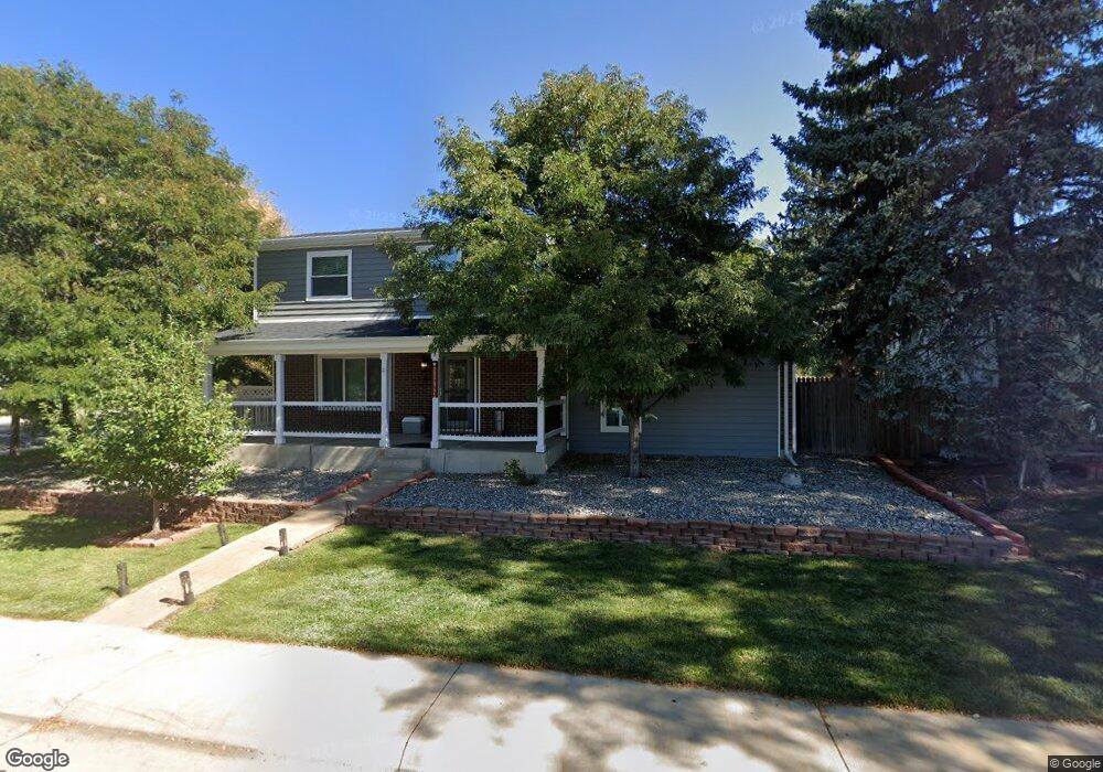
11792 Ash St Thornton, CO 80233
Briar Ridge NeighborhoodEstimated Value: $522,000 - $572,000
4
Beds
3
Baths
2,118
Sq Ft
$256/Sq Ft
Est. Value
About This Home
This home is located at 11792 Ash St, Thornton, CO 80233 and is currently estimated at $542,186, approximately $255 per square foot. 11792 Ash St is a home located in Adams County with nearby schools including Cherry Drive Elementary School, Shadow Ridge Middle School, and Mountain Range High School.
Ownership History
Date
Name
Owned For
Owner Type
Purchase Details
Closed on
May 25, 2018
Sold by
Bryan Cregger
Bought by
Thompson Crystal and Thompson Aaron
Current Estimated Value
Home Financials for this Owner
Home Financials are based on the most recent Mortgage that was taken out on this home.
Original Mortgage
$302,400
Outstanding Balance
$260,279
Interest Rate
4.66%
Estimated Equity
$281,907
Purchase Details
Closed on
Dec 9, 2016
Sold by
Willis Justin
Bought by
Cregger Bryan and Cregger Whitney
Home Financials for this Owner
Home Financials are based on the most recent Mortgage that was taken out on this home.
Original Mortgage
$342,956
Interest Rate
3.54%
Mortgage Type
VA
Purchase Details
Closed on
Jul 8, 2016
Sold by
Willis Justin and Topliff Roger J
Bought by
Willis Justin
Home Financials for this Owner
Home Financials are based on the most recent Mortgage that was taken out on this home.
Original Mortgage
$239,000
Interest Rate
3.48%
Mortgage Type
New Conventional
Purchase Details
Closed on
Nov 10, 2014
Sold by
Foley Michelle S and Foley Robert N
Bought by
Willis Justin and Topliff Roger J
Home Financials for this Owner
Home Financials are based on the most recent Mortgage that was taken out on this home.
Original Mortgage
$235,554
Interest Rate
4.25%
Mortgage Type
FHA
Purchase Details
Closed on
Jun 25, 2003
Sold by
Buster Dennis E and Buster Jeanette
Bought by
Foley Robert N and Foley Michelle S
Home Financials for this Owner
Home Financials are based on the most recent Mortgage that was taken out on this home.
Original Mortgage
$153,000
Interest Rate
4.87%
Mortgage Type
Unknown
Purchase Details
Closed on
Apr 28, 1994
Sold by
Howard Michael F
Bought by
Buster Dennis E and Buster Jeanette
Home Financials for this Owner
Home Financials are based on the most recent Mortgage that was taken out on this home.
Original Mortgage
$95,194
Interest Rate
7.71%
Mortgage Type
FHA
Create a Home Valuation Report for This Property
The Home Valuation Report is an in-depth analysis detailing your home's value as well as a comparison with similar homes in the area
Home Values in the Area
Average Home Value in this Area
Purchase History
We collect this data history from publicly available records. To have your information removed, we recommend requesting removal directly through your county’s website.
| Date | Buyer | Sale Price | Title Company |
|---|---|---|---|
| Thompson Crystal | $383,000 | -- | |
| Cregger Bryan | $332,000 | First American Title | |
| Willis Justin | -- | Fidelity National Title | |
| Willis Justin | $239,900 | Land Title Guarantee Company | |
| Foley Robert N | $170,000 | -- | |
| Buster Dennis E | $95,900 | -- |
Source: Public Records
Mortgage History
We collect this data history from publicly available records. To have your information removed, we recommend requesting removal directly through your county’s website.
| Date | Status | Borrower | Loan Amount |
|---|---|---|---|
| Open | Thompson Crystal | $302,400 | |
| Closed | Thompson Crystal | -- | |
| Previous Owner | Cregger Bryan | $342,956 | |
| Previous Owner | Willis Justin | $239,000 | |
| Previous Owner | Willis Justin | $235,554 | |
| Previous Owner | Foley Robert N | $153,000 | |
| Previous Owner | Buster Dennis E | $95,194 |
Source: Public Records
Tax History
| Year | Tax Paid | Tax Assessment Tax Assessment Total Assessment is a certain percentage of the fair market value that is determined by local assessors to be the total taxable value of land and additions on the property. | Land | Improvement |
|---|---|---|---|---|
| 2025 | $3,530 | $36,380 | $6,600 | $29,780 |
| 2024 | $3,530 | $33,440 | $6,060 | $27,380 |
| 2023 | $3,494 | $37,820 | $6,090 | $31,730 |
| 2022 | $2,967 | $26,930 | $5,770 | $21,160 |
| 2021 | $3,065 | $26,930 | $5,770 | $21,160 |
| 2020 | $3,064 | $27,460 | $5,930 | $21,530 |
| 2019 | $3,070 | $27,460 | $5,930 | $21,530 |
| 2018 | $2,686 | $23,340 | $6,840 | $16,500 |
| 2017 | $2,442 | $23,340 | $6,840 | $16,500 |
| 2016 | $1,476 | $13,730 | $3,180 | $10,550 |
| 2015 | $1,473 | $13,730 | $3,180 | $10,550 |
| 2014 | $1,336 | $12,100 | $2,310 | $9,790 |
Source: Public Records
Map
Nearby Homes
- 4120 E 119th Place
- 4205 E 119th Place Unit C
- 11922 Bellaire St Unit B
- 11750 Harrison St
- 11848 Jackson Cir
- 4432 E 118th Place
- 11961 Bellaire St Unit B
- 11961 Bellaire St Unit C
- 11834 Garfield Cir
- 4875 E 117th Dr
- 11760 Eudora Ct
- 11874 Eudora Dr
- 3991 E 121st Ave
- 4999 E 119th Ct
- 4931 E 116th Ave
- 12195 Bellaire St
- 3841 E 121st Ave
- 3348 E 118th Way
- 11344 Albion St
- 4395 E 122nd Ave
- 4183 E 118th Ave
- 4195 E 118th Ave
- 4171 E 118th Ave
- 4220 E 119th Place Unit C
- 4226 E 119th Place Unit A
- 4226 E 119th Place Unit B
- 4207 E 118th Ave
- 4210 E 119th Place Unit A
- 4210 E 119th Place Unit B
- 4210 E 119th Place Unit C
- 4210 E 119th Place
- 4169 E 118th Ave
- 11791 Ash St
- 11796 Ash Dr
- 4200 E 119th Place Unit C
- 4200 E 119th Place Unit B
- 4200 E 119th Place Unit A
- 4200 E 119th Place
- 4200 E 119th Place
- 4240 E 119th Place Unit E
Your Personal Tour Guide
Ask me questions while you tour the home.