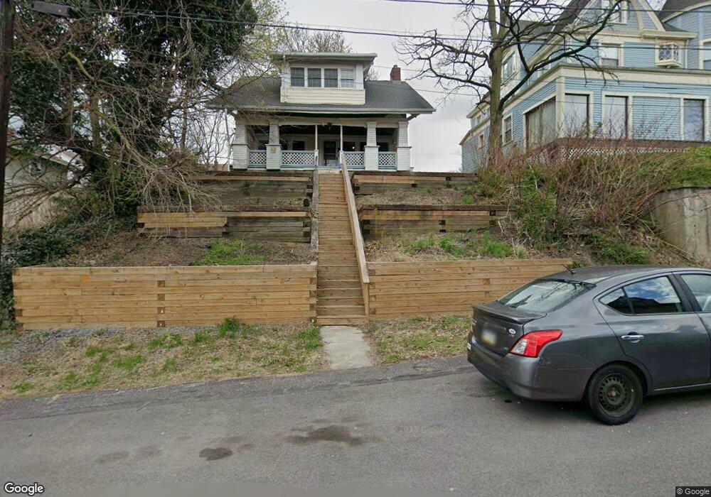
118 Cedar Ave Pittsburgh, PA 15202
Estimated Value: $203,000 - $342,000
3
Beds
3
Baths
2,160
Sq Ft
$128/Sq Ft
Est. Value
About This Home
This home is located at 118 Cedar Ave, Pittsburgh, PA 15202 and is currently estimated at $277,001, approximately $128 per square foot. 118 Cedar Ave is a home located in Allegheny County with nearby schools including Northgate Middle School/High School, St. Cyril of Alexandria School, and Abundant Life Academy.
Ownership History
Date
Name
Owned For
Owner Type
Purchase Details
Closed on
Apr 29, 2013
Sold by
Burrows Anne M and Smith Timothy D
Bought by
Platt Lisa M and Roemele James
Current Estimated Value
Home Financials for this Owner
Home Financials are based on the most recent Mortgage that was taken out on this home.
Original Mortgage
$112,900
Outstanding Balance
$79,170
Interest Rate
3.25%
Mortgage Type
FHA
Estimated Equity
$197,831
Purchase Details
Closed on
Aug 23, 2001
Sold by
Ross Frank J and Ross Wilma I
Bought by
Smith Timothy D and Burrows Anne M
Create a Home Valuation Report for This Property
The Home Valuation Report is an in-depth analysis detailing your home's value as well as a comparison with similar homes in the area
Home Values in the Area
Average Home Value in this Area
Purchase History
| Date | Buyer | Sale Price | Title Company |
|---|---|---|---|
| Platt Lisa M | $115,000 | -- | |
| Smith Timothy D | $78,000 | -- |
Source: Public Records
Mortgage History
| Date | Status | Borrower | Loan Amount |
|---|---|---|---|
| Open | Platt Lisa M | $112,900 |
Source: Public Records
Tax History Compared to Growth
Tax History
| Year | Tax Paid | Tax Assessment Tax Assessment Total Assessment is a certain percentage of the fair market value that is determined by local assessors to be the total taxable value of land and additions on the property. | Land | Improvement |
|---|---|---|---|---|
| 2025 | $4,292 | $111,500 | $23,100 | $88,400 |
| 2024 | $4,292 | $111,500 | $23,100 | $88,400 |
| 2023 | $4,119 | $111,500 | $23,100 | $88,400 |
| 2022 | $4,007 | $111,500 | $23,100 | $88,400 |
| 2021 | $4,007 | $111,500 | $23,100 | $88,400 |
| 2020 | $3,916 | $111,500 | $23,100 | $88,400 |
| 2019 | $3,836 | $111,500 | $23,100 | $88,400 |
| 2018 | $527 | $111,500 | $23,100 | $88,400 |
| 2017 | $3,836 | $111,500 | $23,100 | $88,400 |
| 2016 | $527 | $111,500 | $23,100 | $88,400 |
| 2015 | $527 | $111,500 | $23,100 | $88,400 |
| 2014 | $3,837 | $111,500 | $23,100 | $88,400 |
Source: Public Records
Map
Nearby Homes
- 188 Kendall Ave
- 138 Kendall Ave
- 234 Shiloh Ave
- 150 S Bryant Ave
- 119 S Harrison Ave
- 140 Lincoln Ave
- 21 S Harrison Ave
- 15 Orchard St
- 164 Sheridan Ave
- 301 Lincoln Ave
- 58 S Howard Ave
- 43 Orchard St
- 196 Lincoln Ave
- 258 Brighton Rd
- 4024 Oswald St
- 471 Lincoln Ave
- 113 Ohio St
- 35 N Balph Ave
- 1840 Perrott Ave
- 3586 Elmhurst Ave
- 114 Cedar Ave
- 235 Grant Ave
- 231 Grant Ave
- 235 Grant Avenue Extension
- 237 Grant Ave
- 225 Grant Ave
- 219 Grant Ave
- 180 Kendall Ave
- 186 Kendall Ave
- 176 Kendall Ave
- 119 Cedar Ave
- 115 Cedar Ave
- 170 Kendall Ave
- 215 Grant Ave
- 166 Kendall Ave
- 196 Kendall Ave
- 213 Grant Ave
- 234 Grant Ave
- 230 Grant Ave
- 236 Grant Ave