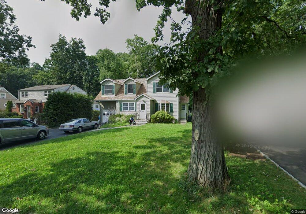
118 Commonwealth Ave New Providence, NJ 07974
Estimated Value: $745,000 - $1,061,000
--
Bed
--
Bath
2,277
Sq Ft
$417/Sq Ft
Est. Value
About This Home
This home is located at 118 Commonwealth Ave, New Providence, NJ 07974 and is currently estimated at $950,027, approximately $417 per square foot. 118 Commonwealth Ave is a home located in Union County with nearby schools including New Providence High School and The Academy of Our Lady of Peace.
Ownership History
Date
Name
Owned For
Owner Type
Purchase Details
Closed on
Jul 14, 2004
Sold by
Relocatoin Advantage Llc
Bought by
Harvey Diane
Current Estimated Value
Purchase Details
Closed on
Apr 22, 2004
Sold by
Day Eric
Bought by
Relocation Advantage Llc
Purchase Details
Closed on
Apr 25, 1996
Sold by
Miller Donald and Miller Joan
Bought by
Day Eric D and Thatcher Day Monica M
Create a Home Valuation Report for This Property
The Home Valuation Report is an in-depth analysis detailing your home's value as well as a comparison with similar homes in the area
Home Values in the Area
Average Home Value in this Area
Purchase History
| Date | Buyer | Sale Price | Title Company |
|---|---|---|---|
| Harvey Diane | $390,000 | -- | |
| Relocation Advantage Llc | $390,000 | -- | |
| Day Eric D | $200,000 | -- |
Source: Public Records
Tax History Compared to Growth
Tax History
| Year | Tax Paid | Tax Assessment Tax Assessment Total Assessment is a certain percentage of the fair market value that is determined by local assessors to be the total taxable value of land and additions on the property. | Land | Improvement |
|---|---|---|---|---|
| 2025 | $16,044 | $310,800 | $103,200 | $207,600 |
| 2024 | $15,562 | $310,800 | $103,200 | $207,600 |
| 2023 | $15,562 | $310,800 | $103,200 | $207,600 |
| 2022 | $15,347 | $310,800 | $103,200 | $207,600 |
| 2021 | $15,235 | $310,800 | $103,200 | $207,600 |
| 2020 | $15,229 | $310,800 | $103,200 | $207,600 |
| 2019 | $16,052 | $329,600 | $103,200 | $226,400 |
| 2018 | $11,051 | $228,100 | $103,200 | $124,900 |
| 2017 | $10,871 | $228,100 | $103,200 | $124,900 |
| 2016 | $10,718 | $228,100 | $103,200 | $124,900 |
| 2015 | $10,570 | $228,100 | $103,200 | $124,900 |
| 2014 | $10,410 | $228,100 | $103,200 | $124,900 |
Source: Public Records
Map
Nearby Homes
- 100 Commonwealth Ave
- 197 Elkwood Ave
- 29 Walton Ave
- 5 Kincaid Ln
- 17B Heritage Dr Unit B
- 283 Riveredge Dr
- 32 Charnwood Rd
- 21G Heritage Dr Unit G
- 1200 Springfield Ave Unit 1B
- 2F Terrace Dr Unit F
- 175 Terrace Dr
- 146 Riveredge Dr
- 45 Runnymede Rd
- 17 Hilltop Terrace
- 336 Fairmount Ave
- 14 Holmes Oval
- 131 van Houton Ave
- 54 Badgley Dr
- 85 Southern Blvd
- 54 Canterbury Rd
- 122 Commonwealth Ave
- 112 Commonwealth Ave
- 106 Commonwealth Ave
- 128 Commonwealth Ave
- 112 Woodbine Cir
- 117 Commonwealth Ave
- 121 Commonwealth Ave
- 136 Commonwealth Ave
- 107 Commonwealth Ave
- 96 Commonwealth Ave
- 127 Commonwealth Ave
- 118 Woodbine Cir
- 101 Commonwealth Ave
- 90 Commonwealth Ave
- 135 Commonwealth Ave
- 14 Edgewood Ave
- 97 Commonwealth Ave
- 11 Edgewood Ave
- 124 Woodbine Cir
- 10 Schindler Place