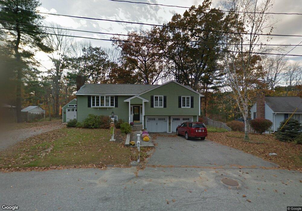
118 Drake Rd Burlington, MA 01803
North Burlington NeighborhoodEstimated Value: $836,152 - $964,000
3
Beds
3
Baths
1,728
Sq Ft
$520/Sq Ft
Est. Value
About This Home
This home is located at 118 Drake Rd, Burlington, MA 01803 and is currently estimated at $899,288, approximately $520 per square foot. 118 Drake Rd is a home located in Middlesex County with nearby schools including Burlington High School, Fox Hill, and Marshall Simonds Middle School.
Ownership History
Date
Name
Owned For
Owner Type
Purchase Details
Closed on
May 3, 2022
Sold by
Pescatore Deanne F and Pescatore Paul E
Bought by
Pdp Lt
Current Estimated Value
Purchase Details
Closed on
May 29, 1969
Bought by
Pescatore Paul and Pescatore Deanne F
Create a Home Valuation Report for This Property
The Home Valuation Report is an in-depth analysis detailing your home's value as well as a comparison with similar homes in the area
Home Values in the Area
Average Home Value in this Area
Purchase History
| Date | Buyer | Sale Price | Title Company |
|---|---|---|---|
| Pdp Lt | -- | None Available | |
| Pescatore Paul | -- | -- |
Source: Public Records
Mortgage History
| Date | Status | Borrower | Loan Amount |
|---|---|---|---|
| Previous Owner | Pescatore Paul | $100,000 | |
| Previous Owner | Pescatore Paul | $116,000 |
Source: Public Records
Tax History Compared to Growth
Tax History
| Year | Tax Paid | Tax Assessment Tax Assessment Total Assessment is a certain percentage of the fair market value that is determined by local assessors to be the total taxable value of land and additions on the property. | Land | Improvement |
|---|---|---|---|---|
| 2025 | $6,252 | $721,900 | $438,300 | $283,600 |
| 2024 | $5,963 | $667,000 | $400,200 | $266,800 |
| 2023 | $5,702 | $606,600 | $347,000 | $259,600 |
| 2022 | $5,573 | $560,100 | $315,700 | $244,400 |
| 2021 | $5,422 | $544,900 | $300,500 | $244,400 |
| 2020 | $5,232 | $542,700 | $295,700 | $247,000 |
| 2019 | $5,284 | $504,200 | $276,700 | $227,500 |
| 2018 | $5,094 | $479,700 | $276,700 | $203,000 |
| 2017 | $5,018 | $479,700 | $276,700 | $203,000 |
| 2016 | $4,985 | $435,000 | $238,700 | $196,300 |
| 2015 | $4,937 | $435,000 | $238,700 | $196,300 |
| 2014 | $4,690 | $390,800 | $206,400 | $184,400 |
Source: Public Records
Map
Nearby Homes
- 38 Freeport Dr
- 21 Spring Valley Rd
- 210 Winn St
- 10 Murray Ave Unit 15
- 12 Murray Ave Unit 18
- 6 Arthur Woods Ave
- 9 Upland Rd
- 29 Beaverbrook Rd
- 25 Sarah St
- 2 Cutting Ln
- 27 Purity Springs Rd
- 129 Cambridge St Unit 1
- 20 Lantern Ln
- 3 County Rd
- 42 Lantern Ln
- 6 Kendal Dr
- 1 Harvard Ave
- 29 Grove Ln Unit 29
- 23 Ward St Unit A
- 2 Stephanie St