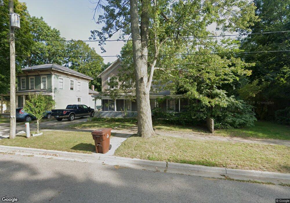
118 E High St Union City, MI 49094
Estimated Value: $150,000 - $202,000
3
Beds
3
Baths
1,894
Sq Ft
$94/Sq Ft
Est. Value
About This Home
This home is located at 118 E High St, Union City, MI 49094 and is currently estimated at $178,482, approximately $94 per square foot. 118 E High St is a home located in Branch County with nearby schools including Union City Elementary School, Union City Middle School, and Union City High School.
Ownership History
Date
Name
Owned For
Owner Type
Purchase Details
Closed on
Dec 10, 2013
Sold by
Fulton Harold Wayne
Bought by
Ousley Danny R and Ousley Sandra L
Current Estimated Value
Purchase Details
Closed on
Oct 22, 2013
Sold by
Pelong Roseanna L and Davis Roseanna L
Bought by
The Harold Wayne Jr & Jeanette Ann Fulto and Neil A & Eileen J Fulton Trust
Purchase Details
Closed on
Nov 13, 2012
Sold by
Fulton Neil A and Fulton Eileen J
Bought by
Fulton Harold Wayne and Fulton Jeanette Ann
Purchase Details
Closed on
Dec 22, 2010
Sold by
Fulton Harold Wayne and Fulton Jeanette Ann
Bought by
Davis Roseanna L
Purchase Details
Closed on
Dec 13, 2007
Sold by
Fulton Harold W and Fulton Jeanette
Bought by
Fulton Harold Wayne and Fulton Jeanette Ann
Create a Home Valuation Report for This Property
The Home Valuation Report is an in-depth analysis detailing your home's value as well as a comparison with similar homes in the area
Purchase History
| Date | Buyer | Sale Price | Title Company |
|---|---|---|---|
| Ousley Danny R | $12,000 | Branch County Abstract & Tit | |
| The Harold Wayne Jr & Jeanette Ann Fulto | -- | Branch County Abstract & Tit | |
| Fulton Harold Wayne | -- | None Available | |
| Fulton Neil A | -- | None Available | |
| Davis Roseanna L | -- | Branch County Abstract & Tit | |
| Fulton Harold Wayne | -- | None Available |
Source: Public Records
Tax History
| Year | Tax Paid | Tax Assessment Tax Assessment Total Assessment is a certain percentage of the fair market value that is determined by local assessors to be the total taxable value of land and additions on the property. | Land | Improvement |
|---|---|---|---|---|
| 2025 | $1,124 | $67,570 | $0 | $0 |
| 2024 | $2 | $60,030 | $0 | $0 |
| 2023 | $229 | $50,340 | $0 | $0 |
| 2022 | $229 | $43,700 | $0 | $0 |
| 2020 | -- | $33,500 | $0 | $0 |
| 2019 | -- | $32,600 | $0 | $0 |
| 2018 | -- | $25,000 | $0 | $0 |
| 2017 | -- | $25,700 | $0 | $0 |
| 2016 | -- | $23,780 | $0 | $0 |
| 2015 | -- | $22,250 | $0 | $0 |
| 2014 | -- | $18,480 | $0 | $0 |
| 2013 | -- | $16,020 | $0 | $0 |
Source: Public Records
Map
Nearby Homes
- 127 W High St
- 216 Crane St
- 569 W Union City Rd
- 321 E Fenton St
- 214 Charlotte St
- 321 W High St
- 313 Saint Joseph St
- 315 W High St
- 317 Saint Joseph St
- 319 W High St
- 340 Woodruff St
- 404 Ellen St
- 401 Saint Joseph St
- 520 S Broadway St
- 307 Railroad St
- 697 Tuttle Rd
- 4041 Case Dr
- 1172 Rustic Hills Dr
- 1161 Oak Grove Park
- 1332 Cherokee Dr
Your Personal Tour Guide
Ask me questions while you tour the home.