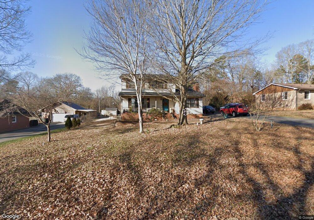
118 Fox Run Dr Fort Mill, SC 29715
Springfield NeighborhoodEstimated Value: $314,000 - $389,000
3
Beds
2
Baths
1,800
Sq Ft
$197/Sq Ft
Est. Value
About This Home
This home is located at 118 Fox Run Dr, Fort Mill, SC 29715 and is currently estimated at $354,189, approximately $196 per square foot. 118 Fox Run Dr is a home located in York County with nearby schools including Fort Mill Elementary School, Fort Mill Middle School, and Nation Ford High School.
Ownership History
Date
Name
Owned For
Owner Type
Purchase Details
Closed on
Sep 26, 2008
Sold by
Broderick Michael S and Broderick Tasha A
Bought by
Devine Frank J
Current Estimated Value
Home Financials for this Owner
Home Financials are based on the most recent Mortgage that was taken out on this home.
Original Mortgage
$148,457
Outstanding Balance
$97,580
Interest Rate
6.36%
Mortgage Type
FHA
Estimated Equity
$256,609
Purchase Details
Closed on
Nov 21, 2003
Sold by
Grubb Margaret T
Bought by
Broderick Michael S and Broderick Tasha A
Create a Home Valuation Report for This Property
The Home Valuation Report is an in-depth analysis detailing your home's value as well as a comparison with similar homes in the area
Home Values in the Area
Average Home Value in this Area
Purchase History
| Date | Buyer | Sale Price | Title Company |
|---|---|---|---|
| Devine Frank J | $150,000 | -- | |
| Broderick Michael S | $111,500 | -- |
Source: Public Records
Mortgage History
| Date | Status | Borrower | Loan Amount |
|---|---|---|---|
| Open | Devine Frank J | $148,457 |
Source: Public Records
Tax History
| Year | Tax Paid | Tax Assessment Tax Assessment Total Assessment is a certain percentage of the fair market value that is determined by local assessors to be the total taxable value of land and additions on the property. | Land | Improvement |
|---|---|---|---|---|
| 2025 | $1,189 | $6,771 | $1,443 | $5,328 |
| 2024 | $1,039 | $5,888 | $2,027 | $3,861 |
| 2023 | $1,007 | $5,888 | $2,027 | $3,861 |
| 2022 | $999 | $5,888 | $2,027 | $3,861 |
| 2021 | -- | $5,888 | $2,027 | $3,861 |
| 2020 | $1,072 | $5,888 | $0 | $0 |
| 2019 | $1,071 | $5,120 | $0 | $0 |
| 2018 | $1,131 | $5,120 | $0 | $0 |
| 2017 | $1,067 | $5,120 | $0 | $0 |
| 2016 | $1,053 | $5,120 | $0 | $0 |
| 2014 | $739 | $5,120 | $1,600 | $3,520 |
| 2013 | $739 | $5,180 | $1,600 | $3,580 |
Source: Public Records
Map
Nearby Homes
- 001 Roanoke Dr
- 000 Roanoke Dr
- 002 Roanoke Dr
- 1710 Merritt Rd Unit 3
- 105 Redcoat Dr
- 1565 Kennel Rd
- 1459 Kilburn Ln
- 9786 Verdun Ct
- 3175 Montreaux Valley Dr
- 3954 Kestrel Ln
- 3534 Jumprock Rd
- 4008 Pinot Way
- 3995 Kestrel Ln
- 336 Newington Ct
- 1297 Edbrooke Ln
- 6517 Ardenne Way
- 711 Mendenhall Ct
- 1123 Regions Blvd
- 2289 Tatton Hall Rd
- 3173 Beacon Heights Rd
- 116 Fox Run Dr
- 120 Fox Run Dr
- 114 Fox Run Dr
- 122 Fox Run Dr
- 119 Fox Run Dr
- 123 Fox Run Dr
- 559 Roanoke Dr
- 112 Fox Run Dr
- 117 Fox Run Dr
- 125 Fox Run Dr
- 202 Fox Run Dr
- 210 Redcoat Dr
- 115 Fox Run Dr Unit 8
- 127 Fox Run Dr
- 208 Redcoat Dr
- 208 Redcoat Dr
- 212 Redcoat Dr
- 110 Fox Run Dr
- 214 Redcoat Dr
- 206 Redcoat Dr
Your Personal Tour Guide
Ask me questions while you tour the home.