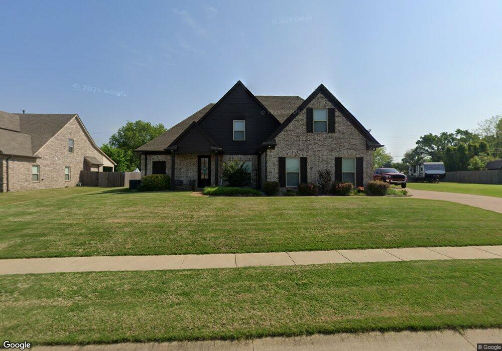
118 G Lafont Cir Munford, TN 38058
Estimated Value: $367,456 - $458,000
--
Bed
--
Bath
2,185
Sq Ft
$195/Sq Ft
Est. Value
About This Home
This home is located at 118 G Lafont Cir, Munford, TN 38058 and is currently estimated at $426,364, approximately $195 per square foot. 118 G Lafont Cir is a home with nearby schools including Munford Elementary School, Munford Middle School, and Munford High School.
Ownership History
Date
Name
Owned For
Owner Type
Purchase Details
Closed on
Aug 15, 2016
Sold by
Apex Home Builders Llc
Bought by
Ryals Charles F and Ryals Amanda C
Current Estimated Value
Home Financials for this Owner
Home Financials are based on the most recent Mortgage that was taken out on this home.
Original Mortgage
$231,911
Outstanding Balance
$183,652
Interest Rate
3.25%
Mortgage Type
FHA
Estimated Equity
$242,712
Purchase Details
Closed on
May 1, 2013
Sold by
Patriot Bank
Bought by
Apex Home Builders Llc
Purchase Details
Closed on
Mar 7, 2007
Bought by
Wring A Bruce
Create a Home Valuation Report for This Property
The Home Valuation Report is an in-depth analysis detailing your home's value as well as a comparison with similar homes in the area
Home Values in the Area
Average Home Value in this Area
Purchase History
| Date | Buyer | Sale Price | Title Company |
|---|---|---|---|
| Ryals Charles F | $236,190 | -- | |
| Apex Home Builders Llc | $587,500 | -- | |
| Wring A Bruce | $1,254,000 | -- |
Source: Public Records
Mortgage History
| Date | Status | Borrower | Loan Amount |
|---|---|---|---|
| Open | Ryals Charles F | $231,911 |
Source: Public Records
Tax History Compared to Growth
Tax History
| Year | Tax Paid | Tax Assessment Tax Assessment Total Assessment is a certain percentage of the fair market value that is determined by local assessors to be the total taxable value of land and additions on the property. | Land | Improvement |
|---|---|---|---|---|
| 2024 | $2,100 | $88,500 | $10,325 | $78,175 |
| 2023 | $2,100 | $88,500 | $10,325 | $78,175 |
| 2022 | $1,987 | $61,925 | $7,600 | $54,325 |
| 2021 | $1,987 | $61,925 | $7,600 | $54,325 |
| 2020 | $1,987 | $61,925 | $7,600 | $54,325 |
| 2019 | $1,885 | $49,025 | $5,850 | $43,175 |
| 2018 | $1,787 | $49,025 | $5,850 | $43,175 |
| 2017 | $1,787 | $49,025 | $5,850 | $43,175 |
| 2016 | $868 | $49,025 | $5,850 | $43,175 |
| 2015 | $213 | $5,850 | $5,850 | $0 |
| 2014 | $198 | $5,844 | $0 | $0 |
Source: Public Records
Map
Nearby Homes
- 71 G Lafont Cir
- 173 Littleton Way
- 118 Robert L Ellis Dr
- 17 Center Ave
- 1503 Beaver Rd
- 16 W Main St
- 372 Beaver Rd
- 1245 Drummonds Rd
- 129 Boardwalk St
- 434 West Dr
- 212 Barnes St
- 144 Park St
- 310 Wooten Oaks Cir
- 44 Pritchett Cove
- 117 Wooten Oaks Cir
- 131 Pritchett Cove
- 110 Pritchett Cove
- 56 S Bigham Cove
- 730 Melanie Ln
- 2212 Drummonds Rd
- 136 G Lafont Cir
- 94 G Lafont Cir
- 121 G Lafont Cir
- 80 G Lafont Cir
- 154 G Lafont Cir
- 43 G Lafont Cir
- 52 G Lafont Cir
- 157 G Lafont Cir
- 172 G Lafont Cir
- 165 G Lafont Cir
- 1005 Munford Giltedge Rd
- 1016 Munford Giltedge Rd
- 19 G Lafont Cir
- 18 Burkhardt Dr
- 166 Littleton Way
- 190 G Lafont Cir
- 36 Burkhardt Dr
- 144 Littleton Way
- 228 Littleton Way
- 208 G Lafont Cir