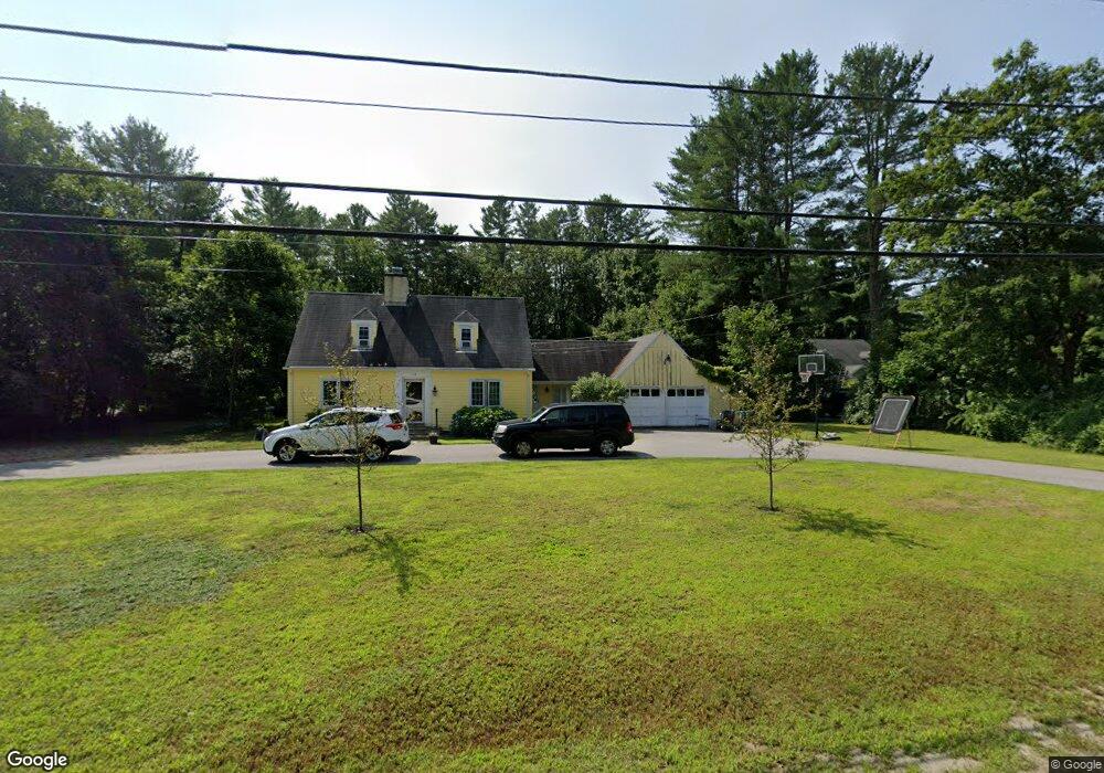
118 High St Kennebunk, ME 04043
Estimated Value: $477,488 - $608,000
3
Beds
2
Baths
1,828
Sq Ft
$298/Sq Ft
Est. Value
About This Home
This home is located at 118 High St, Kennebunk, ME 04043 and is currently estimated at $544,372, approximately $297 per square foot. 118 High St is a home located in York County with nearby schools including Kennebunk High School and The New School.
Create a Home Valuation Report for This Property
The Home Valuation Report is an in-depth analysis detailing your home's value as well as a comparison with similar homes in the area
Home Values in the Area
Average Home Value in this Area
Tax History
| Year | Tax Paid | Tax Assessment Tax Assessment Total Assessment is a certain percentage of the fair market value that is determined by local assessors to be the total taxable value of land and additions on the property. | Land | Improvement |
|---|---|---|---|---|
| 2024 | $4,505 | $265,800 | $83,700 | $182,100 |
| 2023 | $4,266 | $265,800 | $83,700 | $182,100 |
| 2022 | $3,881 | $265,800 | $83,700 | $182,100 |
| 2021 | $3,788 | $265,800 | $83,700 | $182,100 |
| 2020 | $3,761 | $265,800 | $83,700 | $182,100 |
| 2019 | $4,078 | $265,800 | $83,700 | $182,100 |
| 2018 | $4,005 | $199,400 | $62,800 | $136,600 |
| 2017 | $3,954 | $199,400 | $62,800 | $136,600 |
| 2016 | $3,391 | $199,400 | $62,800 | $136,600 |
| 2015 | $3,051 | $199,400 | $62,800 | $136,600 |
| 2014 | $2,971 | $199,400 | $62,800 | $136,600 |
Source: Public Records
Map
Nearby Homes
- 17 Hampton Glen Dr Unit 5
- 14 Hampton Glen Dr Unit 51
- 9 Hampton Glen Dr Unit 3
- 3 Kensington Dr
- 59 Plymouth Grove Unit 11
- 11 Greenwich Way Unit 43
- 24 Cat Mousam Rd
- 2 Lexington Dr Unit 2
- 23 Lilac Ln
- 3 Cider Mill Ln
- 4 Cider Mill Ln
- 17 Legacy Ln
- 1 Hall St
- 2 Cross St
- 30 York St Unit 1
- 15 Casey Ln
- 23 Cascade Cir Unit 22
- 61 Fletcher St
- 3 Hardwood Ln
- 1646 Branch Rd
Your Personal Tour Guide
Ask me questions while you tour the home.