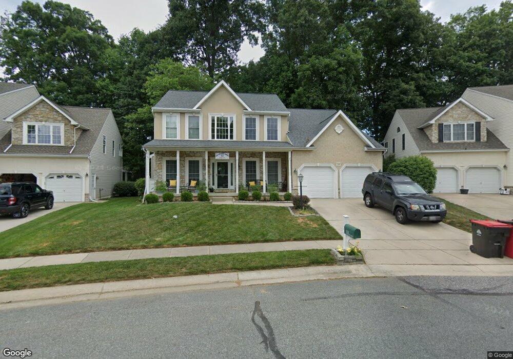
118 Loretta Way Forest Hill, MD 21050
Estimated Value: $633,642 - $679,000
--
Bed
3
Baths
2,476
Sq Ft
$268/Sq Ft
Est. Value
About This Home
This home is located at 118 Loretta Way, Forest Hill, MD 21050 and is currently estimated at $662,661, approximately $267 per square foot. 118 Loretta Way is a home located in Harford County with nearby schools including Forest Hill Elementary School, Bel Air Middle School, and Bel Air High School.
Ownership History
Date
Name
Owned For
Owner Type
Purchase Details
Closed on
May 2, 2022
Sold by
Timothy Colt
Bought by
Colt Timothy
Current Estimated Value
Home Financials for this Owner
Home Financials are based on the most recent Mortgage that was taken out on this home.
Original Mortgage
$308,800
Outstanding Balance
$292,686
Interest Rate
5%
Mortgage Type
New Conventional
Estimated Equity
$369,975
Purchase Details
Closed on
May 6, 2003
Sold by
Forest Glen Home Llc
Bought by
Colt Timothy and Colt Maureen
Create a Home Valuation Report for This Property
The Home Valuation Report is an in-depth analysis detailing your home's value as well as a comparison with similar homes in the area
Home Values in the Area
Average Home Value in this Area
Purchase History
| Date | Buyer | Sale Price | Title Company |
|---|---|---|---|
| Colt Timothy | -- | None Listed On Document | |
| Colt Timothy | $302,908 | -- |
Source: Public Records
Mortgage History
| Date | Status | Borrower | Loan Amount |
|---|---|---|---|
| Open | Colt Timothy | $308,800 | |
| Closed | Colt Timothy | -- |
Source: Public Records
Tax History Compared to Growth
Tax History
| Year | Tax Paid | Tax Assessment Tax Assessment Total Assessment is a certain percentage of the fair market value that is determined by local assessors to be the total taxable value of land and additions on the property. | Land | Improvement |
|---|---|---|---|---|
| 2025 | $4,875 | $473,400 | $129,700 | $343,700 |
| 2024 | $4,875 | $447,300 | $0 | $0 |
| 2023 | $4,591 | $421,200 | $0 | $0 |
| 2022 | $2,153 | $395,100 | $129,700 | $265,400 |
| 2021 | $4,355 | $386,233 | $0 | $0 |
| 2020 | $4,355 | $377,367 | $0 | $0 |
| 2019 | $4,252 | $368,500 | $129,600 | $238,900 |
| 2018 | $4,186 | $366,067 | $0 | $0 |
| 2017 | $4,158 | $368,500 | $0 | $0 |
| 2016 | $140 | $361,200 | $0 | $0 |
| 2015 | $4,276 | $361,200 | $0 | $0 |
| 2014 | $4,276 | $361,200 | $0 | $0 |
Source: Public Records
Map
Nearby Homes
- 253 Trudy Ct
- 2103 Mardic Dr
- 2139 Mardic Dr
- 311 Willrich Cir Unit G
- 1817 Rock Spring Rd
- 310 Willrich Cir
- 1710 Chrisara Ct
- 218 Aster Ln
- 1702 Rich Way Unit 2C
- 2040 Colgate Cir
- 1713 Landmark Dr Unit 1L
- 105 Sunshine Ct Unit G
- 332 Ponfield Rd E
- 1700 Landmark Dr Unit 1M
- 2151 Sewanee Dr
- 1991 Gulfstream Ct
- 1405 Kahoe Rd
- 430 Underwood Ln
- 430 Underwood Cir
- 1615 Samantha Dr