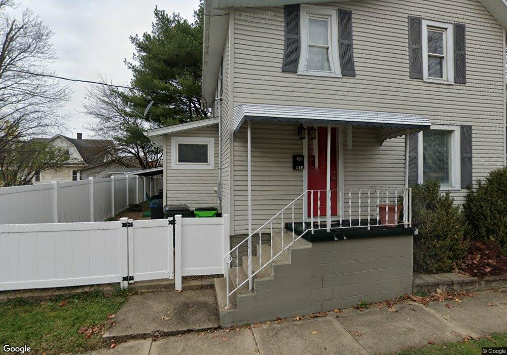
118 Massaro St Wooster, OH 44691
Estimated Value: $114,088 - $151,000
3
Beds
1
Bath
1,152
Sq Ft
$120/Sq Ft
Est. Value
About This Home
This home is located at 118 Massaro St, Wooster, OH 44691 and is currently estimated at $138,022, approximately $119 per square foot. 118 Massaro St is a home located in Wayne County with nearby schools including Cornerstone Elementary School, Edgewood Middle School, and Wooster High School.
Ownership History
Date
Name
Owned For
Owner Type
Purchase Details
Closed on
Apr 27, 2021
Sold by
Saber Properties Llc
Bought by
Lee David
Current Estimated Value
Home Financials for this Owner
Home Financials are based on the most recent Mortgage that was taken out on this home.
Original Mortgage
$73,641
Interest Rate
2.9%
Mortgage Type
FHA
Purchase Details
Closed on
Jan 23, 2014
Sold by
Dodaro Eugene and Dodaro Kathryn Anne
Bought by
Saber Properties Llc
Purchase Details
Closed on
Nov 17, 2010
Sold by
Paull Nancy L
Bought by
Dodaro Eugene and Dodaro Kathryna Nne
Create a Home Valuation Report for This Property
The Home Valuation Report is an in-depth analysis detailing your home's value as well as a comparison with similar homes in the area
Home Values in the Area
Average Home Value in this Area
Purchase History
| Date | Buyer | Sale Price | Title Company |
|---|---|---|---|
| Lee David | $75,000 | Wayne County Title Agcy Inc | |
| Lee David | $75,000 | Wayne County Title | |
| Saber Properties Llc | -- | None Available | |
| Dodaro Eugene | $45,000 | None Available |
Source: Public Records
Mortgage History
| Date | Status | Borrower | Loan Amount |
|---|---|---|---|
| Previous Owner | Lee David | $73,641 |
Source: Public Records
Tax History Compared to Growth
Tax History
| Year | Tax Paid | Tax Assessment Tax Assessment Total Assessment is a certain percentage of the fair market value that is determined by local assessors to be the total taxable value of land and additions on the property. | Land | Improvement |
|---|---|---|---|---|
| 2024 | $1,091 | $26,270 | $3,100 | $23,170 |
| 2023 | $1,091 | $26,270 | $3,100 | $23,170 |
| 2022 | $1,041 | $19,910 | $2,350 | $17,560 |
| 2021 | $1,099 | $19,910 | $2,350 | $17,560 |
| 2020 | $1,037 | $19,910 | $2,350 | $17,560 |
| 2019 | $789 | $14,420 | $2,280 | $12,140 |
| 2018 | $792 | $14,420 | $2,280 | $12,140 |
| 2017 | $798 | $14,420 | $2,280 | $12,140 |
| 2016 | $823 | $13,860 | $2,190 | $11,670 |
| 2015 | $808 | $13,860 | $2,190 | $11,670 |
| 2014 | $809 | $13,860 | $2,190 | $11,670 |
| 2013 | $884 | $14,920 | $1,580 | $13,340 |
Source: Public Records
Map
Nearby Homes
- 202 Palmer St
- 606 E Henry St
- 638 High St
- 554 Nold Ave
- 548 Spring St
- 733 Spink St
- 804 Belmont Ave
- 329 E Bowman St
- 423 N Market St
- 140 Ohio St
- 229 N Walnut St
- 657 N Bever St
- 227 N Walnut St
- 534 N Buckeye St
- 336 Spring St
- 1029 E University St
- 708 N Bever St
- 1132 E University St
- 406 N Walnut St
- 323 N Grant St
- 124 Massaro St
- 132 Massaro St
- 828 Pittsburg Ave
- 820 Pittsburg Ave
- 836 Pittsburg Ave
- 138 Massaro St
- 132 Massaro Ave
- 902 Pittsburg Ave
- 140 Massaro Ave
- 908 Pittsburgh Ave
- 148 Massaro St
- 814 Pittsburg Ave
- 151153 Massaro Ave
- 151 Massaro St
- 916 Pittsburg Ave
- 202 Massaro St
- 924 Pittsburgh Ave
- 205 Massaro St
- 924 Pittsburgh Ave
- 212 Massaro St