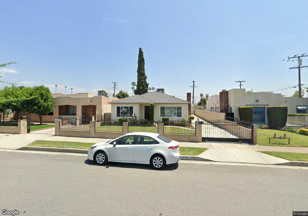
118 N Earle St Unit A San Gabriel, CA 91775
Estimated Value: $1,148,000 - $1,386,000
4
Beds
3
Baths
2,277
Sq Ft
$565/Sq Ft
Est. Value
About This Home
This home is located at 118 N Earle St Unit A, San Gabriel, CA 91775 and is currently estimated at $1,285,933, approximately $564 per square foot. 118 N Earle St Unit A is a home located in Los Angeles County with nearby schools including Wilson Elementary School, Jefferson Middle School, and Gabrielino High School.
Ownership History
Date
Name
Owned For
Owner Type
Purchase Details
Closed on
May 13, 2017
Sold by
Avila Steve and Avila Sofia
Bought by
Avila Steve and The S & S Avila Trust
Current Estimated Value
Purchase Details
Closed on
Feb 8, 2002
Sold by
Avila Steven J and Avila Sofia
Bought by
Avila Steven J and Avila Sofia
Home Financials for this Owner
Home Financials are based on the most recent Mortgage that was taken out on this home.
Original Mortgage
$132,000
Outstanding Balance
$54,503
Interest Rate
7.04%
Estimated Equity
$1,231,430
Purchase Details
Closed on
Jul 1, 1994
Sold by
Montoya Manuel and Montoya Soledad
Bought by
Montoya Manuel and Montoya Soledad
Create a Home Valuation Report for This Property
The Home Valuation Report is an in-depth analysis detailing your home's value as well as a comparison with similar homes in the area
Home Values in the Area
Average Home Value in this Area
Purchase History
| Date | Buyer | Sale Price | Title Company |
|---|---|---|---|
| Avila Steve | -- | None Available | |
| Avila Steve | -- | None Available | |
| Avila Steven J | -- | -- | |
| Avila Steve J | -- | North American Title Co | |
| Montoya Manuel | -- | -- |
Source: Public Records
Mortgage History
| Date | Status | Borrower | Loan Amount |
|---|---|---|---|
| Open | Avila Steve J | $132,000 |
Source: Public Records
Tax History Compared to Growth
Tax History
| Year | Tax Paid | Tax Assessment Tax Assessment Total Assessment is a certain percentage of the fair market value that is determined by local assessors to be the total taxable value of land and additions on the property. | Land | Improvement |
|---|---|---|---|---|
| 2025 | $1,911 | $98,000 | $31,838 | $66,162 |
| 2024 | $1,911 | $96,079 | $31,214 | $64,865 |
| 2023 | $1,881 | $94,196 | $30,602 | $63,594 |
| 2022 | $1,820 | $92,350 | $30,002 | $62,348 |
| 2021 | $1,790 | $90,540 | $29,414 | $61,126 |
| 2020 | $1,769 | $89,613 | $29,113 | $60,500 |
| 2019 | $1,731 | $87,857 | $28,543 | $59,314 |
| 2018 | $1,603 | $86,135 | $27,984 | $58,151 |
| 2016 | $1,510 | $82,793 | $26,899 | $55,894 |
| 2015 | $1,489 | $81,550 | $26,495 | $55,055 |
| 2014 | $1,489 | $79,953 | $25,976 | $53,977 |
Source: Public Records
Map
Nearby Homes
- 5716 N Charlotte Ave
- 1120 E Las Tunas Dr Unit 2
- 5613 N Charlotte Ave
- 1230 Elm Ave Unit G
- 6013 N Walnut Grove Ave
- 831 E Leslie Dr
- 345 N San Gabriel Blvd
- 1349 Elm Ave
- 8313 Frandsen St
- 420 E Las Tunas Dr Unit 3C
- 600 E Broadway
- 401 E Live Oak St
- 6250 Deerfield Ave
- 8413 Seth St
- 6138 Avon Ave
- 143 Country Club Dr
- 818 Santa fe Ave Unit F
- 137 Saint Francis St
- 620 S Gladys Ave Unit D
- 318 E Broadway Unit L
- 112 N Earle St
- 124 N Earle St
- 128 N Earle St
- 1005 E Las Tunas Dr Unit 777
- 119 N Willard Ave
- 132 N Earle St
- 1001 E Las Tunas Dr
- 125 N Willard Ave
- 113 N Willard Ave
- 1017 E Las Tunas Dr Unit A
- 1017 E Las Tunas Dr
- 129 N Willard Ave
- 1019 E Las Tunas Dr
- 138 N Earle St
- 135 N Willard Ave
- 1025 E Las Tunas Dr
- 1031 E Las Tunas Dr
- 1031 E Las Tunas Dr Unit B
- 1031 E Las Tunas Dr Unit C
- 139 N Willard Ave