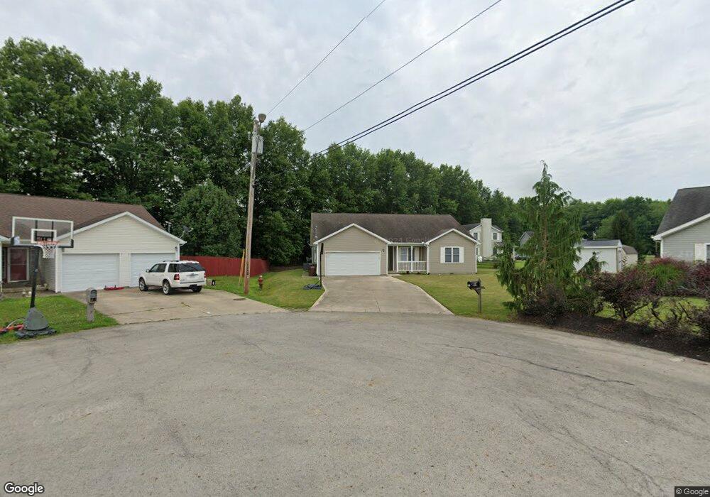
118 Nathans Ln Mount Orab, OH 45154
Estimated Value: $205,000 - $274,702
4
Beds
2
Baths
1,742
Sq Ft
$144/Sq Ft
Est. Value
About This Home
This home is located at 118 Nathans Ln, Mount Orab, OH 45154 and is currently estimated at $250,926, approximately $144 per square foot. 118 Nathans Ln is a home located in Brown County with nearby schools including Western Brown High School.
Ownership History
Date
Name
Owned For
Owner Type
Purchase Details
Closed on
Jul 6, 2016
Sold by
Selene Finance Lp
Bought by
Hilisboro Rental Management Company Llc
Current Estimated Value
Purchase Details
Closed on
Oct 6, 2014
Sold by
Stowell Stacey
Bought by
Selene Finance Lp
Purchase Details
Closed on
Aug 5, 2005
Sold by
Tri State Rental Management Llc
Bought by
Stowell Stacey
Home Financials for this Owner
Home Financials are based on the most recent Mortgage that was taken out on this home.
Original Mortgage
$117,600
Interest Rate
5.87%
Mortgage Type
Fannie Mae Freddie Mac
Purchase Details
Closed on
May 12, 2005
Sold by
Grant Robert S and Grant Viji
Bought by
Tri State Rental Management Llc
Home Financials for this Owner
Home Financials are based on the most recent Mortgage that was taken out on this home.
Original Mortgage
$87,000
Interest Rate
5.82%
Mortgage Type
Purchase Money Mortgage
Create a Home Valuation Report for This Property
The Home Valuation Report is an in-depth analysis detailing your home's value as well as a comparison with similar homes in the area
Home Values in the Area
Average Home Value in this Area
Purchase History
| Date | Buyer | Sale Price | Title Company |
|---|---|---|---|
| Hilisboro Rental Management Company Llc | $90,440 | None Available | |
| Selene Finance Lp | $75,000 | None Available | |
| Stowell Stacey | $148,666 | Premier Title Services Inc | |
| Tri State Rental Management Llc | -- | -- | |
| Grant Robert S | -- | -- |
Source: Public Records
Mortgage History
| Date | Status | Borrower | Loan Amount |
|---|---|---|---|
| Previous Owner | Stowell Stacey | $117,600 | |
| Previous Owner | Grant Robert S | $87,000 |
Source: Public Records
Tax History Compared to Growth
Tax History
| Year | Tax Paid | Tax Assessment Tax Assessment Total Assessment is a certain percentage of the fair market value that is determined by local assessors to be the total taxable value of land and additions on the property. | Land | Improvement |
|---|---|---|---|---|
| 2024 | $2,578 | $74,690 | $3,150 | $71,540 |
| 2023 | $2,578 | $50,680 | $2,020 | $48,660 |
| 2022 | $1,962 | $50,680 | $2,020 | $48,660 |
| 2021 | $1,885 | $50,680 | $2,020 | $48,660 |
| 2020 | $1,655 | $41,180 | $630 | $40,550 |
| 2019 | $1,765 | $6,300 | $6,300 | $0 |
| 2018 | $326 | $8,860 | $6,930 | $1,930 |
| 2017 | $237 | $6,300 | $6,300 | $0 |
| 2016 | $238 | $6,300 | $6,300 | $0 |
| 2015 | $227 | $6,300 | $6,300 | $0 |
| 2014 | $232 | $6,300 | $6,300 | $0 |
| 2013 | $225 | $6,300 | $6,300 | $0 |
Source: Public Records
Map
Nearby Homes
- 108 Boulder Dr
- 103 Stone Trace Dr
- 100 Longwood Blvd
- 115 Sweet Bay Trail
- 3524 Pleasant Hill Rd
- 153 Willow Run Rd
- 3305 Pleasant Hill Rd
- 0 State Route 32 Unit 1795308
- 216 Red Bud Ln
- 309 1/2 Water St
- 408 Smith Ave
- 329 E Main St
- 100 Robin Ave
- 402 E Main St
- 213 Katelin Ln
- 204 Katelin Ln
- 506 E Main St
- 14663 Day Rd
- 781 S High St
- 108 Brookshire Way
- 120 Nathans Ln
- 117 Boulder Dr
- 116 Nathans Ln
- 115 Boulder Dr
- 119 Nathans Ln
- 114 Nathans Ln
- 117 Nathans Ln
- 118 Boulder Dr
- 113 Boulder Dr
- 115 Nathans Ln
- 116 Boulder Dr
- 112 Nathans Ln
- 114 Boulder Dr
- 113 Nathans Ln
- 117 Stone Trace Dr
- 111 Boulder Dr
- 115 Stone Trace Dr
- 110 Nathans Ln
- 113 Stone Trace Dr
- 111 Nathans Ln