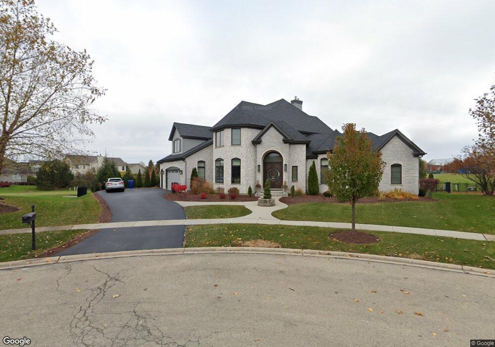
118 Planters Row Geneva, IL 60134
Heartland NeighborhoodEstimated Value: $585,000 - $931,000
--
Bed
--
Bath
--
Sq Ft
0.52
Acres
About This Home
This home is located at 118 Planters Row, Geneva, IL 60134 and is currently estimated at $765,000. 118 Planters Row is a home with nearby schools including Heartland Elementary School, Geneva Community High School, and St. Peter School.
Ownership History
Date
Name
Owned For
Owner Type
Purchase Details
Closed on
Apr 2, 2014
Sold by
Flood Michael T
Bought by
Brown Craig Daniel and Brown Sheri Lyn
Current Estimated Value
Home Financials for this Owner
Home Financials are based on the most recent Mortgage that was taken out on this home.
Original Mortgage
$714,000
Outstanding Balance
$534,689
Interest Rate
3.95%
Mortgage Type
Construction
Estimated Equity
$230,311
Purchase Details
Closed on
Nov 19, 2008
Sold by
Park National Bank
Bought by
Flood Michael T
Create a Home Valuation Report for This Property
The Home Valuation Report is an in-depth analysis detailing your home's value as well as a comparison with similar homes in the area
Home Values in the Area
Average Home Value in this Area
Purchase History
| Date | Buyer | Sale Price | Title Company |
|---|---|---|---|
| Brown Craig Daniel | $135,000 | First American Title | |
| Flood Michael T | $100,000 | None Available |
Source: Public Records
Mortgage History
| Date | Status | Borrower | Loan Amount |
|---|---|---|---|
| Open | Brown Craig Daniel | $714,000 |
Source: Public Records
Tax History Compared to Growth
Tax History
| Year | Tax Paid | Tax Assessment Tax Assessment Total Assessment is a certain percentage of the fair market value that is determined by local assessors to be the total taxable value of land and additions on the property. | Land | Improvement |
|---|---|---|---|---|
| 2024 | $24,362 | $321,932 | $56,223 | $265,709 |
| 2023 | $23,813 | $292,666 | $51,112 | $241,554 |
| 2022 | $22,635 | $271,944 | $47,493 | $224,451 |
| 2021 | $21,987 | $261,837 | $45,728 | $216,109 |
| 2020 | $21,749 | $257,840 | $45,030 | $212,810 |
| 2019 | $21,704 | $252,958 | $44,177 | $208,781 |
| 2018 | $21,234 | $247,846 | $44,177 | $203,669 |
| 2017 | $21,026 | $241,236 | $42,999 | $198,237 |
| 2016 | $20,515 | $231,022 | $42,418 | $188,604 |
| 2015 | -- | $206,375 | $40,329 | $166,046 |
| 2014 | -- | $5,930 | $5,930 | $0 |
| 2013 | -- | $5,930 | $5,930 | $0 |
Source: Public Records
Map
Nearby Homes
- 2731 Stone Cir
- 2771 Stone Cir
- 2767 Stone Cir
- 2692 Stone Cir Unit 203
- 2671 Stone Cir Unit 208
- 231 N Cambridge Dr
- 560 Renee Ct
- 2528 Heritage Ct Unit 1
- 528 Horizon Dr W
- 3024 Langston Cir
- 3497 Winding Meadow Ln
- 2147 Fargo Blvd
- 38W533 Berquist Dr
- Unit 6A Prairie Grove Dr
- Unit 5B Prairie Grove Dr
- Unit 4A Prairie Grove Dr
- Unit 5A Prairie Grove Dr
- Unit 7A Prairie Grove Dr
- Unit 6C Prairie Grove Dr
- Unit 5C Prairie Grove Dr
- 136 Planters Row
- 109 Planters Row
- 150 Planters Row
- 127 Planters Row
- 261 Barnside Cir Unit 2
- 249 Barnside Cir Unit 2
- 283 Barnside Cir Unit 2
- 145 Planters Row
- 227 Barnside Cir
- 172 Planters Row
- 295 Barnside Cir
- 163 Planters Row
- 323 Prairieview Dr
- 205 Barnside Cir Unit 2
- 269 Prairieview Dr Unit 2
- 3375 Harvest Ridge Rd
- 254 Barnside Cir Unit 2
- 198 Planters Row
- 190 Fairview Ct
- 345 Prairieview Dr Unit 2