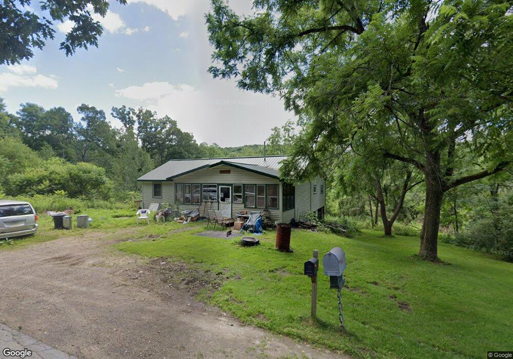
118 Rock Run Rd Turtlepoint, PA 16750
Estimated Value: $109,956 - $156,000
Studio
--
Bath
1,056
Sq Ft
$131/Sq Ft
Est. Value
About This Home
This home is located at 118 Rock Run Rd, Turtlepoint, PA 16750 and is currently estimated at $138,489, approximately $131 per square foot. 118 Rock Run Rd is a home located in McKean County with nearby schools including Port Allegany Elementary School, Port Allegany Junior/Senior High School, and Valley View Amish School.
Ownership History
Date
Name
Owned For
Owner Type
Purchase Details
Closed on
Apr 27, 2015
Sold by
Hopkins Tammy A and Tucker Tammy A
Bought by
Tucker Gordon and Tucker Tammy A
Current Estimated Value
Home Financials for this Owner
Home Financials are based on the most recent Mortgage that was taken out on this home.
Original Mortgage
$43,000
Interest Rate
4%
Mortgage Type
Adjustable Rate Mortgage/ARM
Create a Home Valuation Report for This Property
The Home Valuation Report is an in-depth analysis detailing your home's value as well as a comparison with similar homes in the area
Purchase History
| Date | Buyer | Sale Price | Title Company |
|---|---|---|---|
| Tucker Gordon | -- | None Available |
Source: Public Records
Mortgage History
| Date | Status | Borrower | Loan Amount |
|---|---|---|---|
| Closed | Tucker Gordon | $43,000 |
Source: Public Records
Tax History
| Year | Tax Paid | Tax Assessment Tax Assessment Total Assessment is a certain percentage of the fair market value that is determined by local assessors to be the total taxable value of land and additions on the property. | Land | Improvement |
|---|---|---|---|---|
| 2025 | $1,391 | $43,100 | $9,790 | $33,310 |
| 2024 | $1,352 | $43,100 | $9,790 | $33,310 |
| 2023 | $1,359 | $43,100 | $9,790 | $33,310 |
| 2022 | $1,359 | $43,100 | $9,790 | $33,310 |
| 2021 | $1,330 | $43,100 | $9,790 | $33,310 |
| 2020 | $1,330 | $43,100 | $9,790 | $33,310 |
| 2019 | $1,271 | $43,100 | $9,790 | $33,310 |
| 2018 | $13 | $43,100 | $9,790 | $33,310 |
| 2017 | -- | $43,100 | $9,790 | $33,310 |
| 2016 | $1,197 | $43,100 | $9,790 | $33,310 |
| 2015 | $463 | $43,100 | $9,790 | $33,310 |
| 2014 | $463 | $43,100 | $9,790 | $33,310 |
Source: Public Records
Map
Nearby Homes
- 320 Sartwell Rd
- 801 Annin Creek Rd
- 787 Champlin Hill Rd
- 659 Birch Run Rd
- 3026 Pennsylvania 155
- 3087 Pennsylvania 155
- 40 Berts Dr
- 2125 Annin Creek
- 110 Katherine St
- 82 Church St
- 22 Park Ave
- 0 Pennsylvania 46
- 218 Smith Ave
- 53 Edson St
- 1470 Barden Brook Rd
- 47 Edson St
- 33 Edson St
- 12 Edson St
- 173 Barden Brook
- 26 King St
- 104 Rock Run Rd
- 105 Rock Run Rd
- 88 Rock Run Rd
- 72 Rock Run Rd
- 58 Rock Run Rd
- 53 Rock Run Rd
- 1373 Route 155
- 20 Rock Run Rd
- 229 Rock Run Rd
- 1318 Route 155
- 1396 Route 155
- 1425 Route 155
- 1416 Route 155
- 1459 Route 155
- 1459 Route 155
- 1459 Route 155
- 1459 Route 155
- 1179 Route 155
- 1153 Route 155
- 1109 Route 155
Your Personal Tour Guide
Ask me questions while you tour the home.