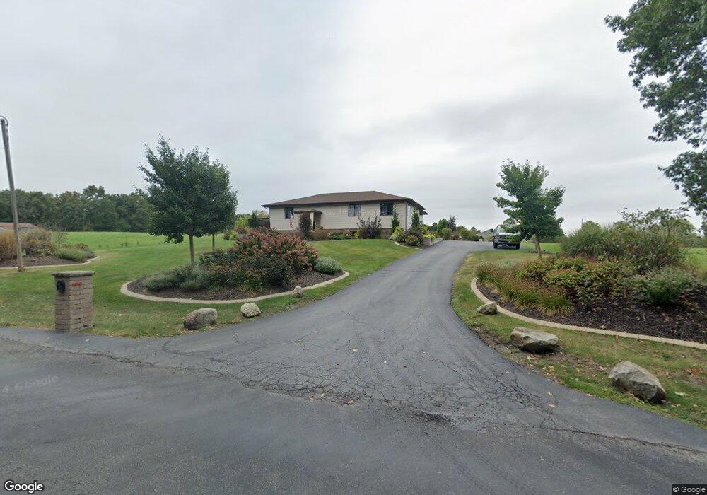
118 S 600 W Hebron, IN 46341
Porter County NeighborhoodEstimated Value: $488,000 - $706,000
3
Beds
4
Baths
3,520
Sq Ft
$155/Sq Ft
Est. Value
About This Home
This home is located at 118 S 600 W, Hebron, IN 46341 and is currently estimated at $546,244, approximately $155 per square foot. 118 S 600 W is a home located in Porter County with nearby schools including Porter Lakes Elementary School, Boone Grove Elementary School, and Boone Grove Middle School.
Ownership History
Date
Name
Owned For
Owner Type
Purchase Details
Closed on
Sep 12, 2019
Sold by
Mulder Andrew D and Mulder Allison D
Bought by
Mulder Andrew D and Mulder Allison D
Current Estimated Value
Purchase Details
Closed on
Oct 15, 2014
Sold by
Lee Anthony Allen
Bought by
Mulder Andrew D and Mulder Allison B
Home Financials for this Owner
Home Financials are based on the most recent Mortgage that was taken out on this home.
Original Mortgage
$142,500
Outstanding Balance
$109,166
Interest Rate
4.08%
Mortgage Type
New Conventional
Estimated Equity
$437,078
Create a Home Valuation Report for This Property
The Home Valuation Report is an in-depth analysis detailing your home's value as well as a comparison with similar homes in the area
Home Values in the Area
Average Home Value in this Area
Purchase History
| Date | Buyer | Sale Price | Title Company |
|---|---|---|---|
| Mulder Andrew D | -- | None Available | |
| Mulder Andrew D | -- | Chicago Title Company Llc |
Source: Public Records
Mortgage History
| Date | Status | Borrower | Loan Amount |
|---|---|---|---|
| Open | Mulder Andrew D | $142,500 |
Source: Public Records
Tax History Compared to Growth
Tax History
| Year | Tax Paid | Tax Assessment Tax Assessment Total Assessment is a certain percentage of the fair market value that is determined by local assessors to be the total taxable value of land and additions on the property. | Land | Improvement |
|---|---|---|---|---|
| 2024 | $2,782 | $399,500 | $39,000 | $360,500 |
| 2023 | $2,699 | $369,600 | $35,400 | $334,200 |
| 2022 | $2,559 | $333,300 | $35,400 | $297,900 |
| 2021 | $2,353 | $288,400 | $35,400 | $253,000 |
| 2020 | $2,063 | $273,100 | $33,300 | $239,800 |
| 2019 | $2,053 | $255,500 | $33,300 | $222,200 |
| 2018 | $1,943 | $243,300 | $33,300 | $210,000 |
| 2017 | $1,803 | $241,100 | $33,300 | $207,800 |
| 2016 | $1,352 | $191,700 | $31,900 | $159,800 |
| 2014 | $1,170 | $174,000 | $31,200 | $142,800 |
| 2013 | -- | $174,200 | $32,700 | $141,500 |
Source: Public Records
Map
Nearby Homes
- 46 S Delmar Ct
- N 675th W
- 595 W 213 S
- 50 Annetto Ct
- 545 W Fatima St
- 726 Verdano Terrace
- 745 Verdano Terrace
- 747 Verdano Terrace
- 742 Druim Tr
- 767 Ketill Trace
- 718 Verdano Terrace
- 763 Ketill Trace
- 710, 712, & 714 Ketill Trace
- 735 Druim Tr
- 228 S 675 W
- 0 W Division (101st for Lake Co ) Rd W
- 665 Windy Oak Ct
- 700 W Bay Ct
- 764 Ketill Trace
- 703 Druim Tr