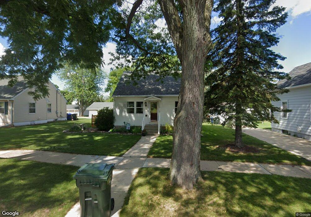
118 S Adams St de Pere, WI 54115
Estimated Value: $228,000 - $244,000
3
Beds
1
Bath
1,248
Sq Ft
$187/Sq Ft
Est. Value
About This Home
This home is located at 118 S Adams St, de Pere, WI 54115 and is currently estimated at $233,920, approximately $187 per square foot. 118 S Adams St is a home located in Brown County with nearby schools including Dickinson Elementary School, Foxview Intermediate School, and De Pere Middle School.
Ownership History
Date
Name
Owned For
Owner Type
Purchase Details
Closed on
Nov 21, 2005
Sold by
Larsen Paul V
Bought by
Larsen Shannon R
Current Estimated Value
Home Financials for this Owner
Home Financials are based on the most recent Mortgage that was taken out on this home.
Original Mortgage
$105,400
Interest Rate
6.46%
Mortgage Type
Fannie Mae Freddie Mac
Create a Home Valuation Report for This Property
The Home Valuation Report is an in-depth analysis detailing your home's value as well as a comparison with similar homes in the area
Home Values in the Area
Average Home Value in this Area
Purchase History
| Date | Buyer | Sale Price | Title Company |
|---|---|---|---|
| Larsen Shannon R | -- | Land Title & Closing Svcs |
Source: Public Records
Mortgage History
| Date | Status | Borrower | Loan Amount |
|---|---|---|---|
| Previous Owner | Larsen Shannon R | $105,400 |
Source: Public Records
Tax History Compared to Growth
Tax History
| Year | Tax Paid | Tax Assessment Tax Assessment Total Assessment is a certain percentage of the fair market value that is determined by local assessors to be the total taxable value of land and additions on the property. | Land | Improvement |
|---|---|---|---|---|
| 2024 | $2,366 | $171,900 | $24,100 | $147,800 |
| 2023 | $2,145 | $162,400 | $24,100 | $138,300 |
| 2022 | $2,017 | $144,200 | $24,100 | $120,100 |
| 2021 | $1,862 | $126,500 | $20,100 | $106,400 |
| 2020 | $1,947 | $119,600 | $20,100 | $99,500 |
| 2019 | $1,936 | $111,000 | $20,100 | $90,900 |
| 2018 | $2,009 | $105,000 | $20,100 | $84,900 |
| 2017 | $1,892 | $95,400 | $20,100 | $75,300 |
| 2016 | $1,910 | $95,400 | $20,100 | $75,300 |
| 2015 | $2,018 | $93,300 | $20,200 | $73,100 |
| 2014 | $1,930 | $93,300 | $20,200 | $73,100 |
| 2013 | $1,930 | $93,300 | $20,200 | $73,100 |
Source: Public Records
Map
Nearby Homes
- 120 N Winnebago St
- 1219 Irwin Ave
- 1020 Franklin St
- 318 S Webster Ave
- 607 N Winnebago St
- 907 Fulton St
- 303 S Huron St
- 103 Zita St
- 1202 Ridgeway Blvd
- 1861 Chicago St
- 636 N Erie St
- 1004 Gulfstream Ct
- 1421 Ridgeway Dr Unit 1423
- 363 Battery Ave
- 1611 N Honeysuckle Cir
- 305 Battery Ave
- 416 Lansdowne St
- 337 Battery Ave
- 385 Battery Ave
- 413 Brookline Ave
- 114 S Adams St
- 126 S Adams St
- 1215 Charles St Unit 1217
- 1217 Charles St
- 117 S Washington St
- 115 S Washington St
- 1214 George St
- 125 S Washington St
- 1218 George St
- 107 S Washington St
- 133 S Washington St
- 119 S Adams St
- 125 S Adams St
- 103 S Washington St
- 1313 Charles St
- 1302 George St
- 1215 George St
- 126 S Washington St
- 114 S Washington St Unit 116
- 1320 George St