Estimated Value: $95,854 - $146,000
--
Bed
1
Bath
900
Sq Ft
$140/Sq Ft
Est. Value
About This Home
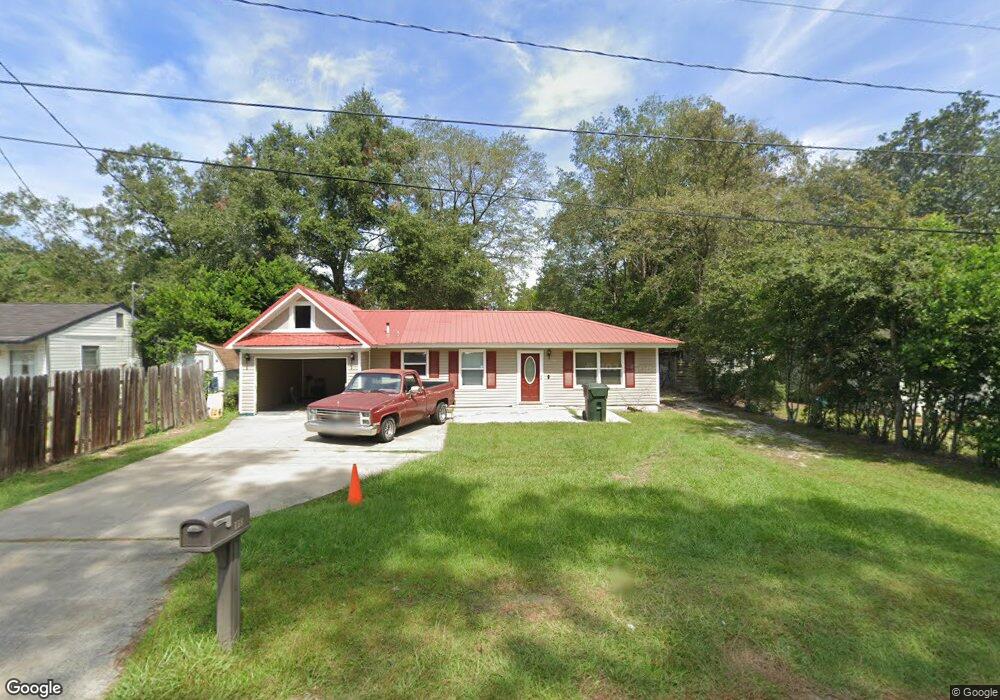
This home is located at 118 S Deborah Cir, Jesup, GA 31546 and is currently estimated at $125,714, approximately $139 per square foot. 118 S Deborah Cir is a home located in Wayne County with nearby schools including Martha Rawls Smith Elementary School, Arthur Williams Middle School, and Wayne County High School.
Ownership History
Date
Name
Owned For
Owner Type
Purchase Details
Closed on
Oct 9, 2019
Sold by
Haynes Fannie Mae
Bought by
Merritt Amos and Fields Ricardo
Current Estimated Value
Purchase Details
Closed on
Aug 2, 2007
Sold by
Nettles Ralph Larearn
Bought by
Williamson J D
Purchase Details
Closed on
May 1, 2003
Sold by
Sapp Larry and Sapp Marla B
Bought by
Haynes Fannie Mae
Purchase Details
Closed on
Jan 1, 1996
Bought by
Sapp Larry and Sapp Marla B
Purchase Details
Closed on
Apr 1, 1995
Purchase Details
Closed on
Sep 1, 1991
Purchase Details
Closed on
May 1, 1979
Create a Home Valuation Report for This Property
The Home Valuation Report is an in-depth analysis detailing your home's value as well as a comparison with similar homes in the area
Home Values in the Area
Average Home Value in this Area
Purchase History
| Date | Buyer | Sale Price | Title Company |
|---|---|---|---|
| Merritt Amos | -- | -- | |
| Williamson J D | $35,000 | -- | |
| Haynes Fannie Mae | $30,500 | -- | |
| Sapp Larry | $19,500 | -- | |
| -- | $6,000 | -- | |
| -- | -- | -- | |
| -- | $15,000 | -- |
Source: Public Records
Tax History Compared to Growth
Tax History
| Year | Tax Paid | Tax Assessment Tax Assessment Total Assessment is a certain percentage of the fair market value that is determined by local assessors to be the total taxable value of land and additions on the property. | Land | Improvement |
|---|---|---|---|---|
| 2024 | $588 | $23,546 | $1,856 | $21,690 |
| 2023 | $738 | $20,849 | $1,852 | $18,997 |
| 2022 | $499 | $20,849 | $1,852 | $18,997 |
| 2021 | $534 | $20,849 | $1,852 | $18,997 |
| 2020 | $727 | $20,849 | $1,852 | $18,997 |
| 2019 | $284 | $20,849 | $1,852 | $18,997 |
| 2018 | $284 | $20,849 | $1,852 | $18,997 |
| 2017 | $189 | $20,849 | $1,852 | $18,997 |
| 2016 | $189 | $20,849 | $1,852 | $18,997 |
| 2014 | $189 | $20,849 | $1,852 | $18,997 |
| 2013 | -- | $20,848 | $1,852 | $18,996 |
Source: Public Records
Map
Nearby Homes
- 0 S Palm St Unit 10609054
- 0 S Palm St Unit 1656795
- 1300 S Palm St
- 158 N Deborah Cir
- 1101 S Palm St
- 805 Littlefield St
- 775 Catherine St
- 985 Seven Oaks Rd
- 50 Ac Hwy 301
- 655 Littlefield St
- 210 Purser Dr
- 945 S Palm St
- 1816 S Palm St
- 1812 S Palm St
- 0 U S 301
- 156 Hannah Dr
- 112 Vixenhill Dr
- 353 Chase Dr
- 113 Vixenhill Dr
- 00 U S 301
- 122 S Deborah Cir
- 114 S Deborah Cir
- 126 S Deborah Cir
- 115 N Deborah Cir
- 123 N Deborah Cir
- LT28 Blk B Harrison Village
- 115 S Deborah Cir
- 119 S Deborah Cir
- 127 N Deborah Cir
- 1140 S Palm St
- 123 S Deborah Cir
- 127 S Deborah Cir
- 131 N Deborah Cir
- 129 S Deborah Cir
- 135 N Deborah Cir
- 118 N Deborah Cir
- Hwy 301 S Palm St
- HIGHWAY 301 S Palm St
- 0 S Palm St Unit 19438
- 0 S Palm St Unit 1645940