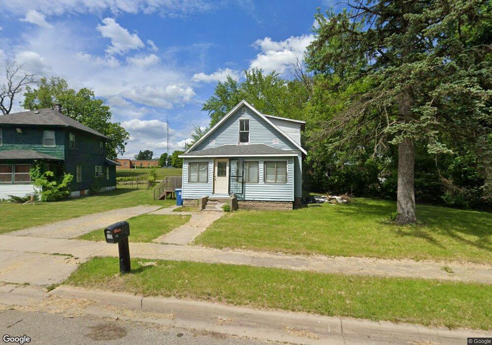
118 Somerset Ave Battle Creek, MI 49037
North Central NeighborhoodEstimated Value: $22,000 - $90,476
3
Beds
1
Bath
1,056
Sq Ft
$66/Sq Ft
Est. Value
About This Home
This home is located at 118 Somerset Ave, Battle Creek, MI 49037 and is currently estimated at $70,119, approximately $66 per square foot. 118 Somerset Ave is a home located in Calhoun County with nearby schools including Ann J. Kellogg School, Northwestern Middle School, and Battle Creek Central High School.
Ownership History
Date
Name
Owned For
Owner Type
Purchase Details
Closed on
Jan 29, 2025
Sold by
Hopkins Fetina L
Bought by
Daudert Richard L
Current Estimated Value
Purchase Details
Closed on
Jun 2, 2006
Sold by
Smith Hervia L
Bought by
Hopkins Fetina L
Purchase Details
Closed on
Jun 5, 2000
Sold by
Smith Patricia A
Bought by
Smith Hervia L
Purchase Details
Closed on
Sep 27, 1995
Bought by
Smith
Create a Home Valuation Report for This Property
The Home Valuation Report is an in-depth analysis detailing your home's value as well as a comparison with similar homes in the area
Home Values in the Area
Average Home Value in this Area
Purchase History
| Date | Buyer | Sale Price | Title Company |
|---|---|---|---|
| Daudert Richard L | $20,000 | Next Door Title Agency | |
| Daudert Richard L | $20,000 | Next Door Title Agency | |
| Hopkins Fetina L | -- | Otc | |
| Smith Hervia L | -- | -- | |
| Smith | $4,000 | -- |
Source: Public Records
Tax History Compared to Growth
Tax History
| Year | Tax Paid | Tax Assessment Tax Assessment Total Assessment is a certain percentage of the fair market value that is determined by local assessors to be the total taxable value of land and additions on the property. | Land | Improvement |
|---|---|---|---|---|
| 2025 | -- | $35,700 | $0 | $0 |
| 2024 | $689 | $28,759 | $0 | $0 |
| 2023 | $787 | $24,491 | $0 | $0 |
| 2022 | $622 | $21,350 | $0 | $0 |
| 2021 | $743 | $15,898 | $0 | $0 |
| 2020 | $787 | $16,777 | $0 | $0 |
| 2019 | $784 | $17,287 | $0 | $0 |
| 2018 | $784 | $17,168 | $832 | $16,336 |
| 2017 | $760 | $18,367 | $0 | $0 |
| 2016 | $759 | $19,486 | $0 | $0 |
| 2015 | $743 | $20,841 | $3,275 | $17,566 |
| 2014 | $743 | $16,134 | $3,275 | $12,859 |
Source: Public Records
Map
Nearby Homes
- 89 Somerset Ave
- 69 Jordan St
- 253 Greenwood Ave
- 629 Van Buren St W
- 60 Graves Ave
- 167 Hubbard St
- 224 Hubbard St
- 562 Van Buren St W
- 0 W Vanburen 027 St Unit 22040287
- 0 W Vanburen 025 St Unit 22040286
- 636 Hamblin Ave W
- 0 W Michigan 011 Ave Unit 22040285
- 0 W Michigan 010 Ave Unit 22040284
- 35 Hubbard St
- 188 Roseneath Ave
- 0 W Vanburen 032 St Unit 22040288
- 0 W Ave Unit 22040282
- 0 W Michigan 005 Ave Unit 22040281
- 9 Thorne St
- 216 Kendall St N
- 124 Somerset Ave
- 455 Parkway Dr
- 119 Somerset Ave
- 102 Somerset Ave
- 129 Somerset Ave
- 111 Somerset Ave
- 447 Parkway Dr
- 98 Somerset Ave
- 133 Somerset Ave
- 103 Somerset Ave
- 79 Plymouth Ave
- 137 Somerset Ave
- 79 Plymouth St
- 97 Somerset Ave
- 192 Graves Ave
- 198 Graves Ave
- 88 Somerset Ave
- 93 Somerset Ave
- 182 Graves Ave
- 485 Parkway Dr