Estimated Value: $230,000 - $253,594
3
Beds
2
Baths
1,310
Sq Ft
$184/Sq Ft
Est. Value
About This Home
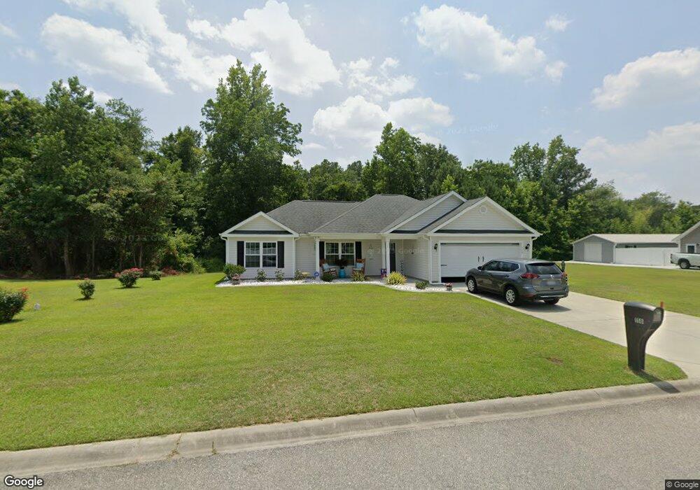
This home is located at 118 St Barnabas Rd, Loris, SC 29569 and is currently estimated at $241,399, approximately $184 per square foot. 118 St Barnabas Rd is a home located in Horry County with nearby schools including Loris Elementary School, Loris Middle School, and Loris High School.
Ownership History
Date
Name
Owned For
Owner Type
Purchase Details
Closed on
Oct 13, 2020
Sold by
Taylor Steven W
Bought by
Parker Danny J and Parker Sabrina H
Current Estimated Value
Purchase Details
Closed on
Dec 4, 2017
Sold by
Cowford Properties Llc
Bought by
Taylor Steven W and Taylor Linda E
Home Financials for this Owner
Home Financials are based on the most recent Mortgage that was taken out on this home.
Original Mortgage
$130,378
Interest Rate
3.94%
Mortgage Type
New Conventional
Purchase Details
Closed on
May 11, 2016
Sold by
Bridgewater Associates Llc
Bought by
Armfield Of Sumter Llc
Home Financials for this Owner
Home Financials are based on the most recent Mortgage that was taken out on this home.
Original Mortgage
$750,000
Interest Rate
3.58%
Mortgage Type
Purchase Money Mortgage
Create a Home Valuation Report for This Property
The Home Valuation Report is an in-depth analysis detailing your home's value as well as a comparison with similar homes in the area
Home Values in the Area
Average Home Value in this Area
Purchase History
| Date | Buyer | Sale Price | Title Company |
|---|---|---|---|
| Parker Danny J | $168,000 | -- | |
| Taylor Steven W | $144,865 | -- | |
| Cowford Properties Llc | $23,000 | -- | |
| Armfield Of Sumter Llc | $486,000 | -- |
Source: Public Records
Mortgage History
| Date | Status | Borrower | Loan Amount |
|---|---|---|---|
| Previous Owner | Cowford Properties Llc | $130,378 | |
| Previous Owner | Armfield Of Sumter Llc | $750,000 |
Source: Public Records
Tax History Compared to Growth
Tax History
| Year | Tax Paid | Tax Assessment Tax Assessment Total Assessment is a certain percentage of the fair market value that is determined by local assessors to be the total taxable value of land and additions on the property. | Land | Improvement |
|---|---|---|---|---|
| 2024 | -- | $9,952 | $2,388 | $7,564 |
| 2023 | $0 | $6,719 | $647 | $6,072 |
| 2021 | $821 | $17,637 | $1,698 | $15,939 |
| 2020 | $1,055 | $16,146 | $1,698 | $14,448 |
| 2019 | $1,102 | $16,146 | $1,698 | $14,448 |
| 2018 | $2,517 | $14,487 | $2,958 | $11,529 |
| 2017 | $295 | $970 | $970 | $0 |
| 2016 | -- | $970 | $970 | $0 |
| 2015 | $291 | $1,698 | $1,698 | $0 |
| 2014 | $281 | $971 | $971 | $0 |
Source: Public Records
Map
Nearby Homes
- 113 Adelphia Rd
- 2708 Main St
- 3110 Pinewood Dr
- TBD Paul St
- 375 State Road S-26-140
- TBD Cannon Rd
- 3539 Harrelson Ave
- 4165 Stevens St
- 5001 Lewis St
- 3604 Church St
- 0 Herman Rd
- 1165 Highway 9 Business W
- TBD Watson St
- 3807 Casey St
- 3629 Sanderson St
- TBD 23.20 AC Highway 45
- 7207 Meadow Walk Loop
- 7447 Meadow Walk Loop
- 7366 Meadow Walk Loop
- 7463 Meadow Walk Loop
- 118 Saint Barnabas Rd
- 118 Saint Barnabas Rd
- 122 Saint Barnabas Rd
- 114 Saint Barnabas Rd
- 114 Saint Barnabas Rd
- 122 Saint Barnabas Rd
- 121 Saint Barnabas Rd
- 121 Saint Barnabas Rd Unit Rylee 2 Plan
- 119 Saint Barnabas Rd
- 119 Saint Barnabas Rd
- 121 Saint Barnabas Rd
- 115 Saint Barnabas Rd
- 115 St Barnabas Rd
- 115 Saint Barnabas Rd
- 126 Saint Barnabas Rd
- 126 Saint Barnabas Rd
- 110 Saint Barnabas Rd
- 110 Saint Barnabas Rd
- 110 St Barnabas Rd
- 125 Saint Barnabas Rd