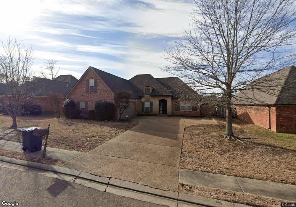
118 Turtle Ridge Dr Unit (Lot 34) Brandon, MS 39047
Estimated Value: $327,000 - $351,000
4
Beds
3
Baths
2,110
Sq Ft
$161/Sq Ft
Est. Value
About This Home
This home is located at 118 Turtle Ridge Dr Unit (Lot 34), Brandon, MS 39047 and is currently estimated at $339,691, approximately $160 per square foot. 118 Turtle Ridge Dr Unit (Lot 34) is a home located in Rankin County with nearby schools including Highland Bluff Elementary School, Northwest Rankin Middle School, and Northwest Rankin High School.
Ownership History
Date
Name
Owned For
Owner Type
Purchase Details
Closed on
Mar 24, 2020
Sold by
Norem Jon R
Bought by
Cannon Leticia
Current Estimated Value
Home Financials for this Owner
Home Financials are based on the most recent Mortgage that was taken out on this home.
Original Mortgage
$233,689
Outstanding Balance
$207,433
Interest Rate
3.62%
Mortgage Type
FHA
Estimated Equity
$132,258
Purchase Details
Closed on
Aug 5, 2015
Sold by
Young Josh D and Young Casey A
Bought by
Noren Jon R
Home Financials for this Owner
Home Financials are based on the most recent Mortgage that was taken out on this home.
Original Mortgage
$213,675
Interest Rate
4.25%
Mortgage Type
FHA
Purchase Details
Closed on
Jul 16, 2007
Sold by
Kirkland Development Inc
Bought by
Young Josh D and Young Casey A
Home Financials for this Owner
Home Financials are based on the most recent Mortgage that was taken out on this home.
Original Mortgage
$219,150
Interest Rate
6.71%
Create a Home Valuation Report for This Property
The Home Valuation Report is an in-depth analysis detailing your home's value as well as a comparison with similar homes in the area
Home Values in the Area
Average Home Value in this Area
Purchase History
| Date | Buyer | Sale Price | Title Company |
|---|---|---|---|
| Cannon Leticia | -- | None Available | |
| Noren Jon R | -- | None Available | |
| Young Josh D | -- | -- |
Source: Public Records
Mortgage History
| Date | Status | Borrower | Loan Amount |
|---|---|---|---|
| Open | Cannon Leticia | $233,689 | |
| Previous Owner | Noren Jon R | $213,675 | |
| Previous Owner | Young Josh D | $219,150 |
Source: Public Records
Tax History Compared to Growth
Tax History
| Year | Tax Paid | Tax Assessment Tax Assessment Total Assessment is a certain percentage of the fair market value that is determined by local assessors to be the total taxable value of land and additions on the property. | Land | Improvement |
|---|---|---|---|---|
| 2024 | $2,231 | $23,500 | $0 | $0 |
| 2023 | $2,579 | $23,254 | $0 | $0 |
| 2022 | $2,545 | $23,254 | $0 | $0 |
| 2021 | $2,595 | $23,254 | $0 | $0 |
| 2020 | $2,620 | $23,254 | $0 | $0 |
| 2019 | $2,403 | $20,678 | $0 | $0 |
| 2018 | $2,377 | $20,678 | $0 | $0 |
| 2017 | $2,399 | $20,678 | $0 | $0 |
| 2016 | $2,253 | $20,258 | $0 | $0 |
| 2015 | $2,253 | $20,258 | $0 | $0 |
| 2014 | $2,210 | $20,258 | $0 | $0 |
| 2013 | -- | $20,258 | $0 | $0 |
Source: Public Records
Map
Nearby Homes
- 707 Tortoise Ridge
- 119 Turtle Ridge Dr
- 126 Turtle Ridge Dr
- 753 Northridge Trail
- 318 Turtle Hollow
- 913 Sea Turtle Cove
- 169 Bellegrove Cir
- 109 Brandy Run Rd
- 112 Wildwood Ln
- 572 Turtle Ln
- 191 Bellegrove Cir
- 243 E Pinebrook Dr
- 114 Sherwood Dr
- 126 Plum Tree Rd
- 300 Deer Hollow
- 504 Pinebark Cove
- 101 Dogwood Cir
- 173 Fallen Oaks Dr
- 173b Cumberland Rd
- 154 Cumberland Rd
- 118 Turtle Ridge Dr
- 120 Turtle Ridge Dr
- 116 Turtle Ridge Dr
- 715 Tortoise Ridge Dr
- 717 Tortoise Ridge
- 717 Tortoise Ridge Unit (Lot 95)
- 713 Tortoise Ridge
- 713 Tortoise Ridge
- 713 Tortoise Ridge Unit DR
- 713 Tortoise Ridge Dr
- 122 Turtle Ridge Dr
- 122 Turtle Ridge Dr Unit (Lot 32)
- 114 Turtle Ridge Dr
- 117 Turtle Ridge Dr
- 117 Turtle Ridge Dr Unit (Lot 48)
- 117 Turtle Ridge
- 115 Turtle Ridge Dr Unit (lot 47)
- 115 Turtle Ridge Dr
- 119 Turtle Ridge Dr Unit (Lot 49)
- 711 Tortoise Ridge