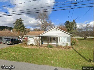
118 W Hill Rd Covington, PA 16917
Estimated Value: $84,000 - $160,000
3
Beds
2
Baths
1,252
Sq Ft
$95/Sq Ft
Est. Value
About This Home
This home is located at 118 W Hill Rd, Covington, PA 16917 and is currently estimated at $118,778, approximately $94 per square foot. 118 W Hill Rd is a home located in Tioga County with nearby schools including Warren L. Miller Elementary School and North Penn-Mansfield Jr./Sr. High School.
Ownership History
Date
Name
Owned For
Owner Type
Purchase Details
Closed on
Dec 19, 2012
Sold by
Herrold Michael D
Bought by
Lowe Herrold Rae Michele
Current Estimated Value
Home Financials for this Owner
Home Financials are based on the most recent Mortgage that was taken out on this home.
Original Mortgage
$40,100
Interest Rate
3.39%
Mortgage Type
Unknown
Purchase Details
Closed on
Jul 25, 2005
Sold by
Lowe Philip and Lowe Maude
Bought by
Lowe Herrold Rae Michele and Herrold Michael D
Create a Home Valuation Report for This Property
The Home Valuation Report is an in-depth analysis detailing your home's value as well as a comparison with similar homes in the area
Home Values in the Area
Average Home Value in this Area
Purchase History
| Date | Buyer | Sale Price | Title Company |
|---|---|---|---|
| Lowe Herrold Rae Michele | -- | None Available | |
| Lowe Herrold Rae Michele | -- | None Available |
Source: Public Records
Mortgage History
| Date | Status | Borrower | Loan Amount |
|---|---|---|---|
| Closed | Lowe Herrold Rae Michele | $40,100 |
Source: Public Records
Tax History Compared to Growth
Tax History
| Year | Tax Paid | Tax Assessment Tax Assessment Total Assessment is a certain percentage of the fair market value that is determined by local assessors to be the total taxable value of land and additions on the property. | Land | Improvement |
|---|---|---|---|---|
| 2024 | $1,549 | $69,080 | $10,350 | $58,730 |
| 2023 | $1,367 | $52,910 | $6,000 | $46,910 |
| 2022 | $1,349 | $52,910 | $6,000 | $46,910 |
| 2021 | $1,330 | $52,910 | $6,000 | $46,910 |
| 2020 | $1,321 | $52,910 | $6,000 | $46,910 |
| 2019 | $1,313 | $52,910 | $6,000 | $46,910 |
| 2018 | $1,286 | $52,910 | $6,000 | $46,910 |
| 2017 | -- | $52,910 | $6,000 | $46,910 |
| 2016 | $1,247 | $52,910 | $6,000 | $46,910 |
| 2015 | -- | $52,910 | $6,000 | $46,910 |
| 2014 | -- | $52,910 | $6,000 | $46,910 |
Source: Public Records
Map
Nearby Homes
- 61 Carlton Dr
- 91 Carlton Dr
- 0 N Williamson Rd Unit 31722280
- 3026 S Main St
- 271 Canada Rd
- 62 Canoe Camp Creek Rd
- 2313 Pennsylvania 660
- 46 Kriner Ln
- 101 Hemlock Dr
- 30 Thorn Apple Ln
- 1731 W Hill Rd
- 154 Spruce Dr
- 342 N Williamson Rd
- 2141-2165 S Main St
- 0 Fourth St
- 317 N Williamson Rd
- 15920 Route 6
- 3119 Cherry Flats Rd
- 16547 Route 6
- 102 Saint James St