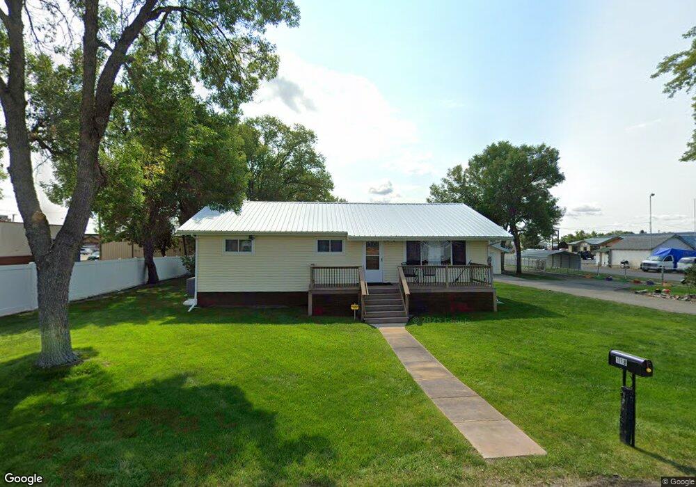
118 W Railroad St Laurel, MT 59044
Estimated Value: $329,000 - $376,000
5
Beds
2
Baths
2,464
Sq Ft
$145/Sq Ft
Est. Value
About This Home
This home is located at 118 W Railroad St, Laurel, MT 59044 and is currently estimated at $358,314, approximately $145 per square foot. 118 W Railroad St is a home located in Yellowstone County with nearby schools including Fred W. Graff School, West School, and Laurel Middle School.
Ownership History
Date
Name
Owned For
Owner Type
Purchase Details
Closed on
Jun 23, 2022
Sold by
Zane C Dawson Trust
Bought by
Everling Ginger Mae and Everling Wayne
Current Estimated Value
Home Financials for this Owner
Home Financials are based on the most recent Mortgage that was taken out on this home.
Original Mortgage
$328,932
Outstanding Balance
$312,926
Interest Rate
5.25%
Mortgage Type
FHA
Estimated Equity
$45,388
Create a Home Valuation Report for This Property
The Home Valuation Report is an in-depth analysis detailing your home's value as well as a comparison with similar homes in the area
Home Values in the Area
Average Home Value in this Area
Purchase History
| Date | Buyer | Sale Price | Title Company |
|---|---|---|---|
| Everling Ginger Mae | -- | Chicago Title |
Source: Public Records
Mortgage History
| Date | Status | Borrower | Loan Amount |
|---|---|---|---|
| Open | Everling Ginger Mae | $328,932 |
Source: Public Records
Tax History Compared to Growth
Tax History
| Year | Tax Paid | Tax Assessment Tax Assessment Total Assessment is a certain percentage of the fair market value that is determined by local assessors to be the total taxable value of land and additions on the property. | Land | Improvement |
|---|---|---|---|---|
| 2025 | $3,012 | $355,300 | $76,567 | $278,733 |
| 2024 | $3,012 | $273,900 | $49,724 | $224,176 |
| 2023 | $2,803 | $273,900 | $49,724 | $224,176 |
| 2022 | $1,830 | $219,400 | $0 | $0 |
| 2021 | $1,958 | $219,400 | $0 | $0 |
| 2020 | $2,021 | $231,100 | $0 | $0 |
| 2019 | $2,139 | $231,100 | $0 | $0 |
| 2018 | $1,872 | $212,900 | $0 | $0 |
| 2017 | $1,308 | $212,900 | $0 | $0 |
| 2016 | $1,603 | $198,100 | $0 | $0 |
| 2015 | $2,081 | $198,100 | $0 | $0 |
| 2014 | $1,917 | $94,181 | $0 | $0 |
Source: Public Records
Map
Nearby Homes
- 211 Woodland Ave
- 116 4th Ave
- 316 Durland Ave
- 419 Durland Ave
- 301 West Ave
- 110 E 5th St
- 102 8th Ave Unit B
- 516 Pennsylvania Ave
- 801 E 4th St
- 717 E 5th, 506 Alder Ave
- 711 Cougar Cir
- 1003 Montana Ave
- 518 Date Ave
- 1006 Sunhaven Dr
- 1008 Sunhaven Dr
- 1004 E 8th St
- 1104 E 8th St
- 611 Elm Ave
- 1108 E 8th St
- 802-816 Date Ave