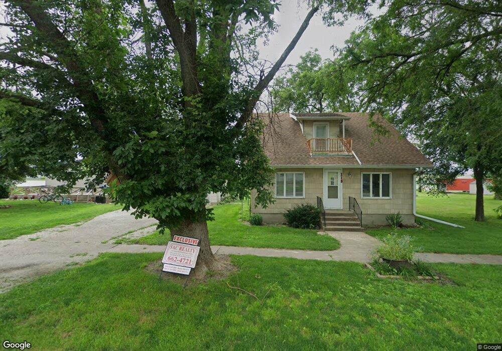
118 Walnut St Lytton, IA 50561
Estimated Value: $64,398 - $80,000
Studio
1
Bath
1,271
Sq Ft
$58/Sq Ft
Est. Value
About This Home
This home is located at 118 Walnut St, Lytton, IA 50561 and is currently estimated at $73,600, approximately $57 per square foot. 118 Walnut St is a home with nearby schools including South Central Calhoun Elementary School, South Central Calhoun High School, and South Central Calhoun Middle School.
Ownership History
Date
Name
Owned For
Owner Type
Purchase Details
Closed on
Feb 19, 2026
Sold by
Raveling Corissa J
Bought by
Reiling Broderick L
Current Estimated Value
Purchase Details
Closed on
Sep 26, 2025
Sold by
Talbott Michelle R
Bought by
Reiling Broderick
Home Financials for this Owner
Home Financials are based on the most recent Mortgage that was taken out on this home.
Original Mortgage
$78,900
Interest Rate
6.58%
Mortgage Type
New Conventional
Purchase Details
Closed on
Jul 18, 2012
Sold by
Dcdonna Estate Of Esther Lake and Ex Geery
Bought by
Talbott Michelle R
Create a Home Valuation Report for This Property
The Home Valuation Report is an in-depth analysis detailing your home's value as well as a comparison with similar homes in the area
Purchase History
| Date | Buyer | Sale Price | Title Company |
|---|---|---|---|
| Reiling Broderick L | -- | None Listed On Document | |
| Reiling Broderick | $80,000 | None Listed On Document | |
| Talbott Michelle R | -- | None Available |
Source: Public Records
Mortgage History
| Date | Status | Borrower | Loan Amount |
|---|---|---|---|
| Previous Owner | Reiling Broderick | $78,900 |
Source: Public Records
Tax History
| Year | Tax Paid | Tax Assessment Tax Assessment Total Assessment is a certain percentage of the fair market value that is determined by local assessors to be the total taxable value of land and additions on the property. | Land | Improvement |
|---|---|---|---|---|
| 2025 | $610 | $49,350 | $2,630 | $46,720 |
| 2024 | $610 | $42,770 | $2,250 | $40,520 |
| 2023 | $514 | $42,770 | $2,250 | $40,520 |
| 2022 | $500 | $31,500 | $2,250 | $29,250 |
| 2021 | $500 | $31,500 | $2,250 | $29,250 |
| 2020 | $334 | $29,970 | $2,250 | $27,720 |
| 2019 | $328 | $29,970 | $2,250 | $27,720 |
| 2018 | $320 | $28,600 | $0 | $0 |
| 2017 | $320 | $28,240 | $0 | $0 |
| 2016 | $294 | $28,240 | $0 | $0 |
| 2015 | $294 | $26,450 | $0 | $0 |
| 2014 | $264 | $26,450 | $0 | $0 |
Source: Public Records
Map
Nearby Homes
- 606 Park Ave
- 407 E Ahrens St
- 415 E Ahrens St
- 716 N 5th St
- 815 Bowery St
- 727 S 9th St
- 919 Audubon St
- 1002 W Main St
- 604 S 10th St
- 612 S 10th St
- 327 S 12th St Unit 1 of 4
- 1101 Schaller St
- 519 S 12th St
- 1323 Maple St
- 1709 Early St
- 500 N 19th St
- 810711200007 Rolf Avenue and Highway 20
- 0 Voss Ave
- 2070 Rolf Ave
- 0 Quincy Ave
Your Personal Tour Guide
Ask me questions while you tour the home.