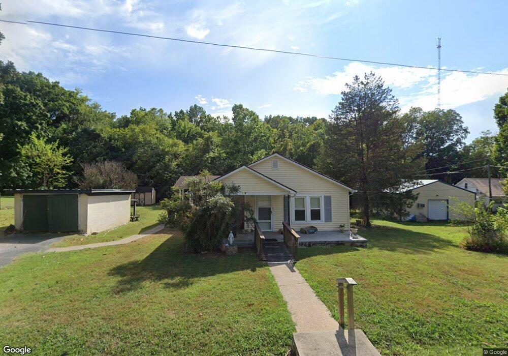
118 Westside Cir Springfield, TN 37172
Estimated Value: $161,072 - $301,000
Studio
1
Bath
904
Sq Ft
$243/Sq Ft
Est. Value
About This Home
This home is located at 118 Westside Cir, Springfield, TN 37172 and is currently estimated at $219,768, approximately $243 per square foot. 118 Westside Cir is a home located in Robertson County with nearby schools including Westside Elementary School, Cheatham Park Elementary School, and Innovation Academy.
Ownership History
Date
Name
Owned For
Owner Type
Purchase Details
Closed on
Sep 17, 1999
Sold by
Axley Patrick E
Bought by
Mcclard Wanda A
Current Estimated Value
Purchase Details
Closed on
Jun 30, 1988
Bought by
Axley Arthur E
Purchase Details
Closed on
Aug 5, 1987
Bought by
Axley Arthur E
Purchase Details
Closed on
May 31, 1960
Create a Home Valuation Report for This Property
The Home Valuation Report is an in-depth analysis detailing your home's value as well as a comparison with similar homes in the area
Home Values in the Area
Average Home Value in this Area
Purchase History
| Date | Buyer | Sale Price | Title Company |
|---|---|---|---|
| Mcclard Wanda A | -- | -- | |
| Axley Arthur E | -- | -- | |
| Axley Arthur E | -- | -- | |
| -- | -- | -- |
Source: Public Records
Tax History
| Year | Tax Paid | Tax Assessment Tax Assessment Total Assessment is a certain percentage of the fair market value that is determined by local assessors to be the total taxable value of land and additions on the property. | Land | Improvement |
|---|---|---|---|---|
| 2025 | -- | $35,825 | $8,750 | $27,075 |
| 2024 | -- | $35,825 | $8,750 | $27,075 |
| 2023 | $898 | $35,825 | $8,750 | $27,075 |
| 2022 | $690 | $18,900 | $4,825 | $14,075 |
| 2021 | $690 | $18,900 | $4,825 | $14,075 |
| 2020 | $690 | $18,900 | $4,825 | $14,075 |
| 2019 | $20,787 | $18,900 | $4,825 | $14,075 |
| 2018 | $690 | $18,900 | $4,825 | $14,075 |
| 2017 | $728 | $16,975 | $6,375 | $10,600 |
| 2016 | $728 | $16,975 | $6,375 | $10,600 |
| 2015 | $706 | $16,975 | $6,375 | $10,600 |
| 2014 | $706 | $16,975 | $6,375 | $10,600 |
Source: Public Records
Map
Nearby Homes
- 244 Green Hills Dr
- 1024 Richard St
- 506 15th Ave W
- 409 7th Ave W
- 610 5th Ave W
- 702 Richard St
- 2130 Bessie St
- 1 Bessie St
- 0 Bessie St
- 7373 New Chapel Rd
- 2067 Bessie St
- 113 11th Ave W
- 588 19th Ave W
- 1205 S Main St
- 409 N Oak St
- 5148 Highway 49 W
- 213 21st Ave W
- 325 N Walnut St
- 109 E 7th Ave
- 311 Walnut St
- 116 Westside Cir
- 1202 5th Ave W
- 109 Westside Cir
- 1106 5th Ave W
- 107 Westside Cir
- 114 Westside Cir
- 114 Westside Cir
- 1104 5th Ave W
- 103 Westside Cir
- 1102 5th Ave W
- 101 Westside Cir
- 112 Westside Cir
- 110 Westside Cir
- 101 Alsup Dr
- 1100 5th Ave W
- 108 Westside Cir
- 103 Alsup Dr
- 1212 5th Ave W
- 105 Alsup Dr
- 102 Westside Cir
Your Personal Tour Guide
Ask me questions while you tour the home.