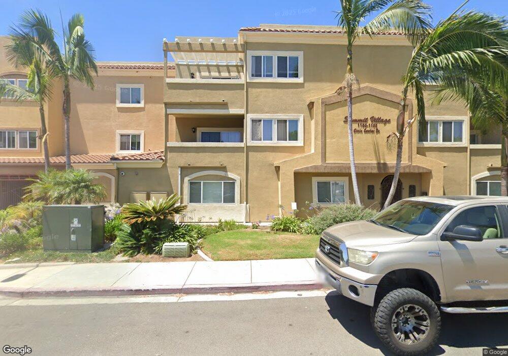
Summit Village 1180 Civic Center Dr Unit B23 Oceanside, CA 92054
Downtown Oceanside NeighborhoodEstimated Value: $855,000 - $1,006,000
3
Beds
2
Baths
1,416
Sq Ft
$649/Sq Ft
Est. Value
About This Home
This home is located at 1180 Civic Center Dr Unit B23, Oceanside, CA 92054 and is currently estimated at $918,856, approximately $648 per square foot. 1180 Civic Center Dr Unit B23 is a home located in San Diego County with nearby schools including Laurel Elementary School, Lincoln Middle School, and Oceanside High School.
Ownership History
Date
Name
Owned For
Owner Type
Purchase Details
Closed on
Apr 8, 2013
Sold by
Gonzales Andrew A and Gonzales Anita M
Bought by
Malott Theodore and Malott Jill
Current Estimated Value
Home Financials for this Owner
Home Financials are based on the most recent Mortgage that was taken out on this home.
Original Mortgage
$276,000
Interest Rate
3.41%
Mortgage Type
New Conventional
Purchase Details
Closed on
Feb 25, 2003
Sold by
Summit Village At Oceanside Inc
Bought by
Gonzales Andrew A and Gonzales Anita M
Home Financials for this Owner
Home Financials are based on the most recent Mortgage that was taken out on this home.
Original Mortgage
$214,400
Interest Rate
5.83%
Mortgage Type
Purchase Money Mortgage
Create a Home Valuation Report for This Property
The Home Valuation Report is an in-depth analysis detailing your home's value as well as a comparison with similar homes in the area
Home Values in the Area
Average Home Value in this Area
Purchase History
| Date | Buyer | Sale Price | Title Company |
|---|---|---|---|
| Malott Theodore | $345,000 | First American Title Company | |
| Gonzales Andrew A | $268,000 | Fidelity National Title Co |
Source: Public Records
Mortgage History
| Date | Status | Borrower | Loan Amount |
|---|---|---|---|
| Previous Owner | Malott Theodore | $276,000 | |
| Previous Owner | Gonzales Andrew A | $214,400 |
Source: Public Records
Tax History Compared to Growth
Tax History
| Year | Tax Paid | Tax Assessment Tax Assessment Total Assessment is a certain percentage of the fair market value that is determined by local assessors to be the total taxable value of land and additions on the property. | Land | Improvement |
|---|---|---|---|---|
| 2025 | $4,623 | $424,834 | $246,282 | $178,552 |
| 2024 | $4,623 | $416,504 | $241,453 | $175,051 |
| 2023 | $4,480 | $408,338 | $236,719 | $171,619 |
| 2022 | $4,411 | $400,332 | $232,078 | $168,254 |
| 2021 | $4,427 | $392,483 | $227,528 | $164,955 |
| 2020 | $4,290 | $388,459 | $225,195 | $163,264 |
| 2019 | $4,164 | $380,843 | $220,780 | $160,063 |
| 2018 | $4,118 | $373,376 | $216,451 | $156,925 |
| 2017 | $71 | $366,056 | $212,207 | $153,849 |
| 2016 | $3,910 | $358,880 | $208,047 | $150,833 |
| 2015 | $3,795 | $353,490 | $204,922 | $148,568 |
| 2014 | $3,647 | $346,566 | $200,908 | $145,658 |
Source: Public Records
About Summit Village
Map
Nearby Homes
- 421 N Weitzel St
- 509 N Horne St
- 1346 Bush St
- 109 S Horne St
- 701 N Nevada St
- 505 N Freeman St Unit 201
- 580 Sportfisher Dr
- 401 N Coast Hwy Unit 314
- 1417 Lemon St
- 718-20 N Freeman St
- 110 S Freeman St
- 508 N Tremont St Unit A
- 415 Bush St
- 610 N Tremont St
- 301 S Horne St
- 1223 Division St
- 355 N Cleveland St Unit 206
- 355 N Cleveland St Unit 101
- 301 Mission Ave Unit 509
- 326 Grant St
- 1140 Civic Center Dr Unit A21
- 1100 Civic Center Dr Unit C-26
- 1180 Civic Center Dr
- 1100 Civic Center Dr
- 1100 Civic Center Dr Unit C24
- 1180 Civic Center Dr Unit B36
- 1180 Civic Center Dr Unit B22
- 1180 Civic Center Dr Unit B21
- 1100 Civic Center Dr Unit C35
- 1180 Civic Center Dr Unit B25
- 1100 Civic Center Dr Unit C32
- 1100 Civic Center Dr Unit C36
- 1180 Civic Center Dr Unit B34
- 1100 Civic Center Dr Unit C34
- 1140 Civic Center Dr Unit A32
- 1180 Civic Center Dr Unit B32
- 1100 Civic Center Dr Unit C23
- 1180 Civic Center Dr Unit B31
- 1140 Civic Center Dr Unit A22
- 1180 Civic Center Dr Unit B33