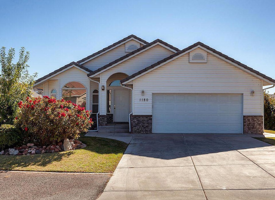
1180 Hubbard Place Saint George, UT 84790
Bloomington Hills NeighborhoodEstimated payment $3,460/month
Highlights
- Mountain View
- Vaulted Ceiling
- No HOA
- Desert Hills Middle School Rated A-
- Main Floor Primary Bedroom
- Covered Patio or Porch
About This Home
No HOA!
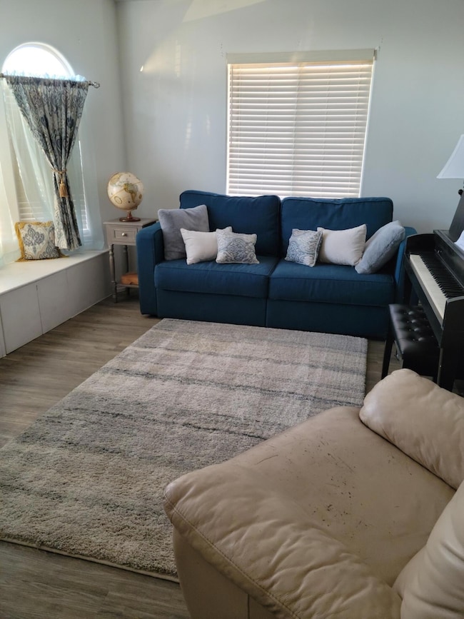
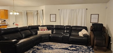
Tucked away in the heart of Bloomington Hills, this beautifully maintained home offers the perfect blend of comfort, space, and breathtaking mountain views. Thoughtfully designed with both function and flow in mind, the open-concept layout is ideal for everyday living and effortless entertaining. Situated in a peaceful cul-de-sac with no backyard neighbors, the setting provides rare privacy and serenity.
Inside, you'll find a spacious floor plan with multiple living areas, two inviting family rooms, and generously sized bedrooms—plenty of room for everyone to spread out and feel at home. The property has been lovingly cared for, with abundant storage (including cold storage!) and an unbeatable location. This home truly checks all the boxes!
Pictures coming soon.

Home Details
Home Type
- Single Family
Est. Annual Taxes
- $3,571
Year Built
- Built in 1999
Lot Details
- 8,712 Sq Ft Lot
- Cul-De-Sac
- Landscaped
- Sprinkler System
Parking
- Attached Garage
Property Views
- Mountain
- Valley
Home Design
- Brick Exterior Construction
- Tile Roof
- Aluminum Siding
Interior Spaces
- 3,327 Sq Ft Home
- 2-Story Property
- Vaulted Ceiling
- Ceiling Fan
- Walk-Out Basement
Kitchen
- Free-Standing Range
- Microwave
- Dishwasher
- Disposal
Bedrooms and Bathrooms
- 5 Bedrooms
- Primary Bedroom on Main
- Walk-In Closet
- 3 Bathrooms
Outdoor Features
- Covered Deck
- Covered Patio or Porch
Schools
- Bloomington Hills Elementary School
- Desert Hills Middle School
- Desert Hills High School
Utilities
- Central Air
- Heating System Uses Natural Gas
Community Details
- No Home Owners Association
- Bloomington Hills Subdivision
Listing and Financial Details
- Assessor Parcel Number SG-BLH-9-106
Map
Home Values in the Area
Average Home Value in this Area
Tax History
| Year | Tax Paid | Tax Assessment Tax Assessment Total Assessment is a certain percentage of the fair market value that is determined by local assessors to be the total taxable value of land and additions on the property. | Land | Improvement |
|---|---|---|---|---|
| 2025 | $3,699 | $542,400 | $163,300 | $379,100 |
| 2023 | $3,832 | $572,500 | $172,500 | $400,000 |
| 2022 | $4,014 | $564,000 | $143,800 | $420,200 |
| 2021 | $3,519 | $405,500 | $92,000 | $313,500 |
| 2020 | $3,232 | $350,800 | $74,800 | $276,000 |
| 2019 | $3,136 | $332,500 | $74,800 | $257,700 |
| 2018 | $3,080 | $297,700 | $0 | $0 |
| 2017 | $1,801 | $174,020 | $0 | $0 |
| 2016 | $1,907 | $170,445 | $0 | $0 |
| 2015 | $1,816 | $155,760 | $0 | $0 |
| 2014 | $1,788 | $154,330 | $0 | $0 |
Property History
| Date | Event | Price | List to Sale | Price per Sq Ft |
|---|---|---|---|---|
| 10/06/2025 10/06/25 | For Sale | $600,000 | -- | $180 / Sq Ft |
Purchase History
| Date | Type | Sale Price | Title Company |
|---|---|---|---|
| Warranty Deed | -- | Southern Utah Title Co | |
| Interfamily Deed Transfer | -- | None Available | |
| Interfamily Deed Transfer | -- | None Available | |
| Interfamily Deed Transfer | -- | None Available |
Mortgage History
| Date | Status | Loan Amount | Loan Type |
|---|---|---|---|
| Open | $325,986 | FHA |
Source: Washington County Board of REALTORS®
MLS Number: 25-265724
APN: 0213168
Disclaimer: Certain information contained herein is derived from information provided by parties other than Homes.com. All information provided is deemed reliable, but is not guaranteed to be accurate and should be independently verified.
![]() All information should be verified by the recipient and none is guaranteed as accurate by ARMLS
All information should be verified by the recipient and none is guaranteed as accurate by ARMLS
Listing Information presented by local MLS brokerage: Ten-X, local REALTOR®- Arlene Richardson - (888)-952-6393
- 1125 E Sherman Cir
- 2050 S 1400 E Unit K101
- 2050 S 1400 E Unit 3
- 2050 S 1400 E Unit 23
- 2050 S 1400 E Unit 18
- 2280 Bloomington Hills Dr Unit 5
- 2285 Shilo Cir
- 1365 E Fort Pierce Dr Unit 9
- 2271 S 1400 E
- 2045 S 1400 E Unit 14
- 2045 S 1400 E Unit 12
- 2045 S 1400 E Unit 10
- 2045 S 1400 E Unit 13
- 2291 S Augusta Dr
- 955 Summit Ridge Dr Unit 20
- 1448 E 2190 South Cir
- 2376 S Augusta Dr Unit DDR
- 1790 S River Rd
- Cambria Plan at Cottam Cove
- Scarlett Plan at Cottam Cove
- 1593 E Dihedral Dr
- 1843 E 1220 S St
- 444 Sunland Dr
- 997 Willow Breeze Ln
- 300 W 2025 S Unit 20
- 514 S 1990 E
- 220 E 600 S
- 277 S 1000 E
- 344 S 1990 E
- 368 S Mall Dr
- 676 676 W Lava Pointe Dr
- 770 S 2780 E
- 543 S Main St
- 325 S 200 E Unit 3
- 460 S Main St
- 175 S 400 E
- 2271 E Dinosaur Crossing Dr
- 3226 E 2930 S
- 605 E Tabernacle St
- 2409 E Dinosaur Crossing Dr