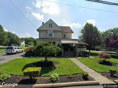
1180 Newark Rd Toughkenamon, PA 19374
Estimated Value: $351,000 - $558,000
9
Beds
4
Baths
3,511
Sq Ft
$129/Sq Ft
Est. Value
About This Home
This home is located at 1180 Newark Rd, Toughkenamon, PA 19374 and is currently estimated at $451,667, approximately $128 per square foot. 1180 Newark Rd is a home located in Chester County with nearby schools including Kennett Middle School, Kennett High School, and Avon Grove Charter School.
Ownership History
Date
Name
Owned For
Owner Type
Purchase Details
Closed on
Feb 18, 2022
Sold by
Damico Thelma J
Bought by
Rdi Property Group Llc
Current Estimated Value
Home Financials for this Owner
Home Financials are based on the most recent Mortgage that was taken out on this home.
Original Mortgage
$700,000
Outstanding Balance
$662,203
Interest Rate
3.55%
Mortgage Type
New Conventional
Estimated Equity
-$176,870
Purchase Details
Closed on
May 8, 1972
Bought by
Damico Anthony and Damico Thelma J
Create a Home Valuation Report for This Property
The Home Valuation Report is an in-depth analysis detailing your home's value as well as a comparison with similar homes in the area
Home Values in the Area
Average Home Value in this Area
Purchase History
| Date | Buyer | Sale Price | Title Company |
|---|---|---|---|
| Rdi Property Group Llc | $400,000 | None Listed On Document | |
| Damico Anthony | $32,500 | -- |
Source: Public Records
Mortgage History
| Date | Status | Borrower | Loan Amount |
|---|---|---|---|
| Open | Rdi Property Group Llc | $700,000 | |
| Previous Owner | Damico Anthony V | $100,000 |
Source: Public Records
Tax History Compared to Growth
Tax History
| Year | Tax Paid | Tax Assessment Tax Assessment Total Assessment is a certain percentage of the fair market value that is determined by local assessors to be the total taxable value of land and additions on the property. | Land | Improvement |
|---|---|---|---|---|
| 2024 | $7,031 | $175,550 | $29,120 | $146,430 |
| 2023 | $6,795 | $175,550 | $29,120 | $146,430 |
| 2022 | $6,696 | $175,550 | $29,120 | $146,430 |
| 2021 | $6,628 | $175,550 | $29,120 | $146,430 |
| 2020 | $6,502 | $175,550 | $29,120 | $146,430 |
| 2019 | $6,414 | $175,550 | $29,120 | $146,430 |
| 2018 | $6,314 | $175,550 | $29,120 | $146,430 |
| 2017 | $6,185 | $175,550 | $29,120 | $146,430 |
| 2016 | $696 | $175,550 | $29,120 | $146,430 |
| 2015 | $696 | $175,550 | $29,120 | $146,430 |
| 2014 | $696 | $175,550 | $29,120 | $146,430 |
Source: Public Records
Map
Nearby Homes
- 1265 W Baltimore Pike
- 1003 Newark Rd
- 110 Daniel Dr
- 162 Bancroft Rd Unit CARLTON GRND
- 162 Bancroft Rd Unit CARLTON
- 162 Bancroft Rd Unit SUTTON
- 162 Bancroft Rd Unit SG
- 1 Hiview Dr
- 100 Declan Unit HAWTHORNE
- 100 Declan Unit MAGNOLIA
- 100 Declan Unit SAVANNAH
- 100 Declan Unit NOTTINGHAM
- 8841 Gap Newport Pike
- 413 Bucktoe Rd
- 605 Church Rd
- 301 E 3rd St
- 100 Fernwood Dr
- 208 Honey Locust Dr
- 250 Kestrel Ct
- 109 Ronway Dr
- 1180 Newark Rd
- 1170 Newark Rd
- 112 Church St
- 114 Church St
- 1165 Newark Rd
- 116 Church St
- 1480 Baltimore Pike
- 1179 Newark Rd
- 118 Church St
- 1185 Newark Rd
- 119 Church St
- 1159 Newark Rd
- 1470 Baltimore Pike
- 119/125 Church St
- 1150 Newark Rd
- 126 Church St
- 125 Church St
- 1464 Baltimore Pike
- 1475 Baltimore Pike
- 1460 Baltimore Pike